Decorative Collective - www.decorativecollective.com
Sellers's Details
LONDON FINE ANTIQUES
Tel: +44 (0)207 1833511
Email: [email protected]
https://www.decorativecollective.com/dealers/london-fine-antiquesItem Details
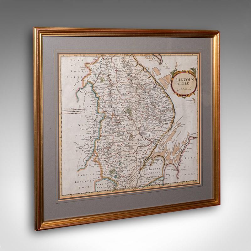
This is a fine antique county map of Lincolnshire. An English, framed reproduction engraving, dating to the Victorian period and later, circa 1900. A superb cartographic reproduction originally charted by Robert Morden in the late 17th century. With its hand-coloured detailing and charming aged appearance, this piece makes a wonderful display for the study, hallway, or library.
Faithful county cartography reproduction, capturing a historic period of Lincolnshire
Originally charted by Robert Morden, one of England’s most esteemed early mapmakers
Displays a desirable aged patina and remains in good order throughout
Presented behind clear glass within a tasteful later glazed frame
Fascinating level of cartographic detail, illustrating administrative regions, rivers, and historic towns
Displays Wapon Taks - an alternative form of Wapentake, the county equivalent of political Hundreds
Fine detail given to The Wash, the tidal estuary between Lincolnshire and Norfolk
Hand coloured palette accentuates borders and settlements with period accuracy
Dressed to the rear with a hanging braid, ensuring ease of display upon arrival
This is a charming antique map of Lincolnshire, beautifully presented and steeped in geographic and historic interest, offering an elegant addition to any period interior or collector’s wall. Delivered ready to display, ideal for collectors of antique maps or English county history
Dimensions:
Max Width: 55cm (21.75'')
Max Depth: 2.5cm (1'')
Max Height: 50cm (19.75'')
Map Width: 41.5cm (16.25'')
Map Height: 35.5cm (14'')
- Period: 1900
-
- Price: £685.00
- €803 Euro
- $916 US Dollar
- Location: Devon
-
- Dimensions: H: 50cm (19.69in)
- W: 55cm (21.65in)
- D: 2.5cm (0.98in)