Decorative Collective - www.decorativecollective.com
Sellers's Details
LONDON FINE ANTIQUES
Tel: +44 (0)207 1833511
Email: [email protected]
https://www.decorativecollective.com/dealers/london-fine-antiquesItem Details
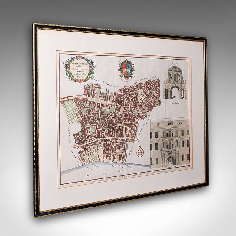
This is an antique London street map. An English, framed and hand-coloured map showing the ward of Farringdon, dating to the Georgian period and later, circa 1755.
Full title: Farringdon Ward without its Division into Parishes according to a New Survey.
Appealing London interest, as it stood when surveyed in the mid 18th century
Presented behind clear bright glass and mounted within a tasteful cream card border
Displays a desirable aged patina, with an ebonised and gilt later frame
Dressed to the rear with mounting wire for ease of hanging
Title given within a decorative cartouche to the upper part of the map
Hand coloured for added visual interest and legibility
Heraldic interest with the family coat of arms for the cartographer Richard Beckford Esquire
Encompassing Smithfield, Fleet Street and Holbourn
Superb architectural excerpts for Temple Bar and Bridewell North Gate
Named and dated by Richard Beckford in the year 1755
This is a fascinating 18th century London street map, with appealing lithography detail and tasteful presentation. Delivered ready to display.
Dimensions:
Max Width: 61cm (24'')
Max Depth: 1.5cm (.5'')
Max Height: 51cm (20'')
Map Width: 47.5cm (18.75'')
Map Height: 37.5cm (14.75'')
- Period: 1750s
-
- Price: £595.00
- €703 Euro
- $787 US Dollar
- Location: Devon
-
- Dimensions: H: 51cm (20.08in)
- W: 61cm (24.02in)
- D: 1.5cm (0.59in)