Decorative Collective - www.decorativecollective.com
Sellers's Details
LONDON FINE ANTIQUES
Tel: +44 (0)207 1833511
Email: [email protected]
https://www.decorativecollective.com/dealers/london-fine-antiquesItem Details
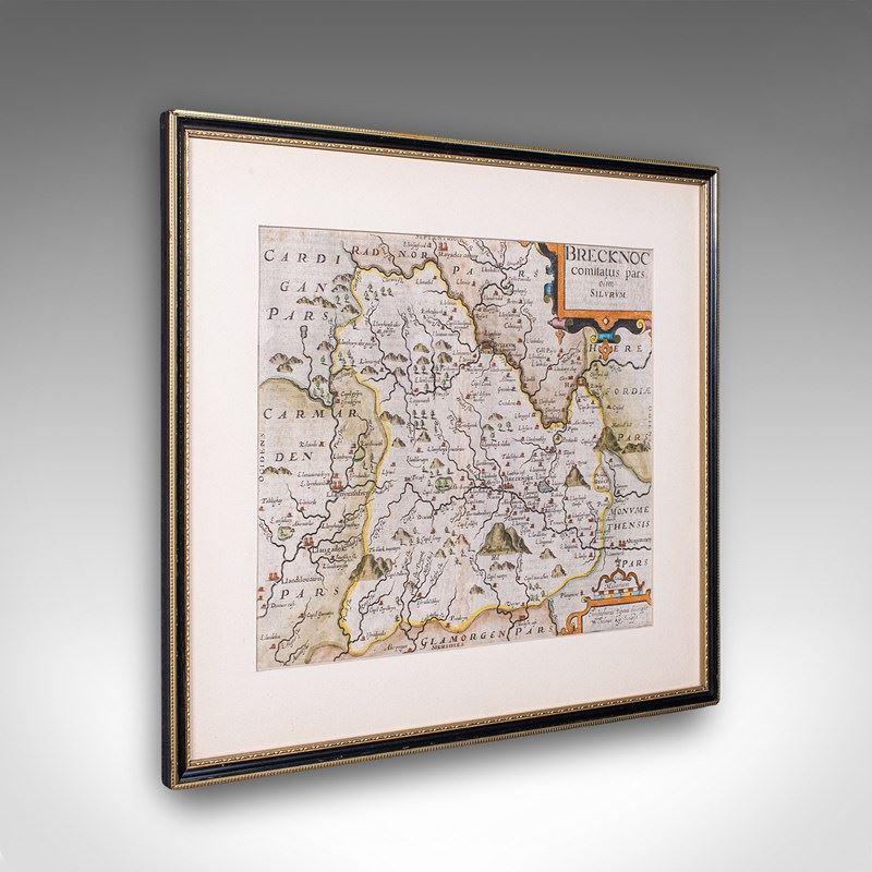
This is an antique map of Brecknoc (modern - Breconshire). An English, framed regional map by Christopher Saxton, with dual sided atlas excerpt, dating to the early 17th century, circa 1607.
Full title; Brecknoc - comitatus pars olim silvrvm
Superb atlas cartography with dual view aspect for additional interest
Displays a desirable aged patina and in lightly time worn order
Presented behind clear, bright glass within a later, ebonised and gilt frame
Authentic atlas excerpt, with the text visible through the antique paper
Dressed to the rear with hanging wire for ease of mounting
Excellent Elizabethan period cartography by the renowned Christopher Saxton
Presented here from its later 1607 appearance in the atlas Britannia, published by William Camden
Fascinating cartography showing the county of Brecknoc as it stood in the Elizabethan age
Originally attributed to the 5th century Welsh King Brychan, the name Brecknoc held official status until 1996
Charming detail, as expected from a Saxton map, with administrative border and settlement details
The informative opposite page is dedicated to a written history of the county, in the earlier Latin print run
Later editions from 1610 and 1637 were published in English, lacking the marginal notes present here
This is a delightful antique map of Brecknoc, presenting a fascinating 16th century atlas excerpt with dual sided framing. A treat for collectors or county residents. Delivered ready to display.
Dimensions:
Max Width: 44cm (17.25'')
Max Depth: 1.5cm (.5'')
Max Height: 39cm (15.25'')
Map Width: 31.5cm (12.5'')
Map Height: 26.5cm (10.5'')
- Period: 1600s
-
- Price: £795.00
- €930 Euro
- $1,050 US Dollar
- Location: Devon
-
- Dimensions: H: 39cm (15.35in)
- W: 44cm (17.32in)
- D: 1.5cm (0.59in)