Decorative Collective - www.decorativecollective.com
Sellers's Details
LONDON FINE ANTIQUES
Tel: +44 (0)207 1833511
Email: [email protected]
https://www.decorativecollective.com/dealers/london-fine-antiquesItem Details
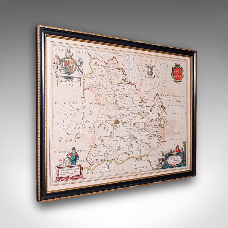
This is an antique map of Breconshire. A Dutch, framed Welsh county map by Joan Blaeu (1596 - 1673) with dual sided atlas excerpt, dating to the mid 17th century, published 1660.
Full title; Comitatus Brechiniae - Breknoke
Superb atlas cartography with dual view aspect for additional interest
Displays a desirable aged patina and in lightly time worn order
Presented behind clear, bright glass within a later, ebonised and gilt frame
Dressed to the rear with hanging wire for ease of mounting
Hand coloured title cartouche, heraldic crests and figural detail add great visual appeal
Scale given in Milliaria Anglica quorum quattuor unum Germanicum
Broadly translates to 'Four English miles to one German'
Reverse view shows the atlas text from Blaeu's Theatrum Orbis Terrarum sive Atlas Novus
This is a delightful antique map of Breconshire, being a desirable example by the renowned dutch cartographer Joan Blaeu. This example is a treat for collectors and area natives. Delivered ready to display.
Dimensions:
Max Width: 57cm (22.5'')
Max Depth: 2cm (.75'')
Max Height: 44.5cm (17.5'')
Map Width: 50cm (19.75'')
Map Height: 37.5cm (14.75'')
- Period: 1660s
-
- Price: £895.00
- €1,056 Euro
- $1,181 US Dollar
- Location: Devon
-
- Dimensions: H: 44.5cm (17.52in)
- W: 57cm (22.44in)
- D: 2cm (0.79in)