Decorative Collective - www.decorativecollective.com
Sellers's Details
LONDON FINE ANTIQUES
Tel: +44 (0)207 1833511
Email: [email protected]
https://www.decorativecollective.com/dealers/london-fine-antiquesItem Details
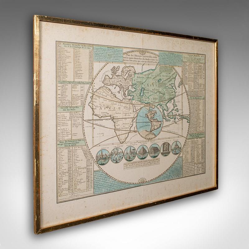
This is an antique Plan de l'Historie Universelle World Map. A Dutch, framed atlas engraving by Henri Abraham Chatelain, dating to the 18th century and later, circa 1730.
Published in Amsterdam, with all text in French. The full title reads; Plan de l'Historie Universelle, Oulon voit les Quartre Monarchies du Monde, et tous les Anciens Etats auffi bien que ceux qui fubsiste
A fascinating 18th century world map, accentuated with encyclopaedic detail
Displaying a desirable aged patina and in good original order
Wonderful period cartography piece, set within a later glazed frame
Compiled by Chatelain with profuse detail of monarchs, the Seven Wonders of the World et al
Map centred around Eurasia, with the Americas charmingly featured within a medallion
Annotated with the Equator and the tropics of Cancer and Capricorn respectively
Replete with a grid reference system for locating points of interest
Hand coloured palette accentuates the map throughout to great visual effect
Further detailing monarchs and ancient states such as the Roman Empire and Carthage
Medallion excerpts present the ancient Seven Wonders of the World with appealing illustrations
The map is dressed to the rear with hanging braid for ease of mounting
This is a captivating antique Plan de l'Historie Universelle World Map, with fine cartographic interest and fascinating 18th century encyclopaedic detail. A treat for collectors of cartography, historic reference or Francophiles. Delivered ready to display.
Dimensions:
Max Width: 54.5cm (21.5'')
Max Depth: 2cm (.75'')
Max Height: 44.5cm (17.5'')
Map Width: 44.5cm (17.5'')
Map Height: 34cm (13.5'')
- Period: 1730s
-
- Price: £925.00
- €1,084 Euro
- $1,237 US Dollar
- Location: Devon
-
- Dimensions: H: 44.5cm (17.52in)
- W: 54.5cm (21.46in)
- D: 2cm (0.79in)