Decorative Collective - www.decorativecollective.com
Sellers's Details
LONDON FINE ANTIQUES
Tel: +44 (0)207 1833511
Email: [email protected]
https://www.decorativecollective.com/dealers/london-fine-antiquesItem Details
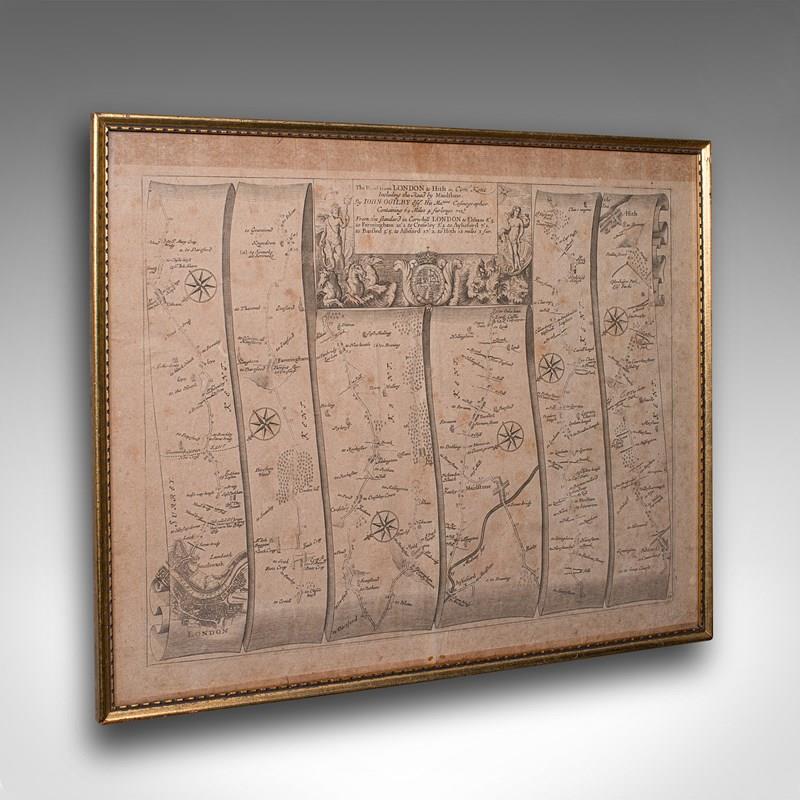
This is an antique Road Map from London to Hythe, Kent. An English, cartographic atlas excerpt by John Ogilby, dating to the late 17th century with later frame, circa 1675
A superb example of early English road cartography, this antique atlas excerpt by John Ogilby depicts the historic route from London to Hythe, Kent. Beautifully preserved and presented within a later glazed frame, this piece embodies the craftsmanship and innovation of Britain’s first road atlas annotated in miles.
Fascinating coaching road map, compiled by John Ogilby and published in 1675 within the monochrome Itinerarium Angliæ
Skilfully engraved across six vertical panels from London (bottom left) to Hythe (top right)
Ornate title panel embellished with decorative frieze and cartouche detailing
Ogilby’s pioneering trundle wheel method mapped the route at 1 inch to the mile scale
Displays a pleasing aged patina, the engraving clear and legible throughout
Set behind clear glass within a tasteful later frame, complementing the map’s antiquity
Dressed to the rear with hanging loop for ease of wall mounting
A fine example of Restoration-era road mapping, combining historical interest and decorative appeal
This is a quality antique road map of London to Hythe, offering remarkable cartographic charm and ready for elegant display in any collection or period setting. Delivered ready to display.
Dimensions:
Max Width: 48.5cm (19'')
Max Depth: 2.5cm (1'')
Max Height: 40cm (15.75'')
Map Width: 46.5cm (18.25'')
Map Height: 37.5cm (14.75'')
- Period: 1675
-
- Price: £525.00
- €615 Euro
- $702 US Dollar
- Location: Devon
-
- Dimensions: H: 40cm (15.75in)
- W: 48.5cm (19.09in)
- D: 2.5cm (0.98in)