Decorative Collective - www.decorativecollective.com
Sellers's Details
LONDON FINE ANTIQUES
Tel: +44 (0)207 1833511
Email: [email protected]
https://www.decorativecollective.com/dealers/london-fine-antiquesItem Details
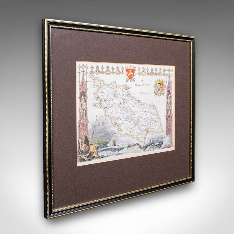
This is a vintage Isle of Man map. An English, fine reproduction of the Thomas Moule original atlas engraving, dating to the late 20th century, circa 1970.
Beautifully reproduced print of the island from a renowned 19th century cartographer
Displays a desirable aged patina and in good order
Presented behind clear, bright glass with a brown card border
Later frame in gilt and ebonised towns, with hanging wire to the reverse
Superb cartography by Thomas Moule (1784 - 1851) writer, antiquarian and map maker
Gives excellent detail to the Isle of Man, in the Irish Sea between Ireland and Britain
Accentuated with the Manx Triskelion emblem - the three legged symbol and a heraldic coat of arms
Published in an unusual orientation by Moule, with West raised at the top and East lowered
The map itself is presented inside an elaborate Gothic architectural border
Further flanked by two standing knights in armour at the sides
Scale is given in English Miles with increments from 1-8 miles
George Virtue included these Moule maps in James Barclay's Complete & Universal English Dictionary
This edition was an updated example originally released in June 1843
This is a fascinating vintage Isle of Man map, with a detailed and quality reconstruction of the Thomas Moule original. A treat for Manx residents, descendants or collectors. Delivered ready to display.
Dimensions:
Max Width: 40.5cm (16'')
Max Depth: 1.5cm (.5'')
Max Height: 36.5cm (14.25'')
Map Width: 27cm (10.75'')
Map Height: 20cm (7.75'')
- Period: 1970s
-
- Price: £395.00
- €472 Euro
- $528 US Dollar
- Location: Devon
-
- Dimensions: H: 36.5cm (14.37in)
- W: 40.5cm (15.94in)
- D: 1.5cm (0.59in)