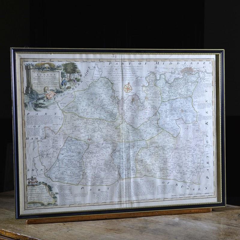
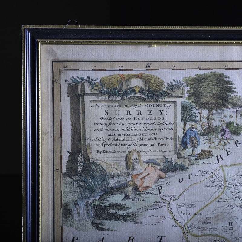
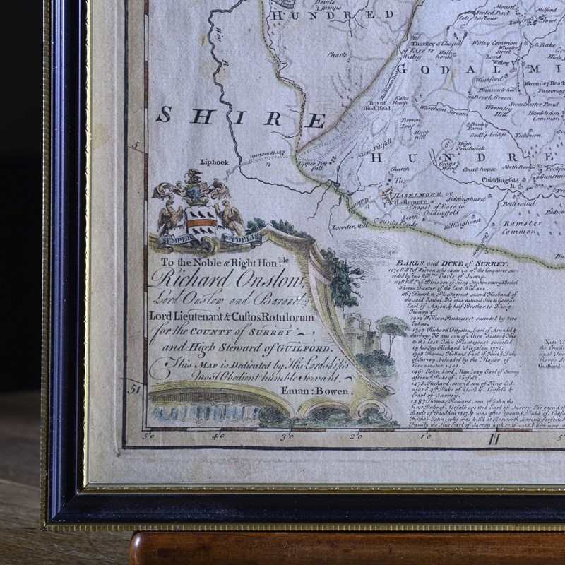
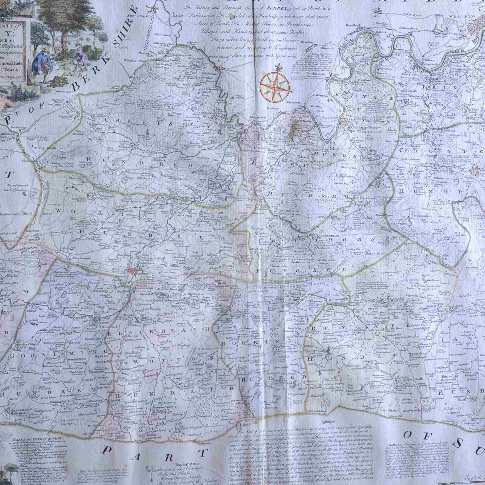
Map Of Surrey By Emanuel Bowen
Stock No
C15017
2019
- £425.00
- €496 Euro
- $532 US Dollar
Questions about this item?
Like this item?
Item Description
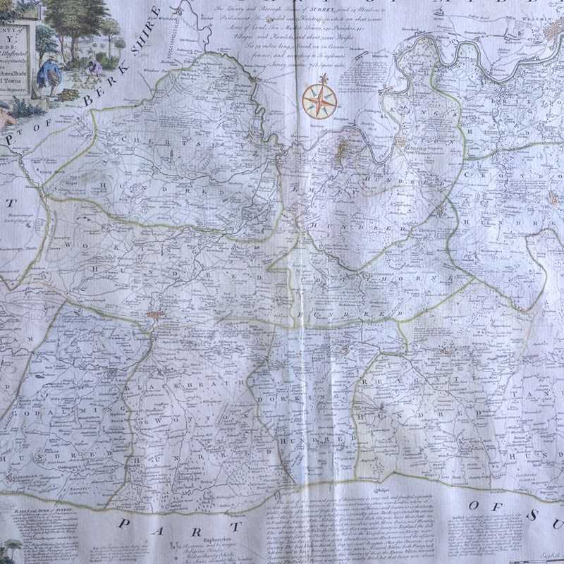
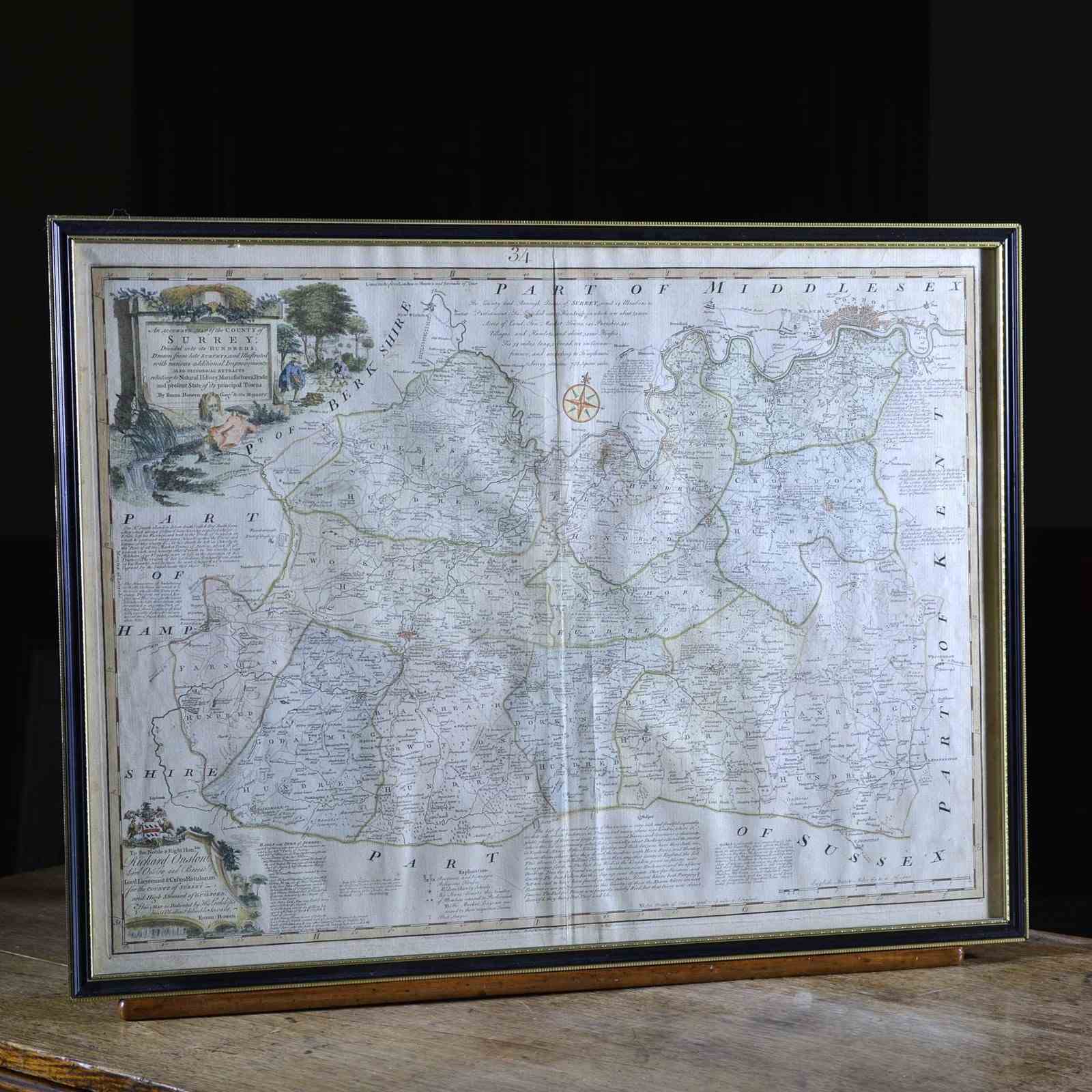
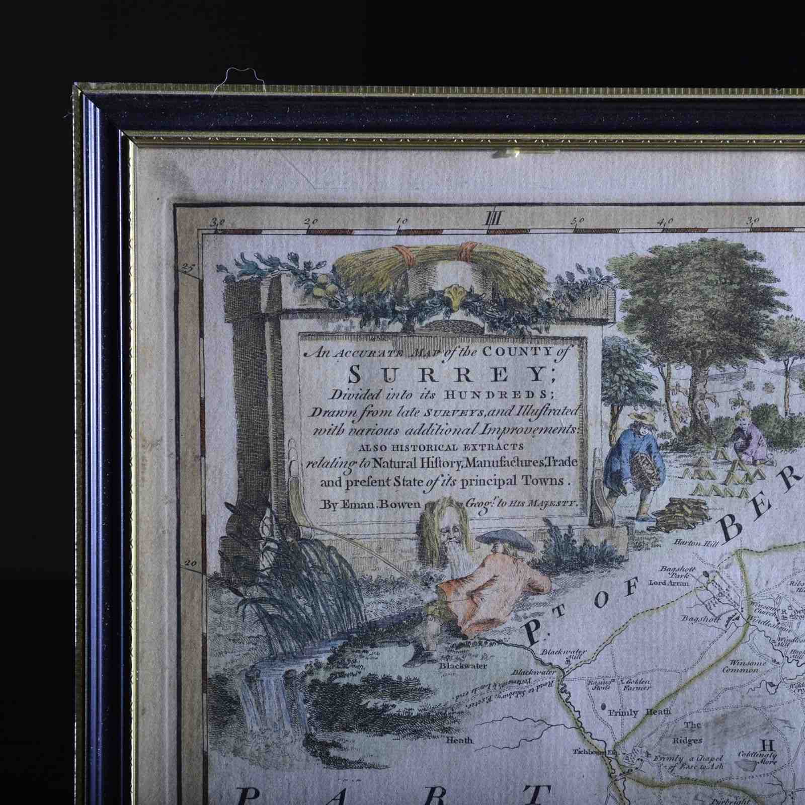
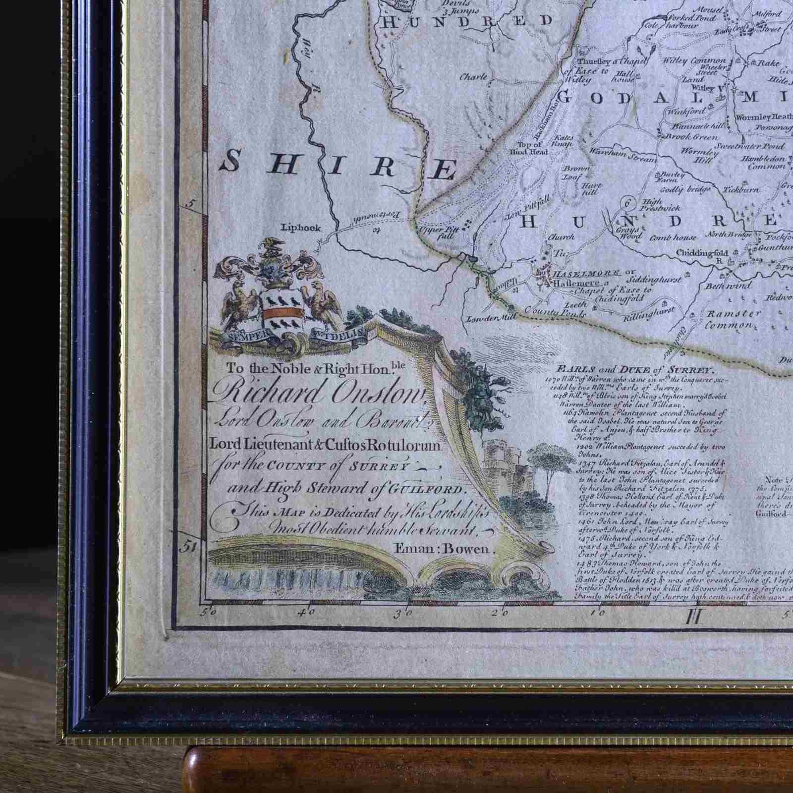
Map of Surrey by Emanuel Bowen
Emanuel Bowen
An Accurate Map of the County of Surrey Divided into its Hundreds... Present State of the City of its principal Towns
Hand coloured engraved map from The Large English Atlas
Published for Carrington Bowles in St. Paul's Church Yard & Robert Sayer in Fleet Street
English, circa 1760
Framed and glazed in a 20th century ebonised gilt frame.
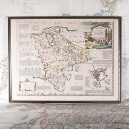
The map includes descriptions of principal towns including Totnes, Dartmouth, Tavistock, Exeter and others, together with a note of the Earls and Dukes of Devonshire.
536mm H, 720mm W (the plate mark), 60cm H, 78cm W (the frame).
Condition: The map is well struck and neatly hand coloured, this is a very crisp and clean example. The frame is in good condition.
Item Info
Seller
Seller Location
Scotland, Scotland
Item Dimensions
H: 60cm W: 78cm
Period
18th Century & Earlier
Item Location
United Kingdom
Seller Location
Scotland, Scotland
Item Location
United Kingdom
Seller Contact No
+44 (0)1556 509270
+44 (0)7881 823369
More from LESLIE & BAGGOTT