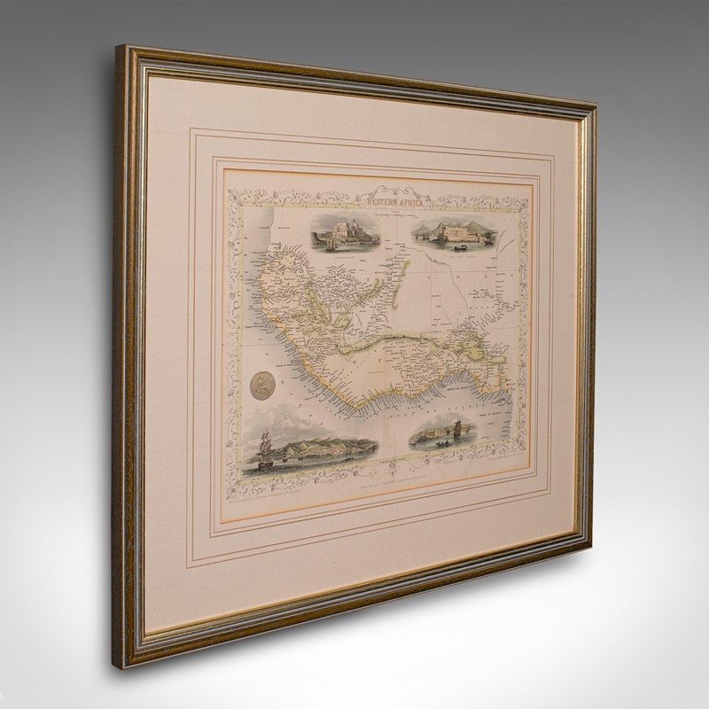
Antique Lithography Map, West Africa, English, Framed, Cartography, Victorian
Stock No
18.9996
2024
- £395.00
- €465 Euro
- $527 US Dollar
Questions about this item?
Like this item?
Item Description
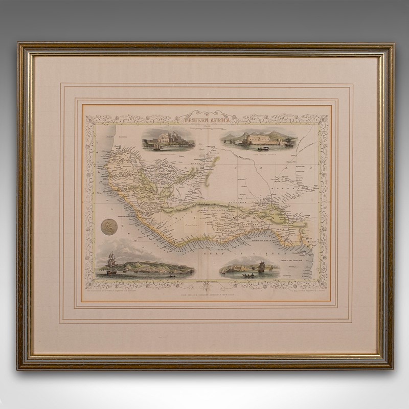
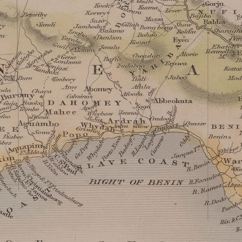
This is an antique lithography map of Western Africa. An English, framed atlas engraving of cartographic interest by John Rapkin, dating to the early Victorian period and later, circa 1850.
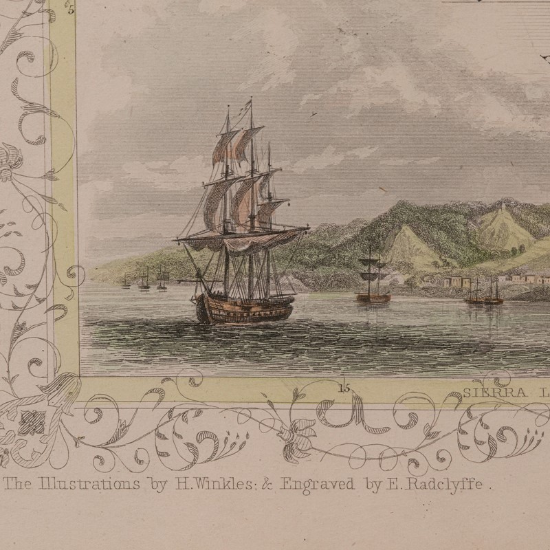
John Rapkin was considered as one of the best map makers of the mid 19th century, working in conjunction with John Tallis to engrave maps for the Illustrated Atlas and Modern History of the World (1845-51).
Quality lithography of West Africa and its constituent countries - ideal for display
Displaying a desirable aged patina and in very good order
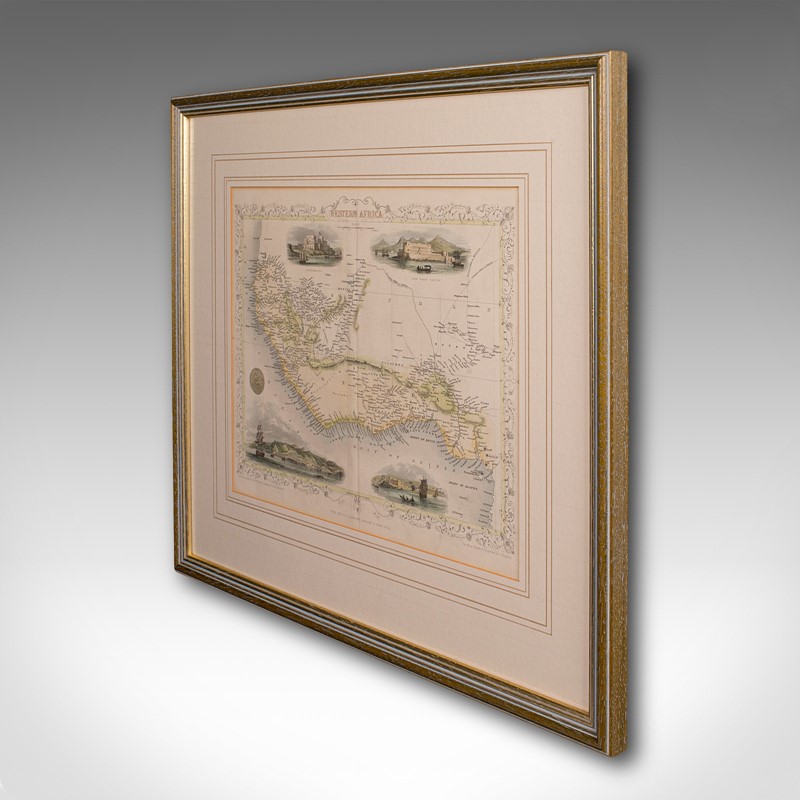
Fascinating cartography, presented tastefully within quality, later frames
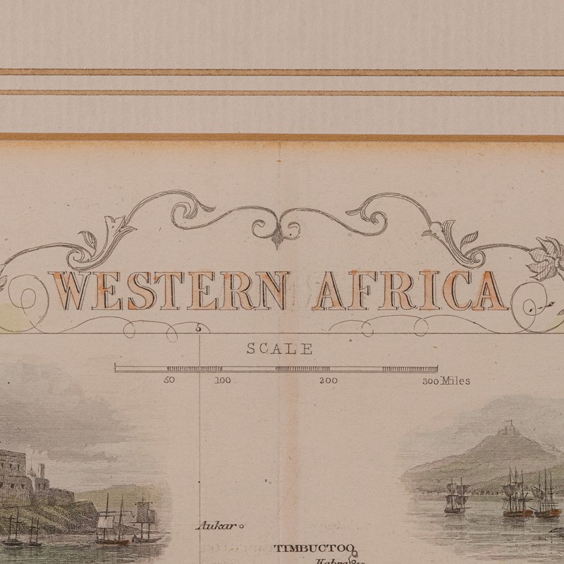
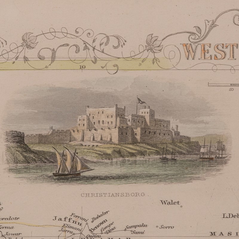
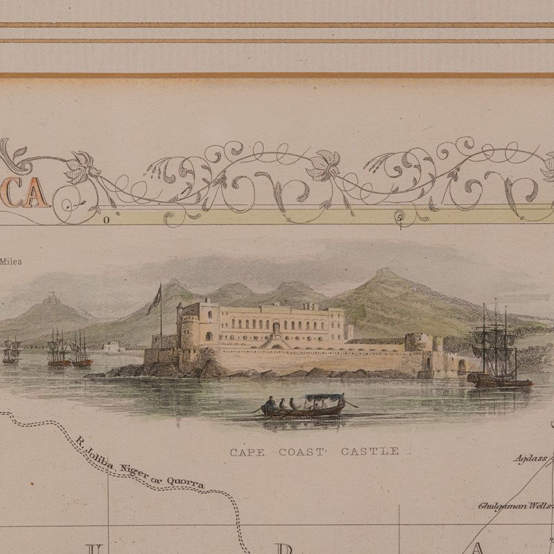
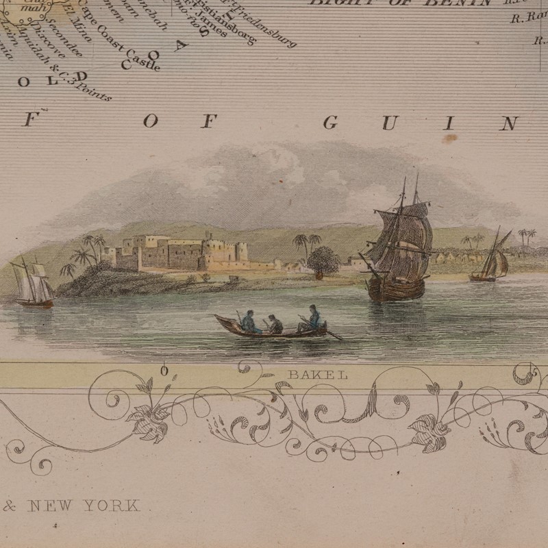
Major locations, coloured topography and tributaries annotate the map
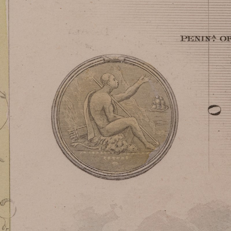
Superb illustrations showcase coastal ports and local coinage
Dressed to the rear with hanging cord for ease of mounting
This is a quality antique lithography map of Western Africa, with fine cartographic interest. Delivered ready to display.
Dimensions:
Max Width: 50.5cm (20'')
Max Depth: 2cm (.75'')
Max Height: 44.5cm (17.5'')
Map Width: 33.5cm (13.25'')
Map Height: 26.5cm (10.5'')
We offer a 100% satisfaction guarantee with all of our antiques.
We ship worldwide with professional packing and attractive rates – please send us your post / zip code and country for a quote.
Free delivery to most of the U.K. – Please send us your post code for confirmation.
Deliveries taking on average ten working days to arrive at your door from receipt of payment.
Please contact us if you require any further information - we are here to help.
Our Ref: 18.9996
Item Info
Seller
Seller Location
Hele, Devon
Item Dimensions
H: 44.5cm W: 50.5cm D: 2cm
Period
c.1850
Item Location
United Kingdom
Seller Location
Hele, Devon
Item Location
United Kingdom
Seller Contact No
+44 (0)207 1833511
More from LONDON FINE ANTIQUES