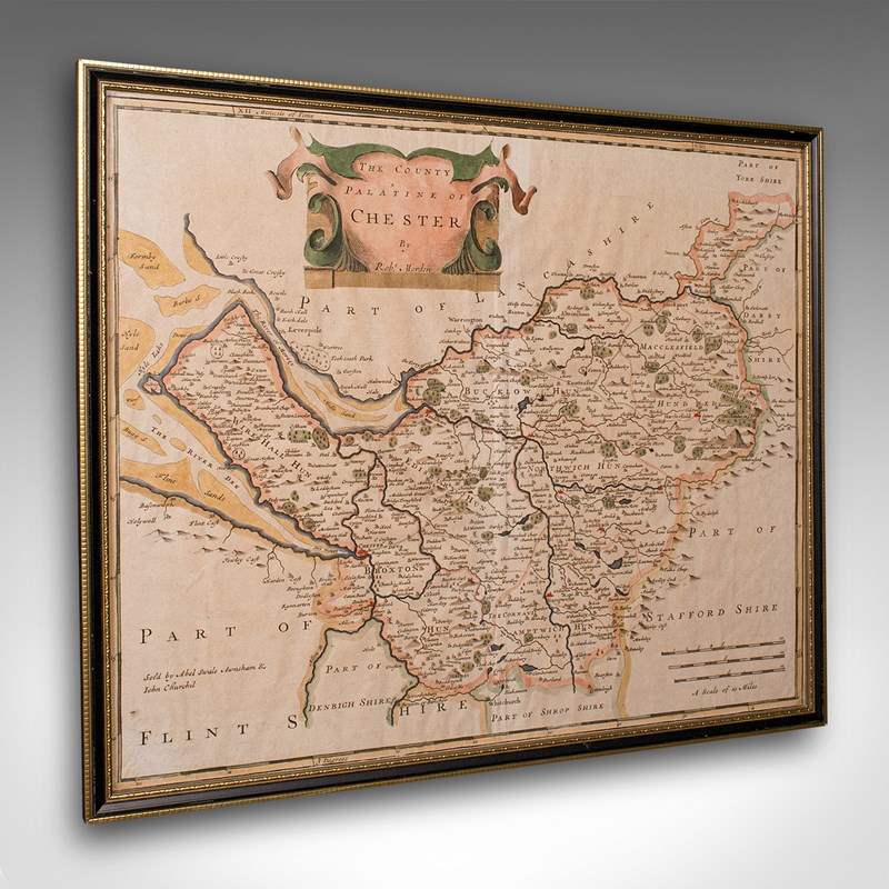

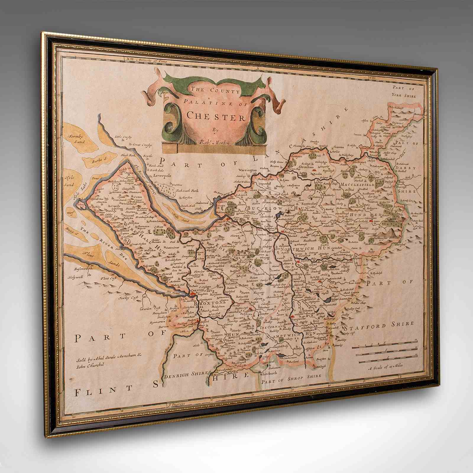
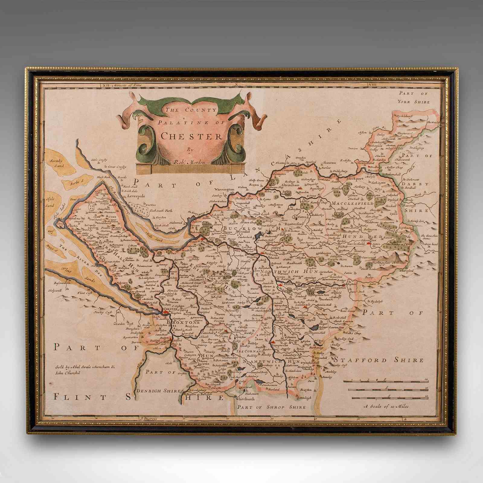

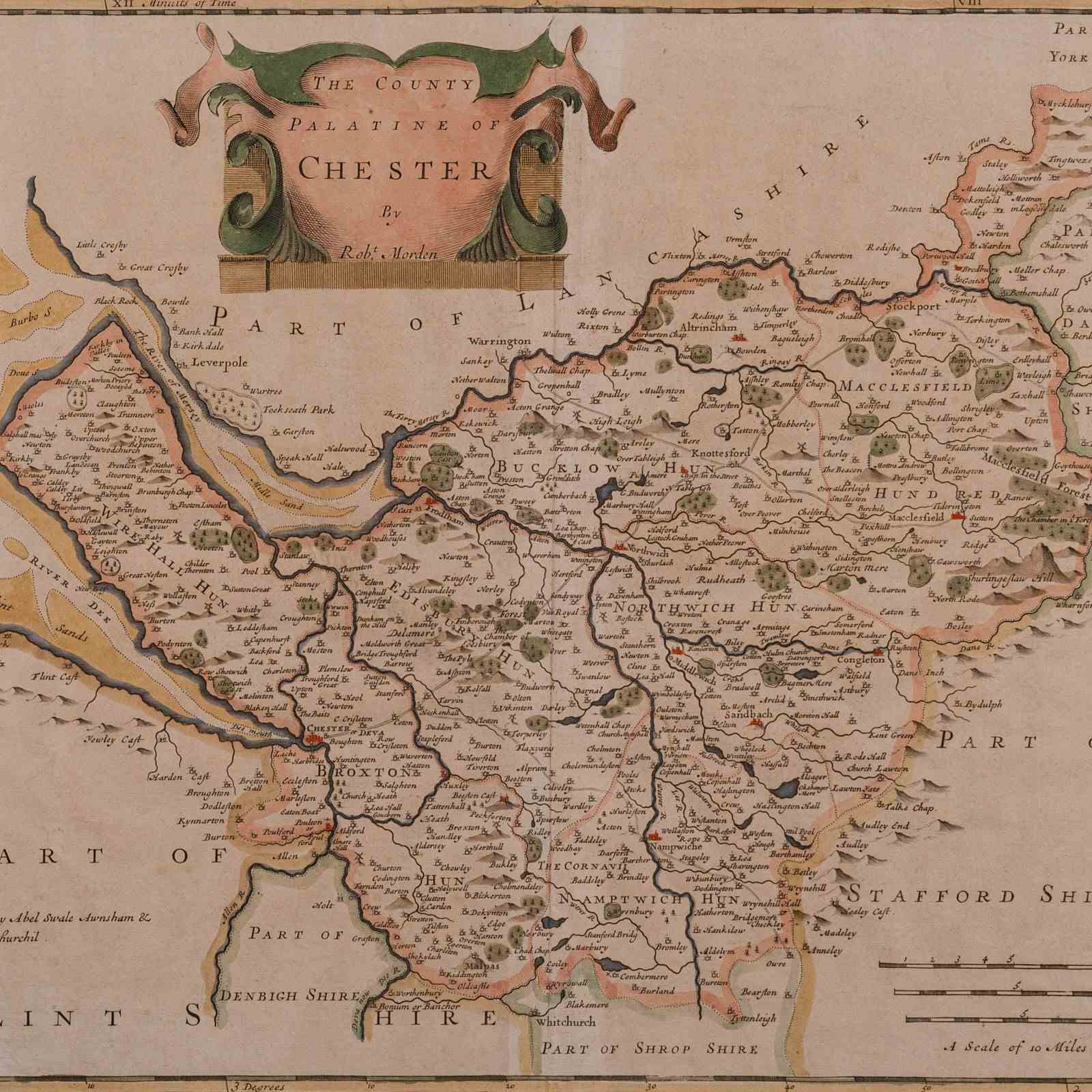
Antique County Map, Cheshire, English, Framed Cartography, Robert Morden, 18Th.C
Stock No
25580
2024
- £575.00
- €674 Euro
- $769 US Dollar
Questions about this item?
Like this item?
Item Description
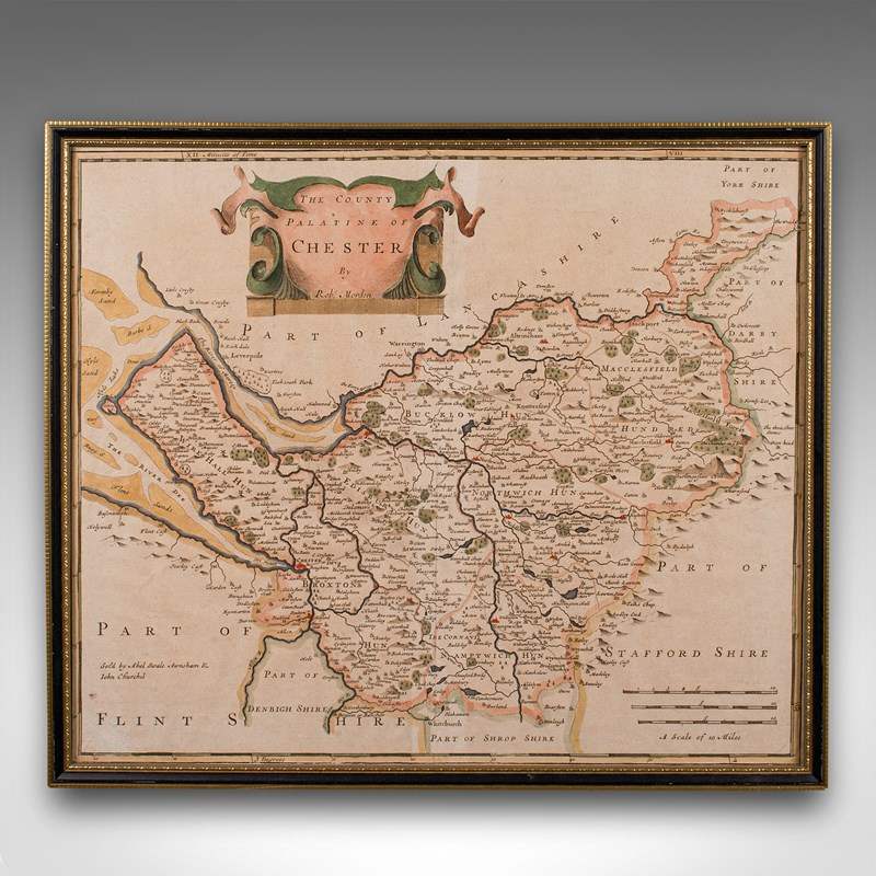
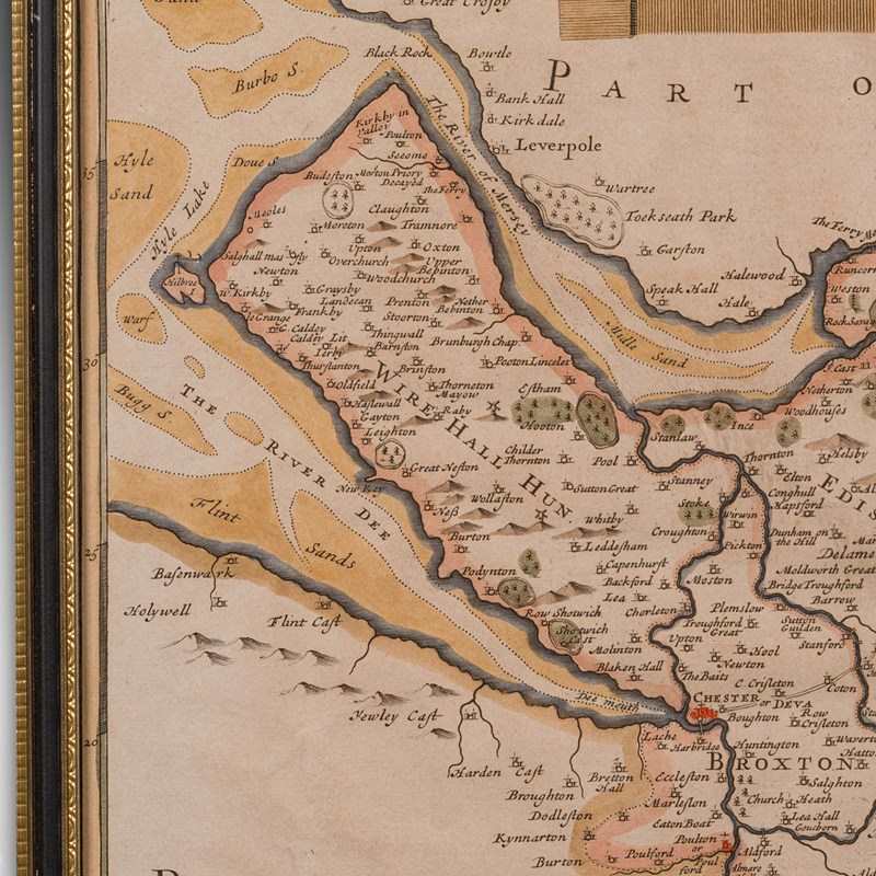
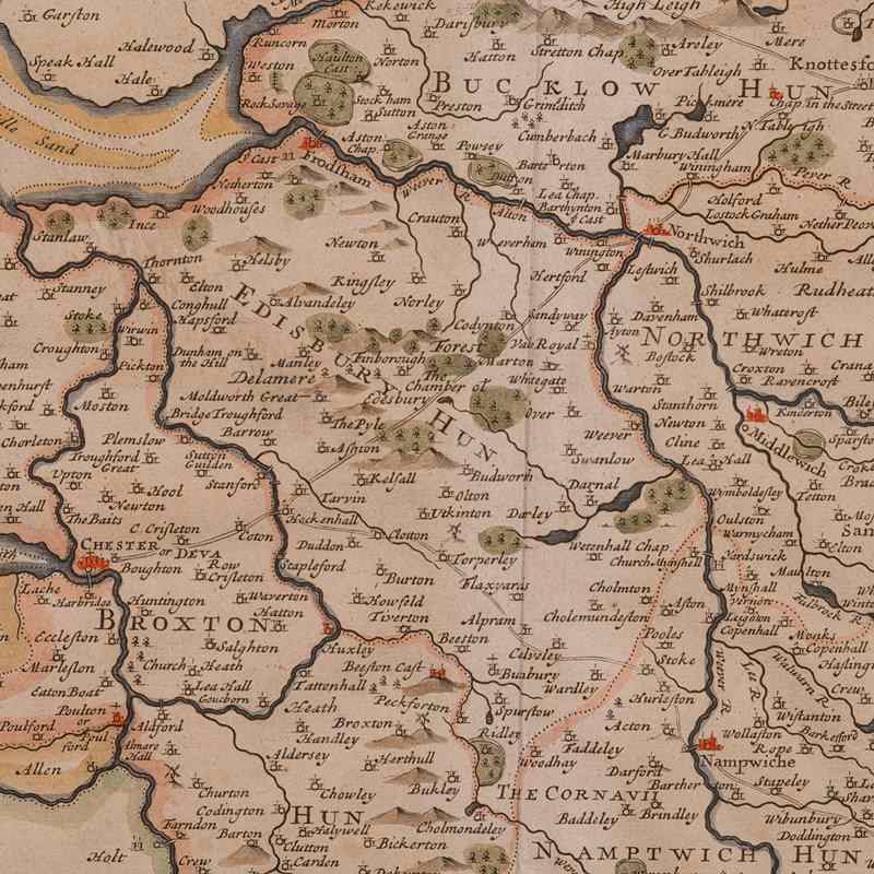
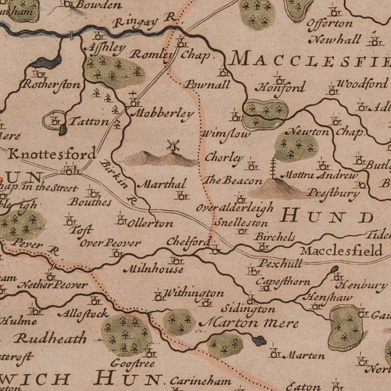
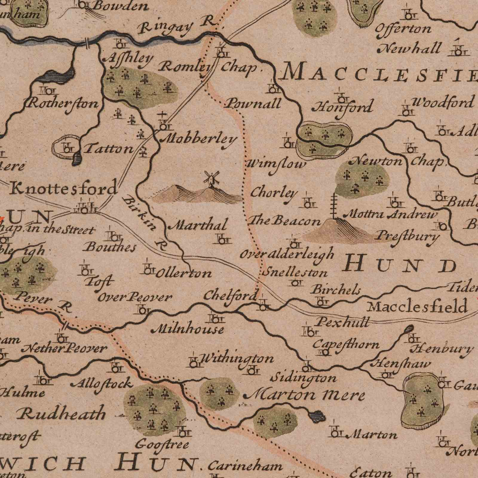
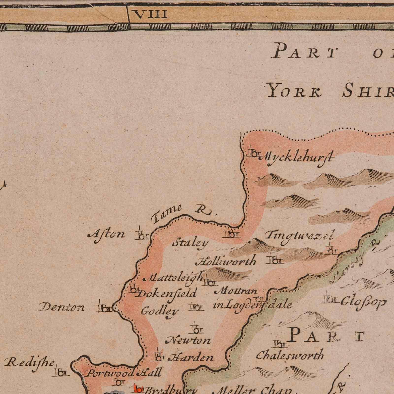
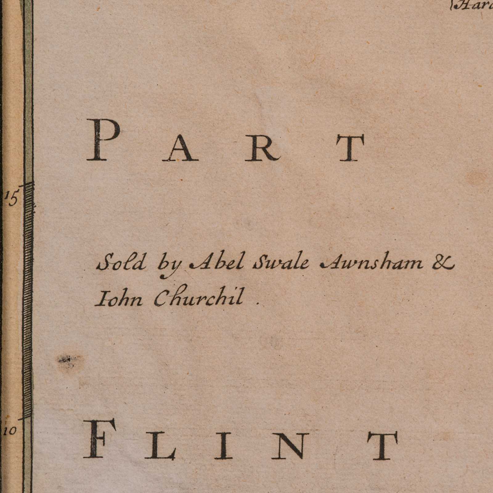
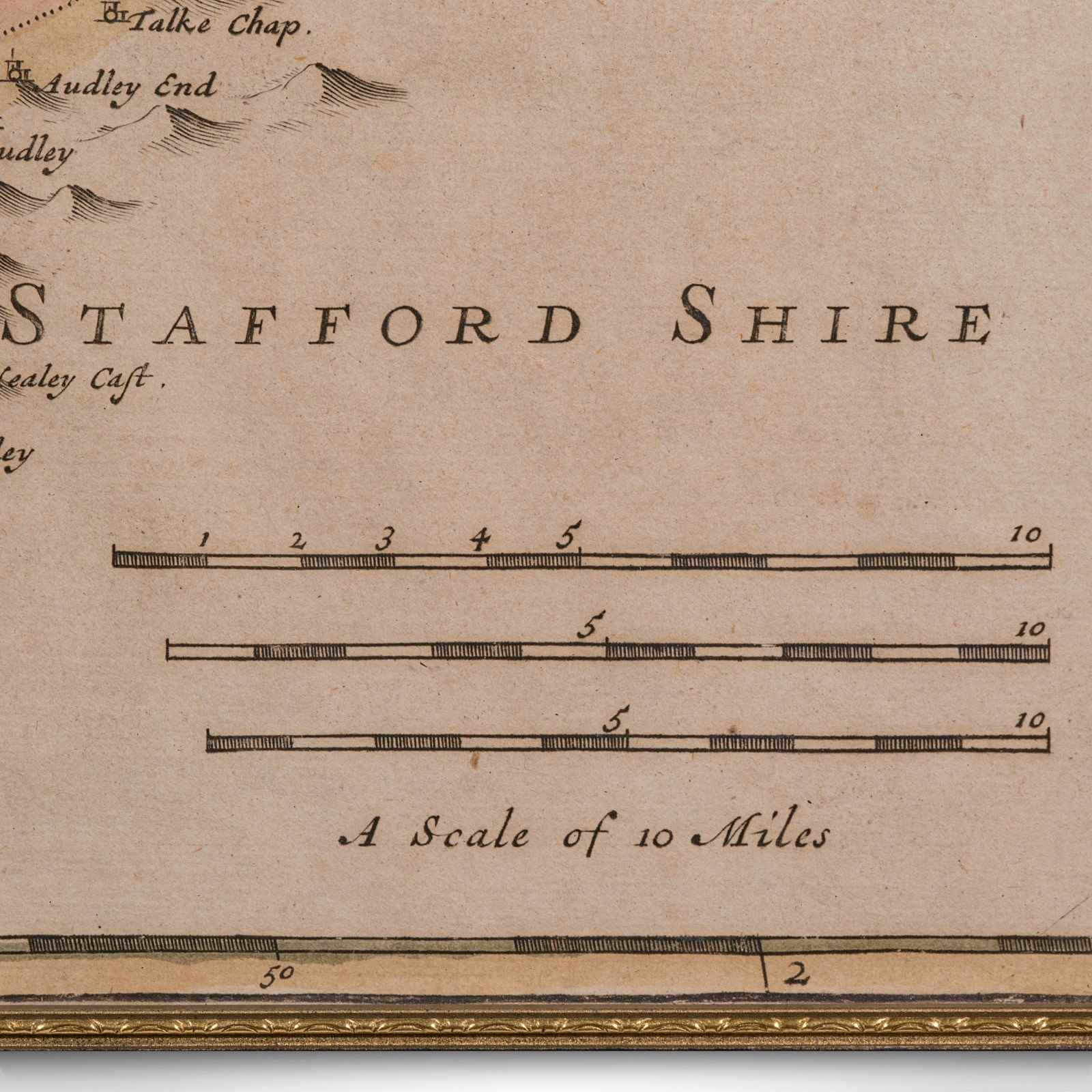
This is an antique county map of Cheshire, an English framed cartographic engraving by Robert Morden, dating to the early Georgian period, circa 1720. A charming and historically rich representation of the county, this Victorian period hand-coloured engraving captures the elegance of early 18th century mapmaking.
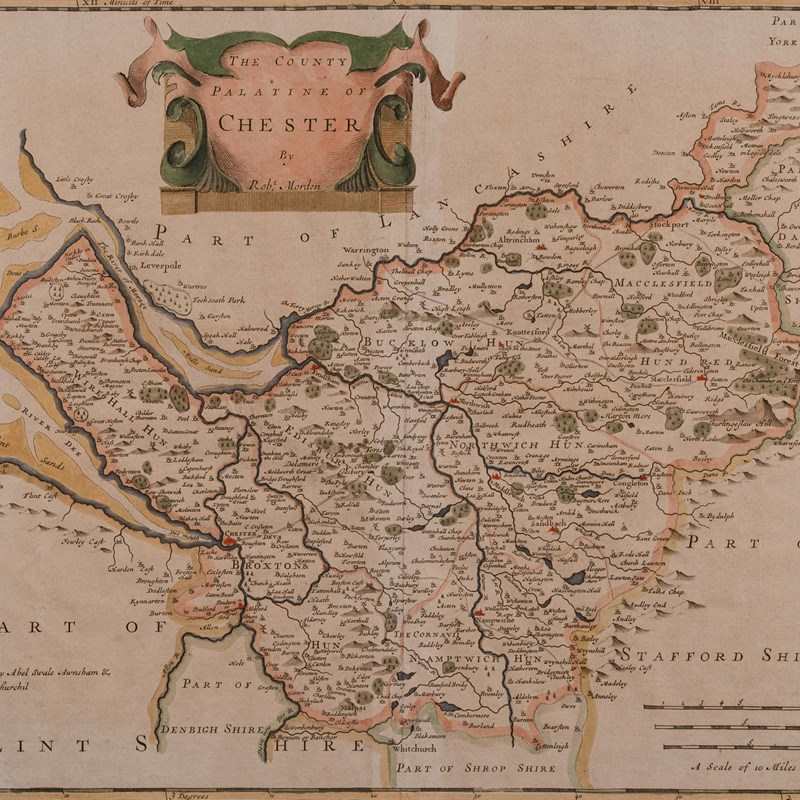
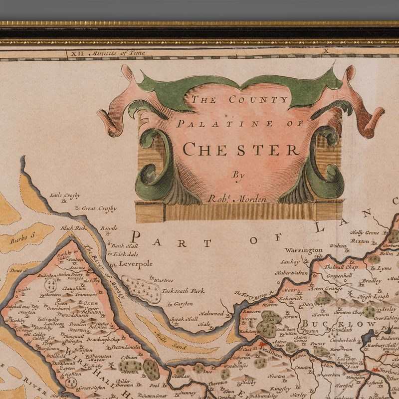
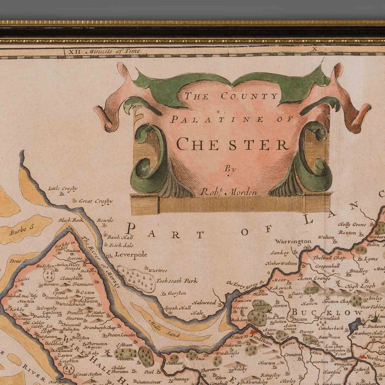
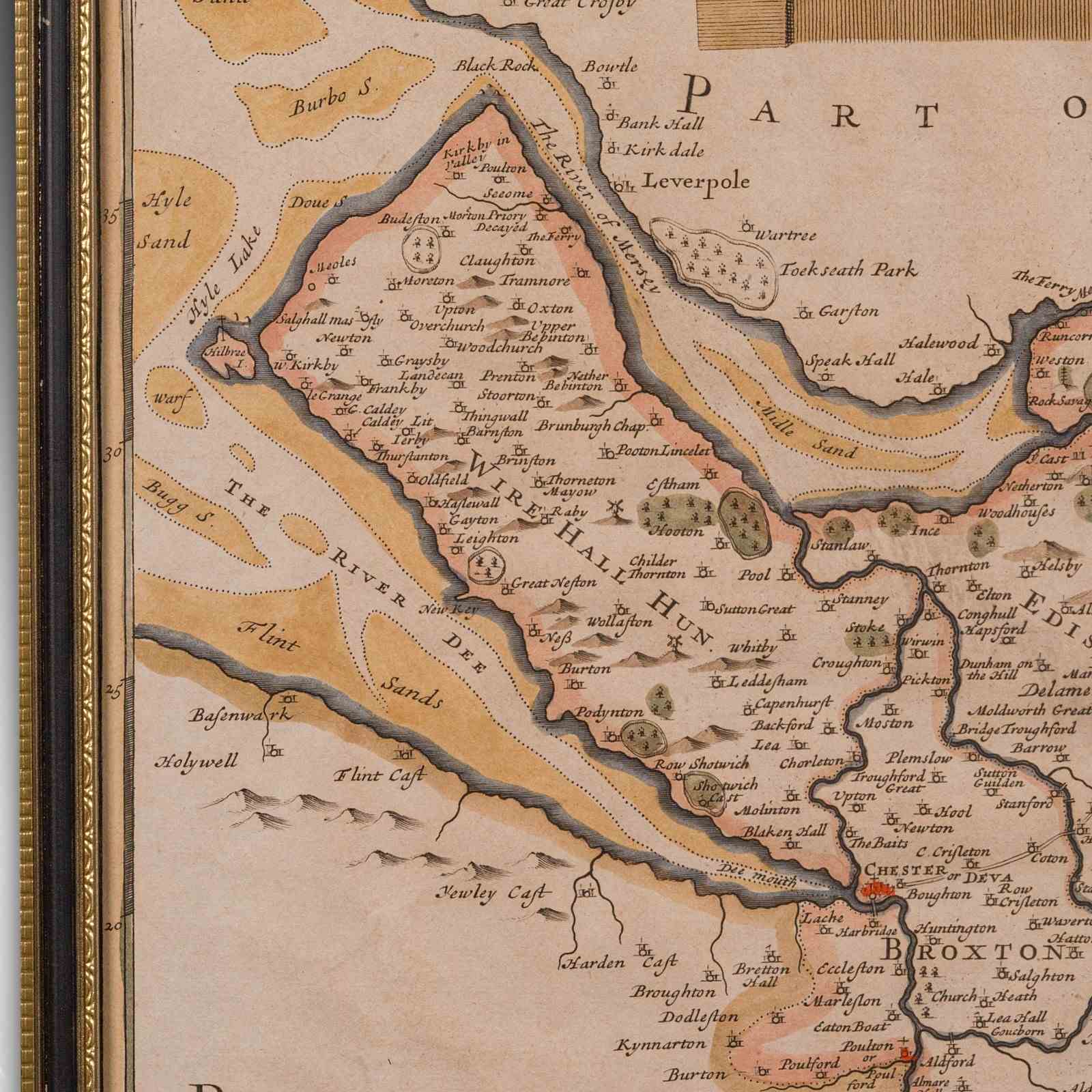
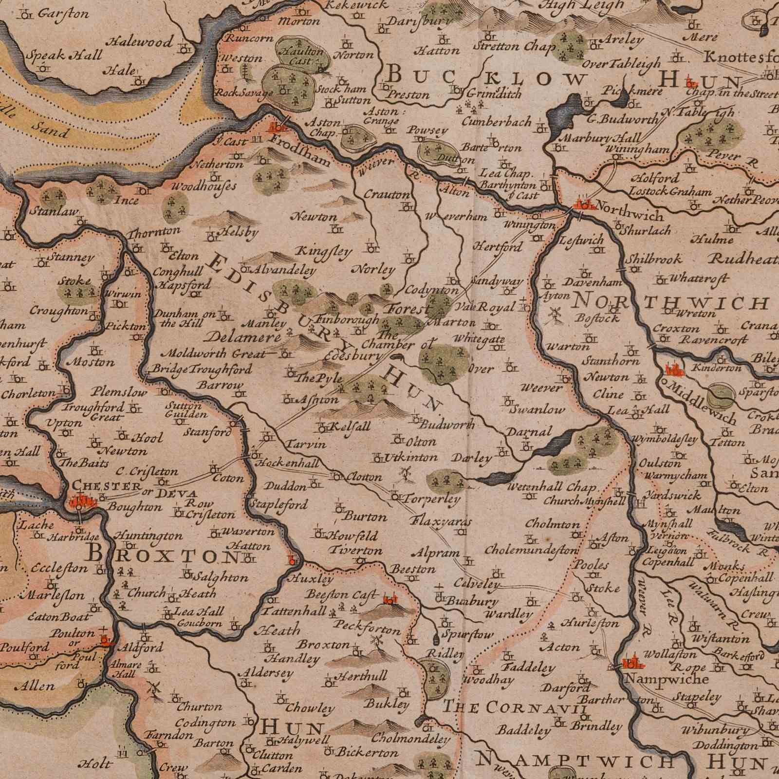
Fascinating 18th century map of the County and Palantine of Chester, brimming with historic detail and charm
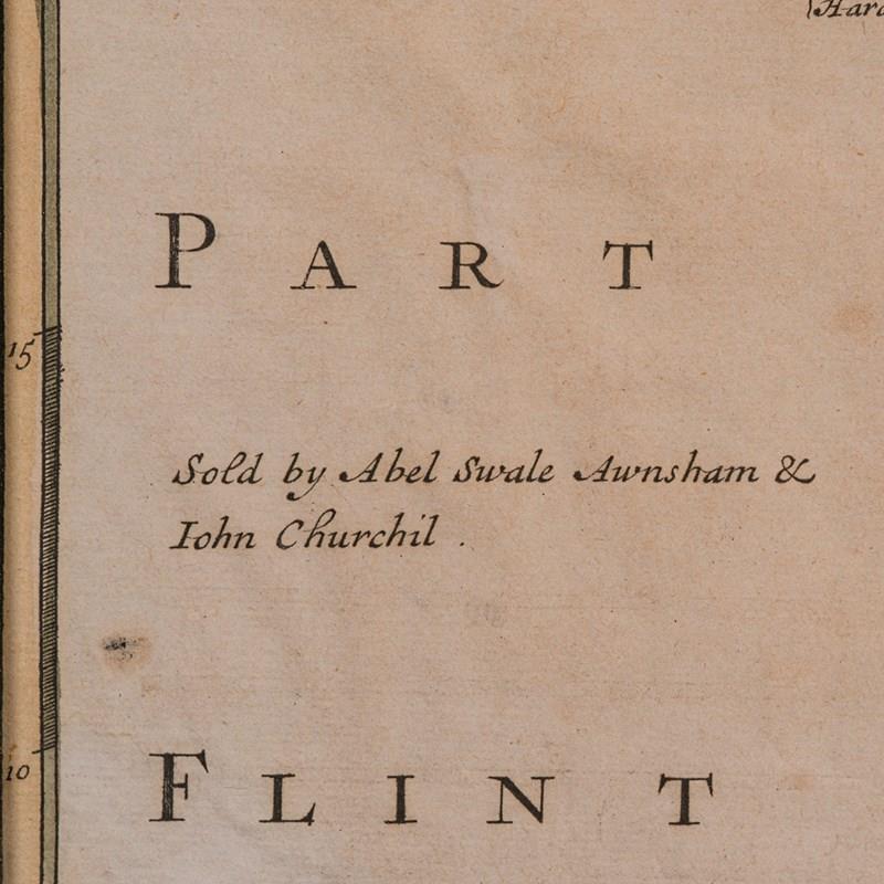
Posthumous reproduction of Robert Morden’s celebrated work, as published in Magna Britannia by Thomas Cox, 1720
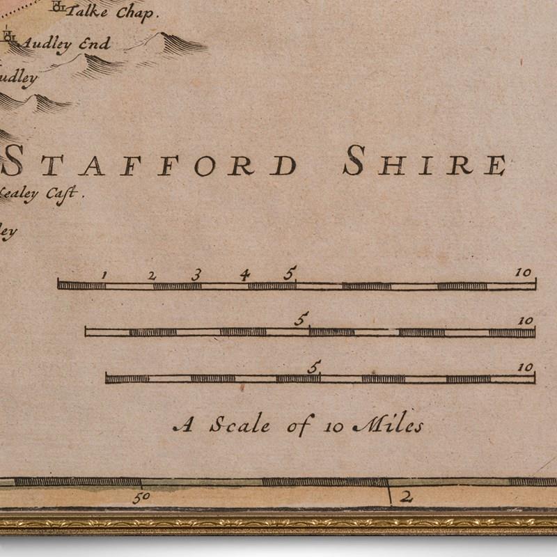
Engraved cartography displays the administrative Hundreds and antique spellings of familiar towns and regions
Hand coloured accents enrich the visual appeal, with delicate tonality throughout
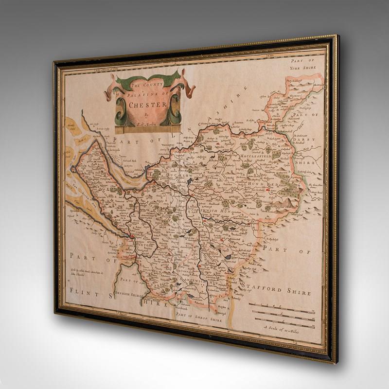
Presented in a tasteful later frame, offering sympathetic enhancement to the period character
Glazed with clear glass, protecting the map while ensuring excellent clarity
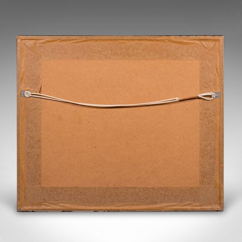
Dressed to the rear with mounting braid, ready for immediate wall hanging
A wonderful piece for collectors of early British cartography, or those with a fondness for Cheshire heritage
This antique county map is a delightful and informative decorative piece, steeped in early Georgian geography. An ideal addition to the traditional study, country house interior, or heritage gallery wall. Delivered ready to display.
Dimensions:
Max Width: 44cm (17.25'')
Max Depth: 1cm (.5'')
Max Height: 37.5cm (14.75'')
Map Width: 41cm (16.25'')
Map Height: 34.5cm (13.5'')
Item Info
Seller
Seller Location
Hele, Devon
Item Dimensions
H: 37.5cm W: 44cm D: 1cm
Period
1900s
Item Location
United Kingdom
Seller Location
Hele, Devon
Item Location
United Kingdom
Seller Contact No
+44 (0)207 1833511
More from LONDON FINE ANTIQUES