
Antique South America Map, English, Framed Cartography, De La Rochette, Georgian
Stock No
25610
2024
- £895.00
- €1,049 Euro
- $1,197 US Dollar
Questions about this item?
Like this item?
Item Description
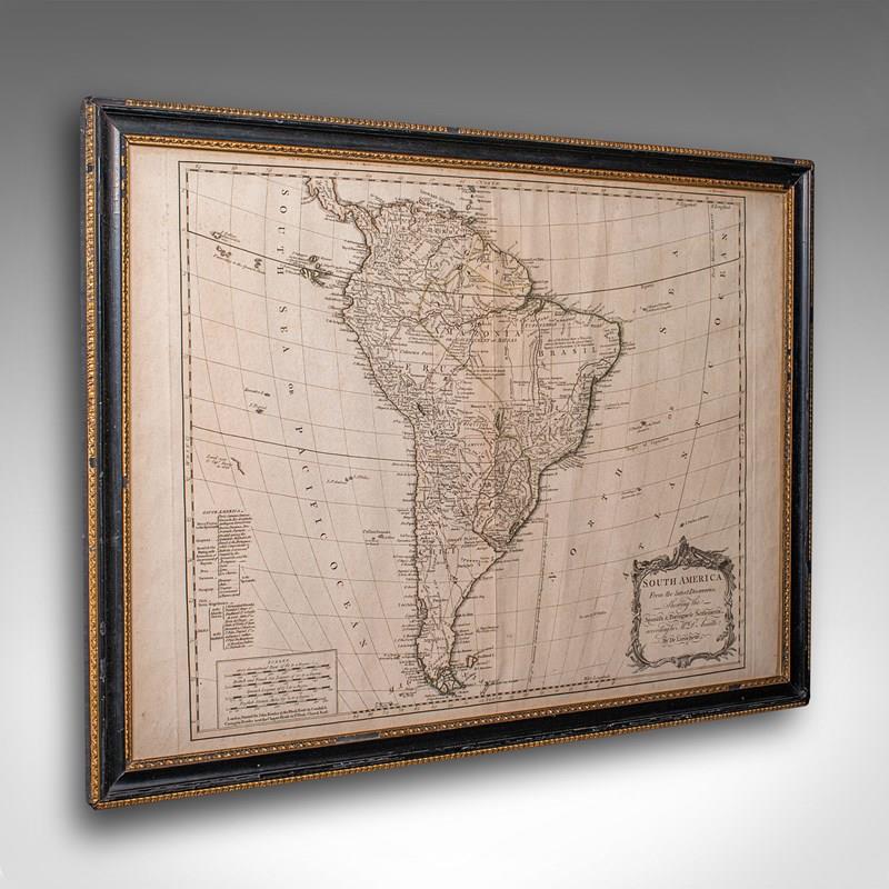
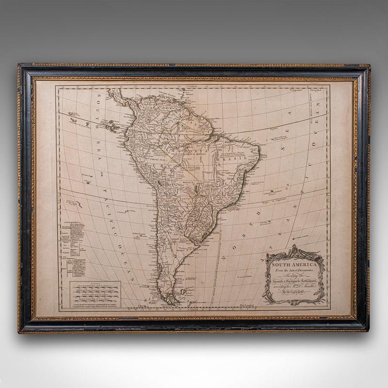
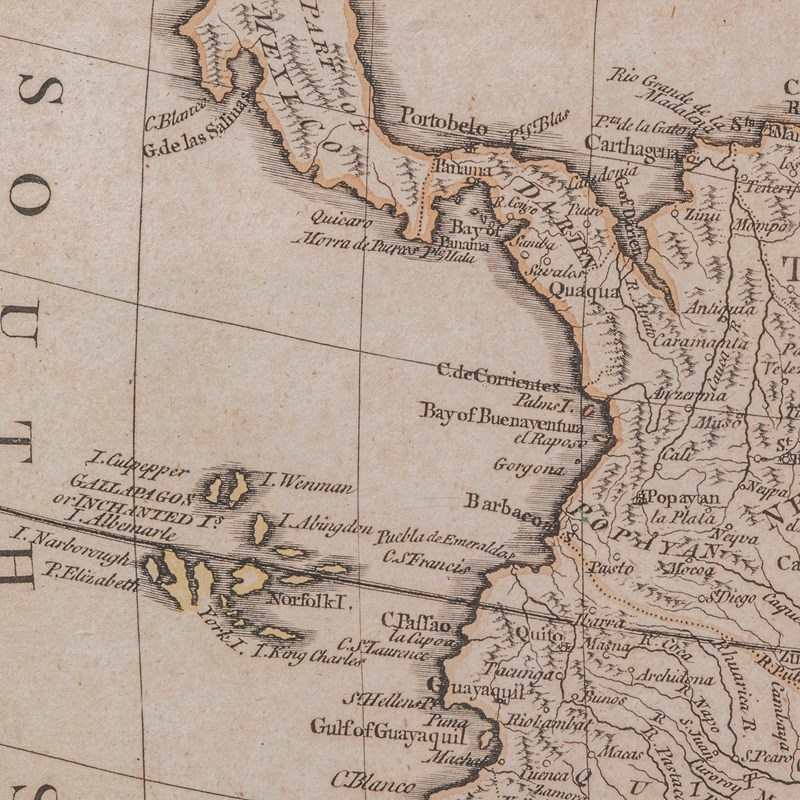
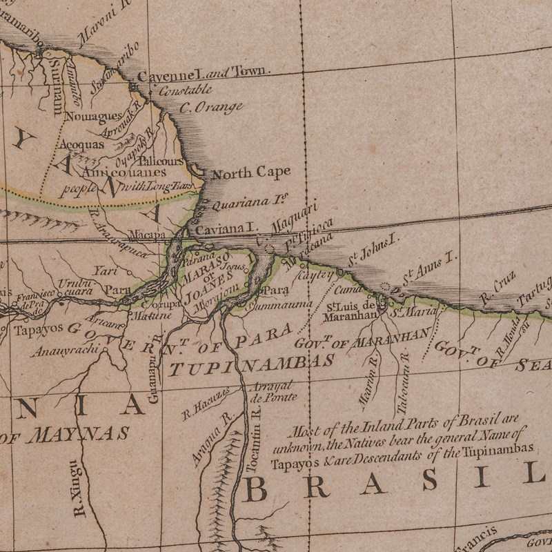
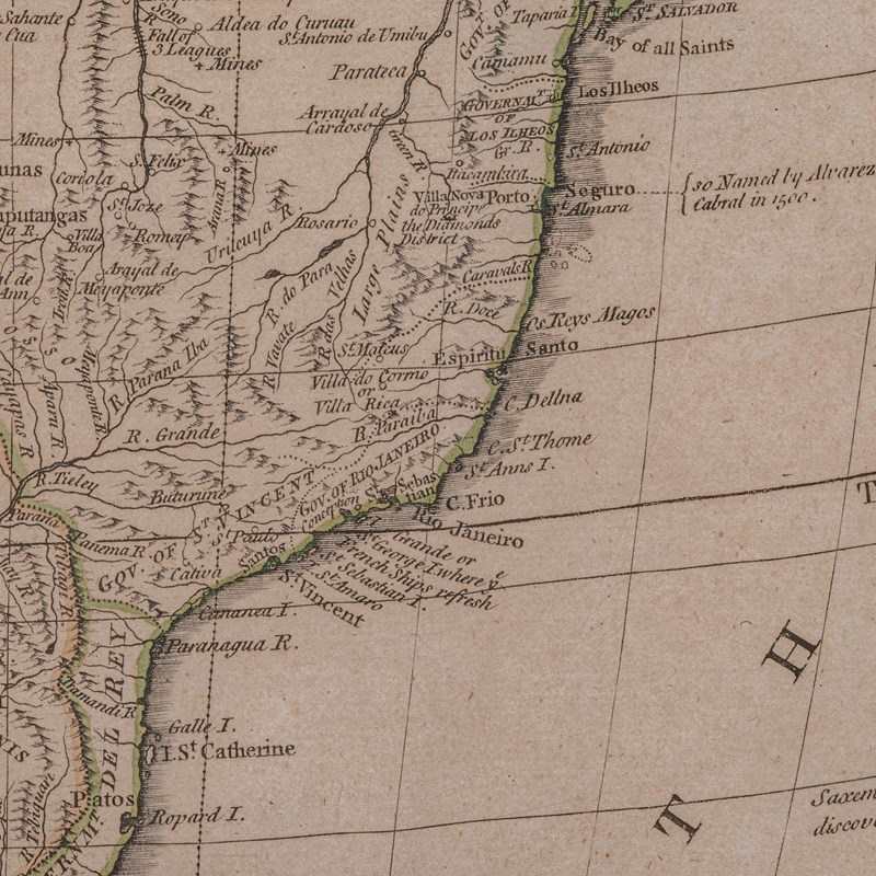
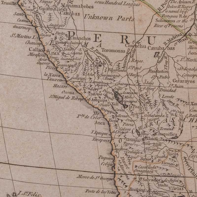
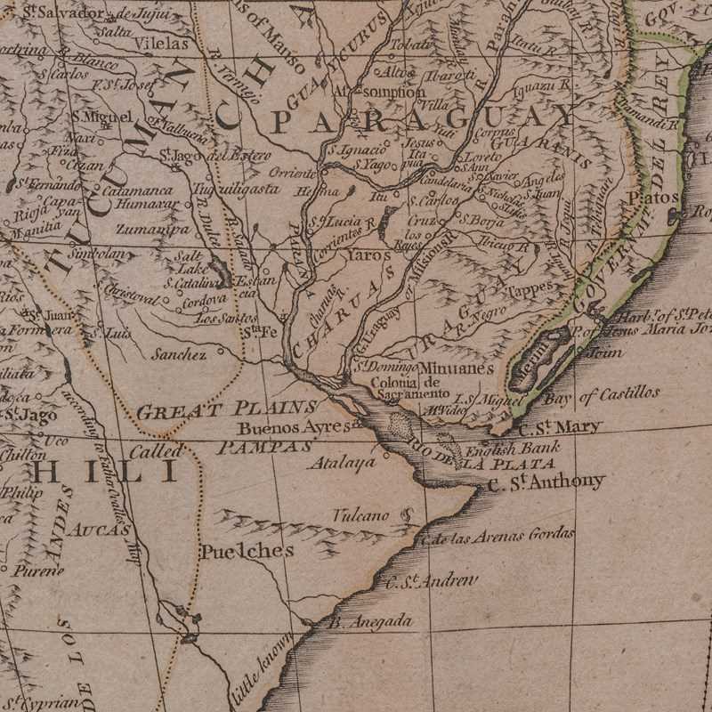
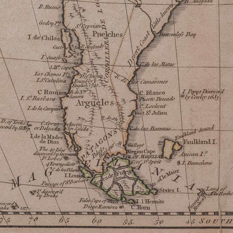
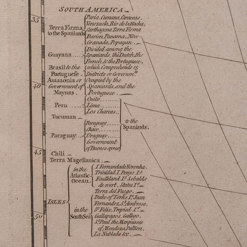
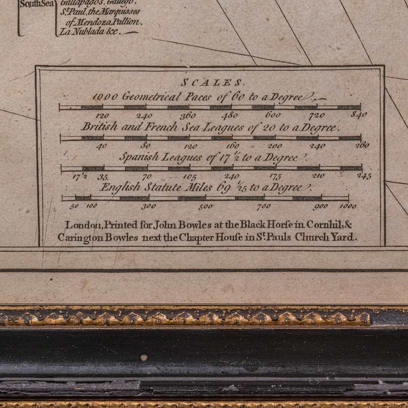
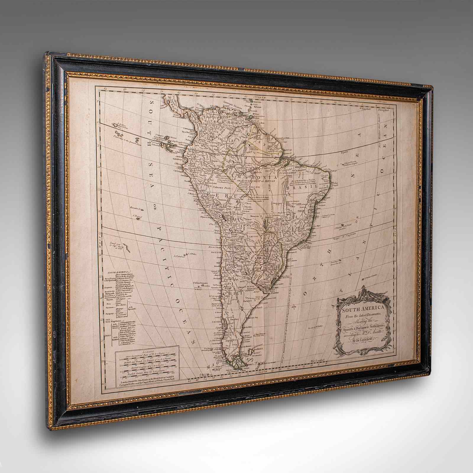
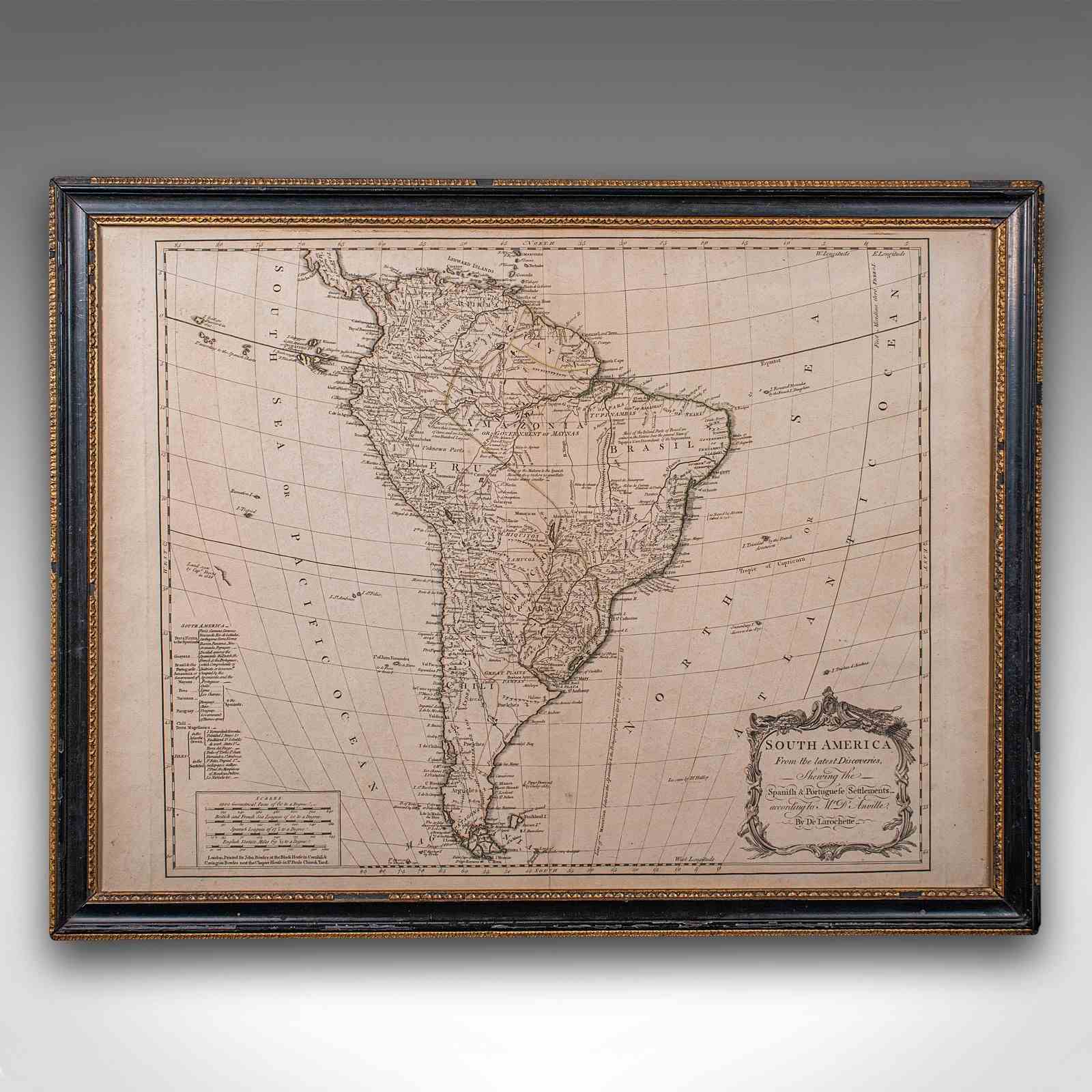
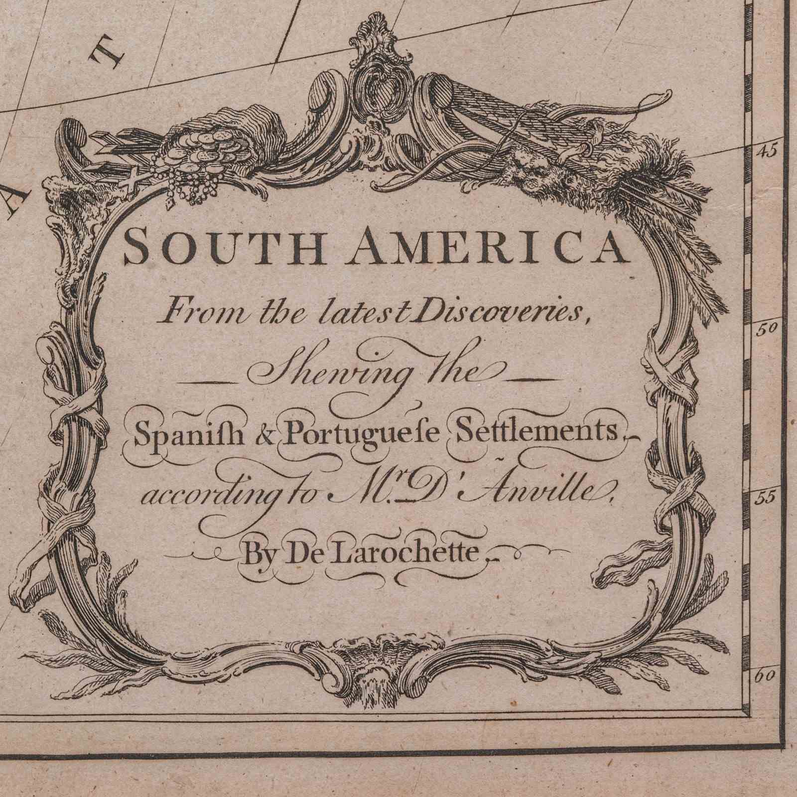
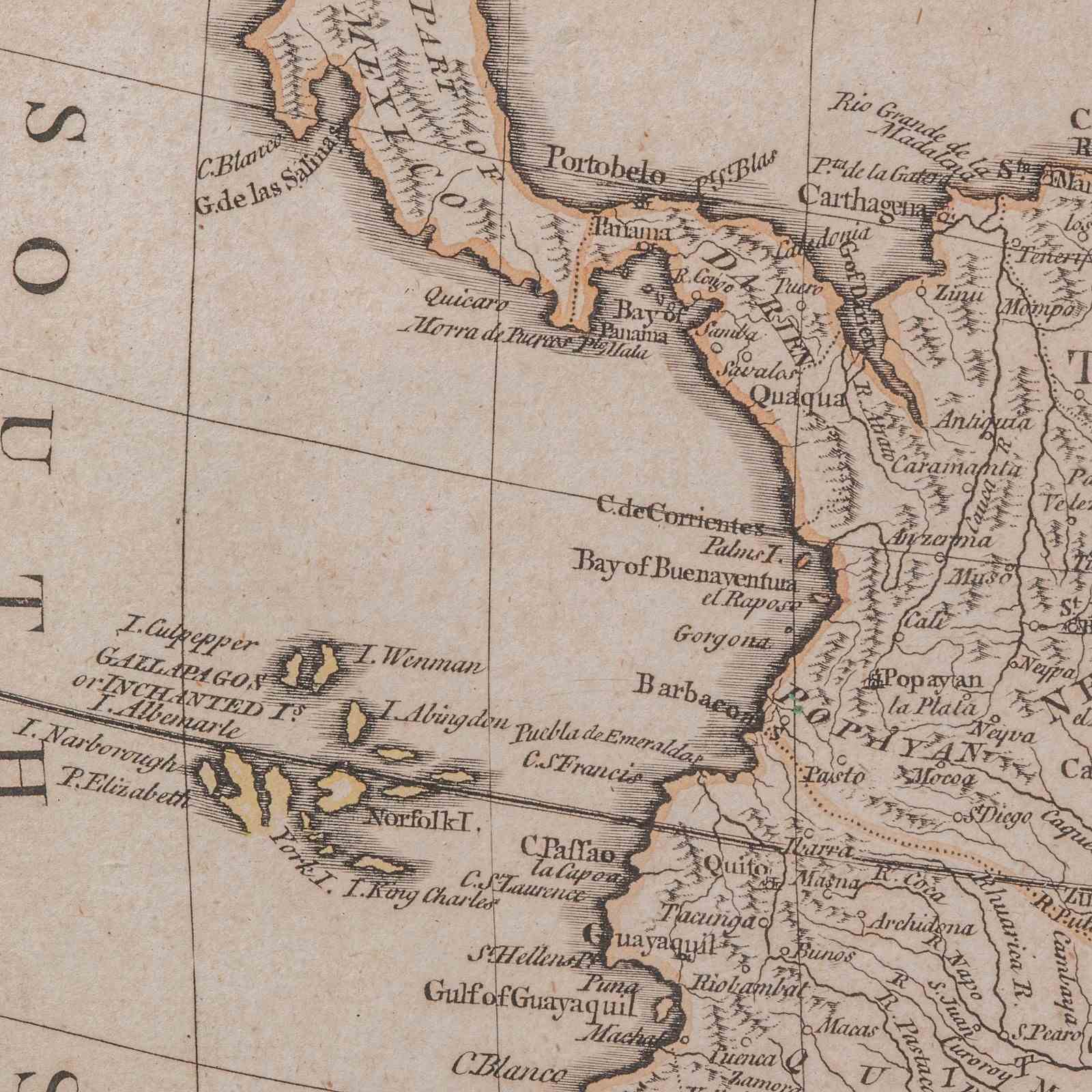
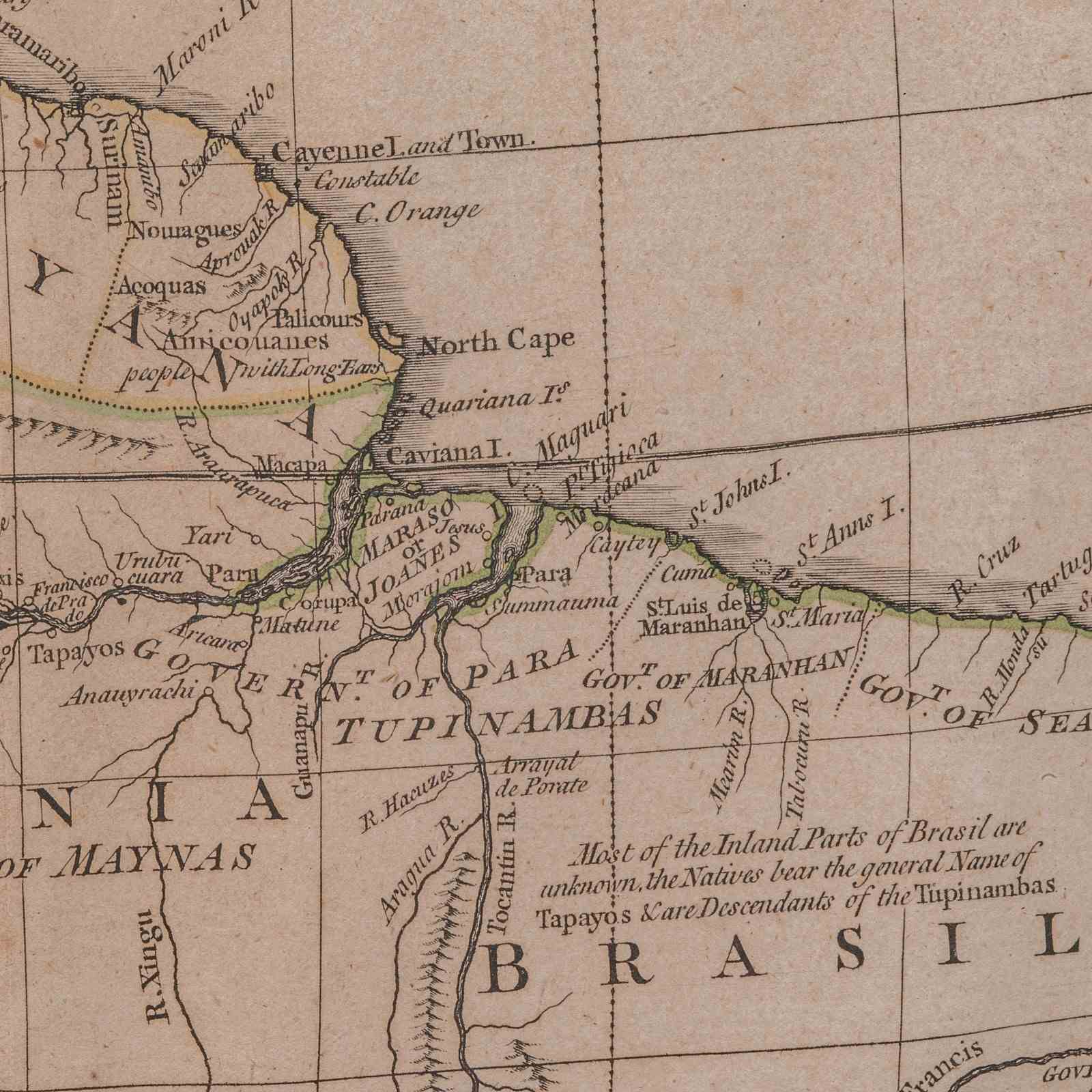
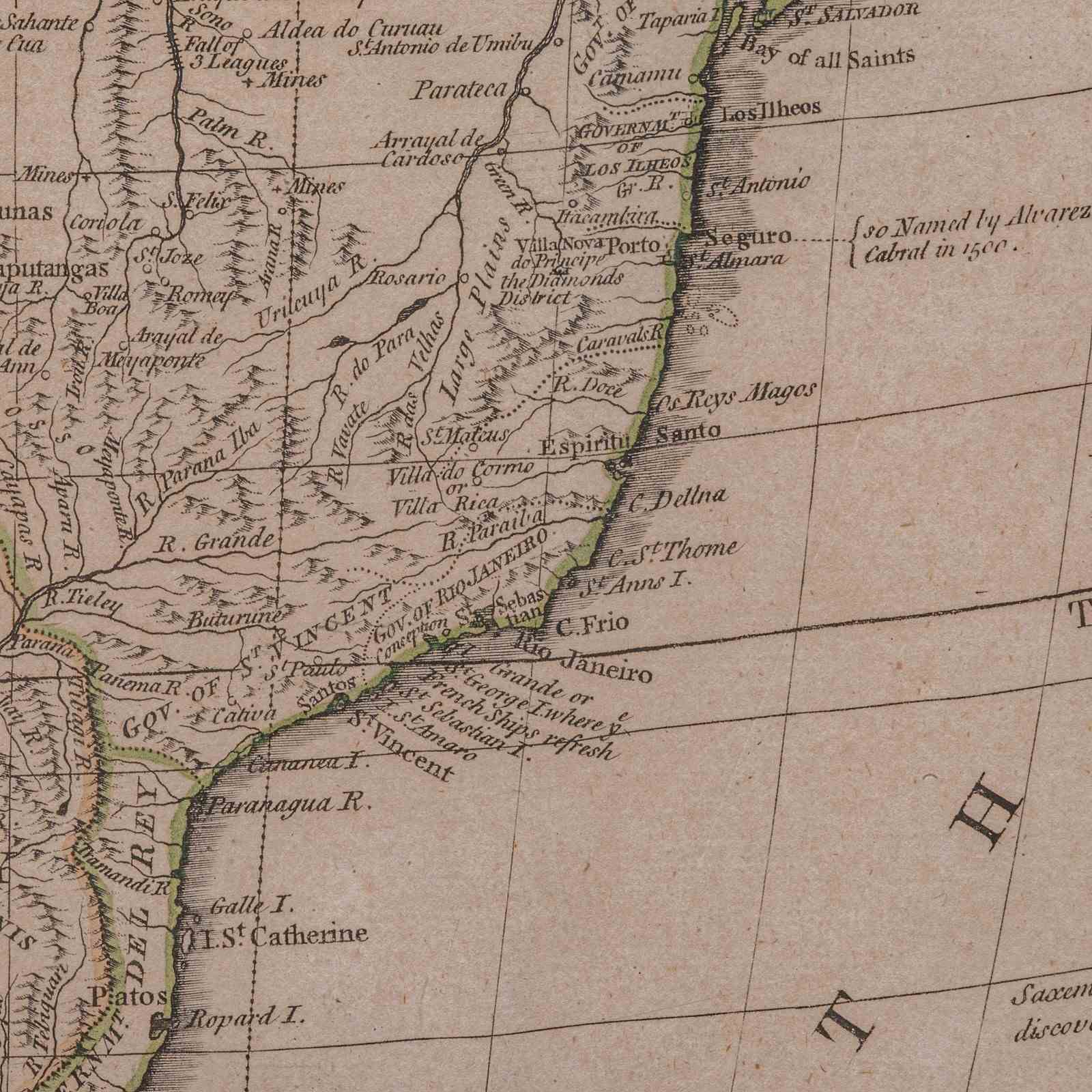
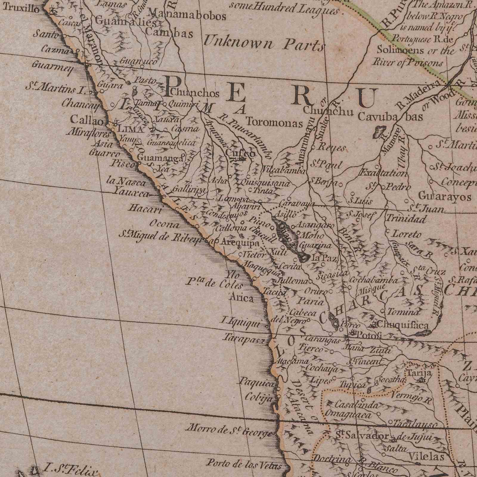
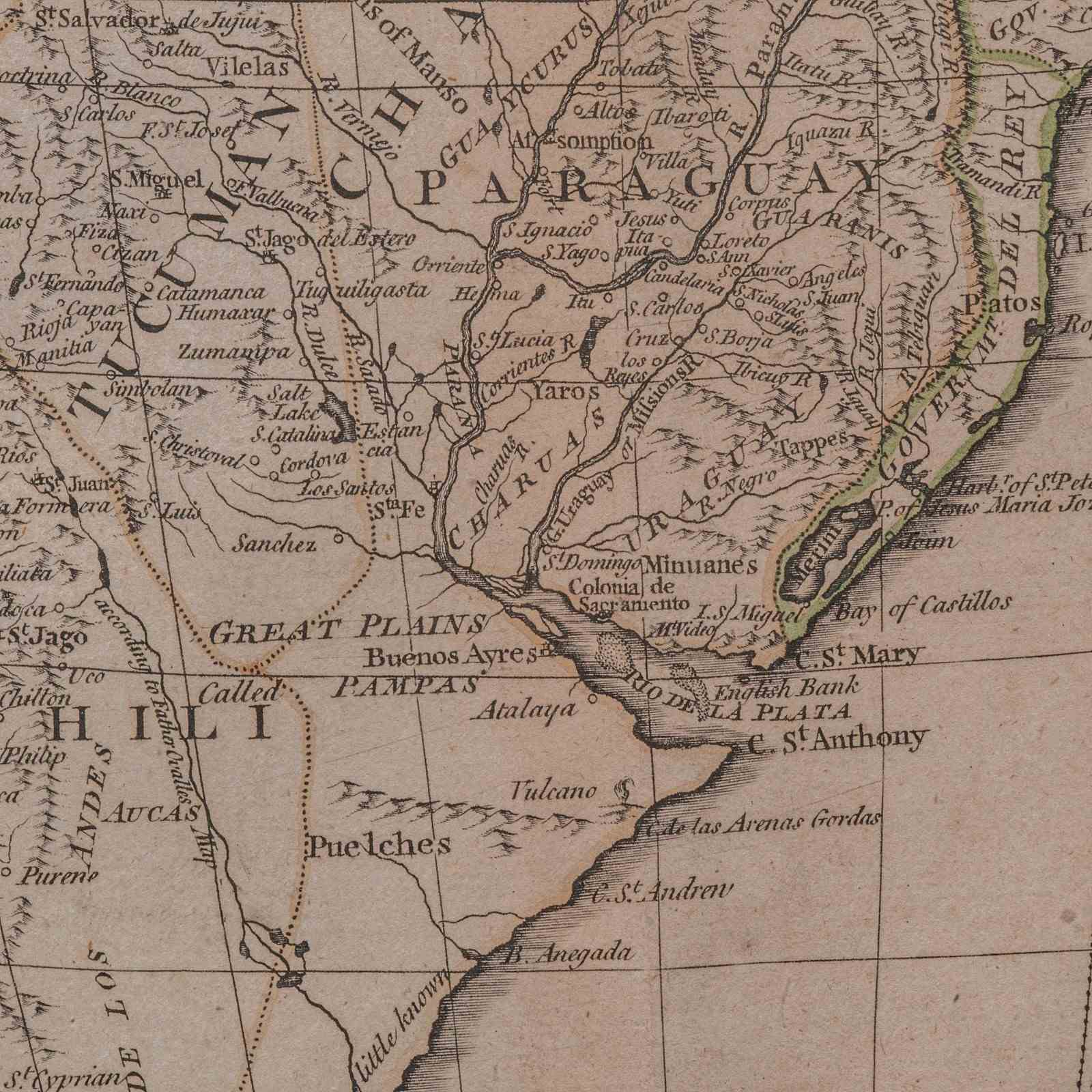
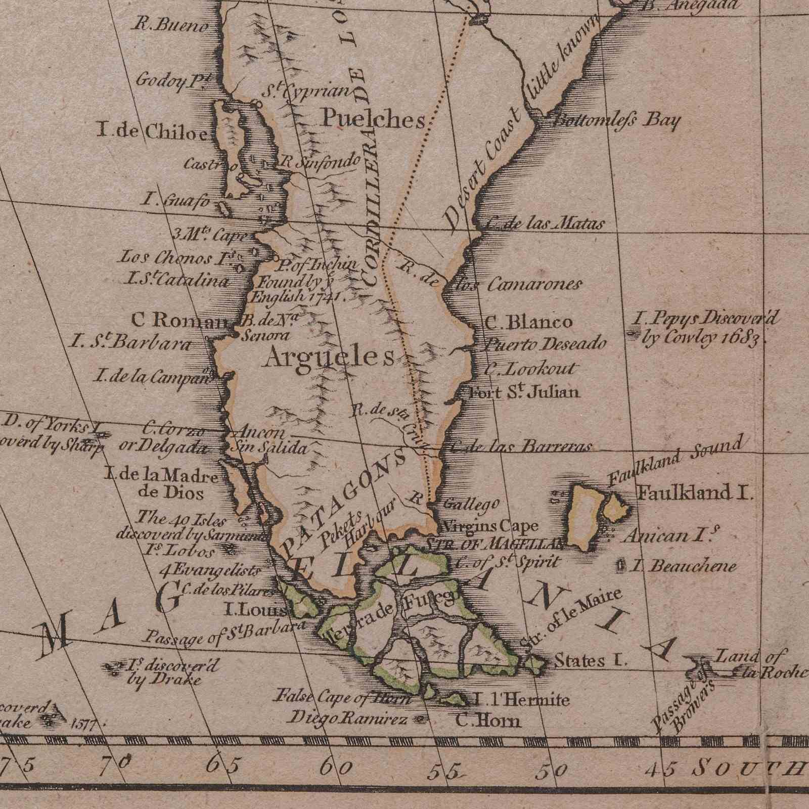
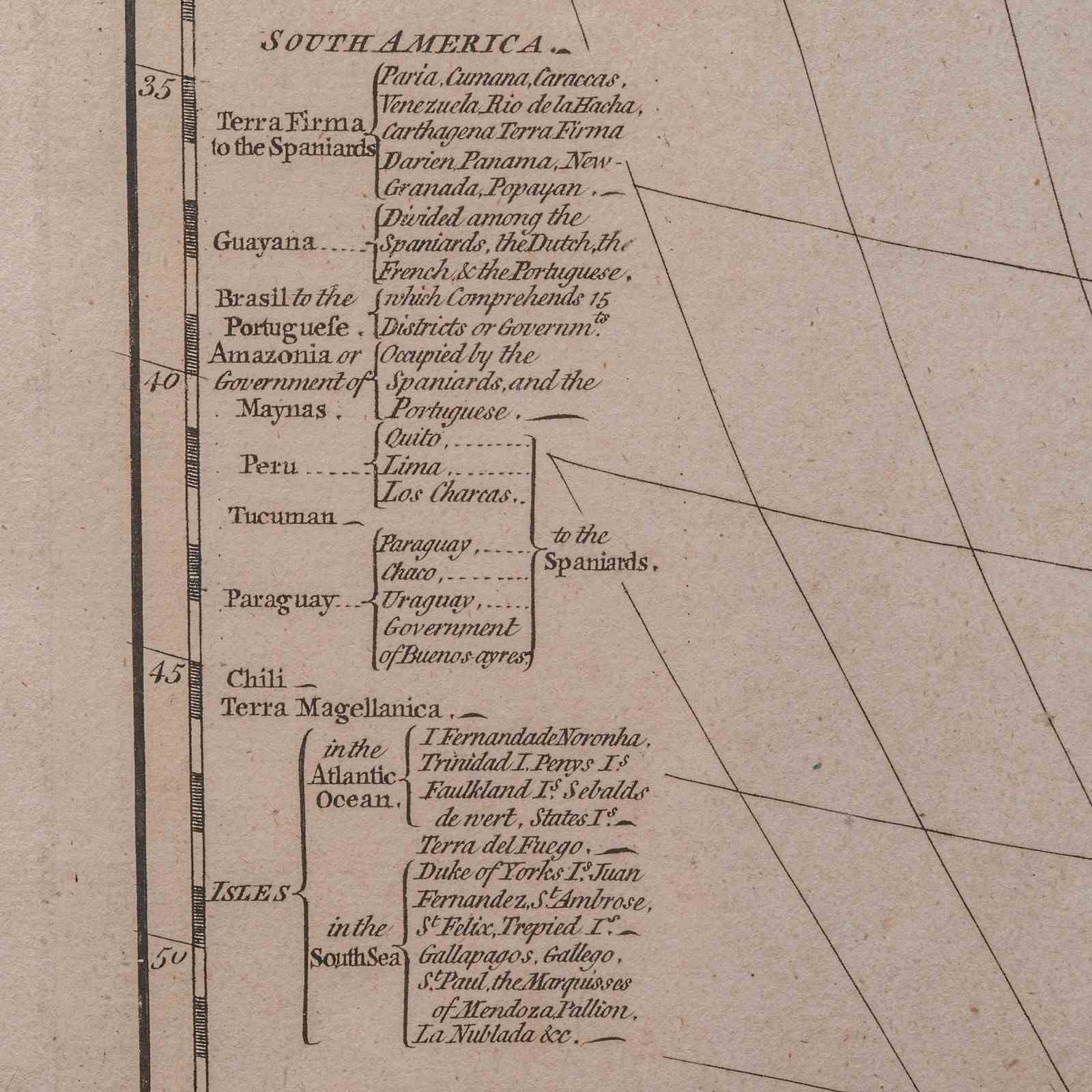
This is a superb antique map of South America. An English, framed cartographic engraving by Louis Stanislas De La Rochette, dating to the Georgian period and later, circa 1790. A fascinating example of late 18th century mapping, elegantly presented for display.
Delightful Georgian period cartography depicting the continent of South America in fine detail
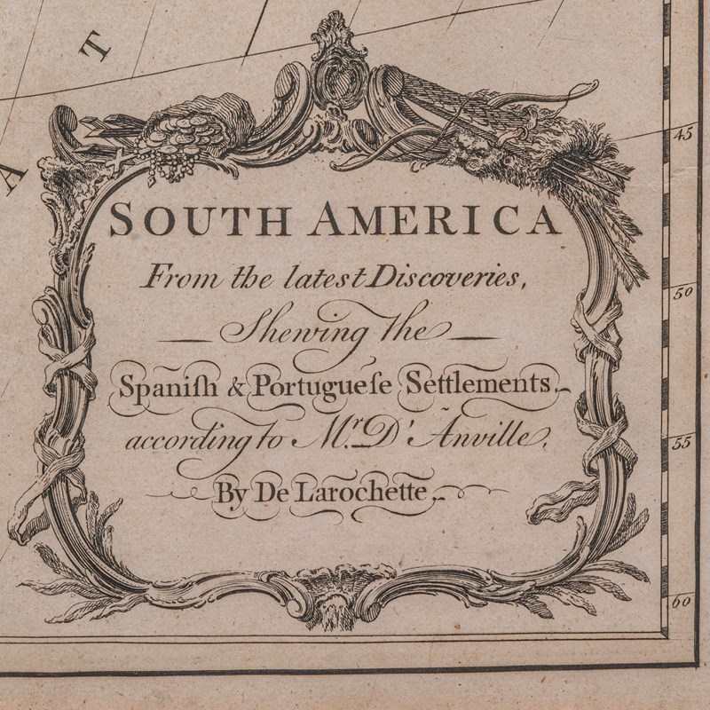
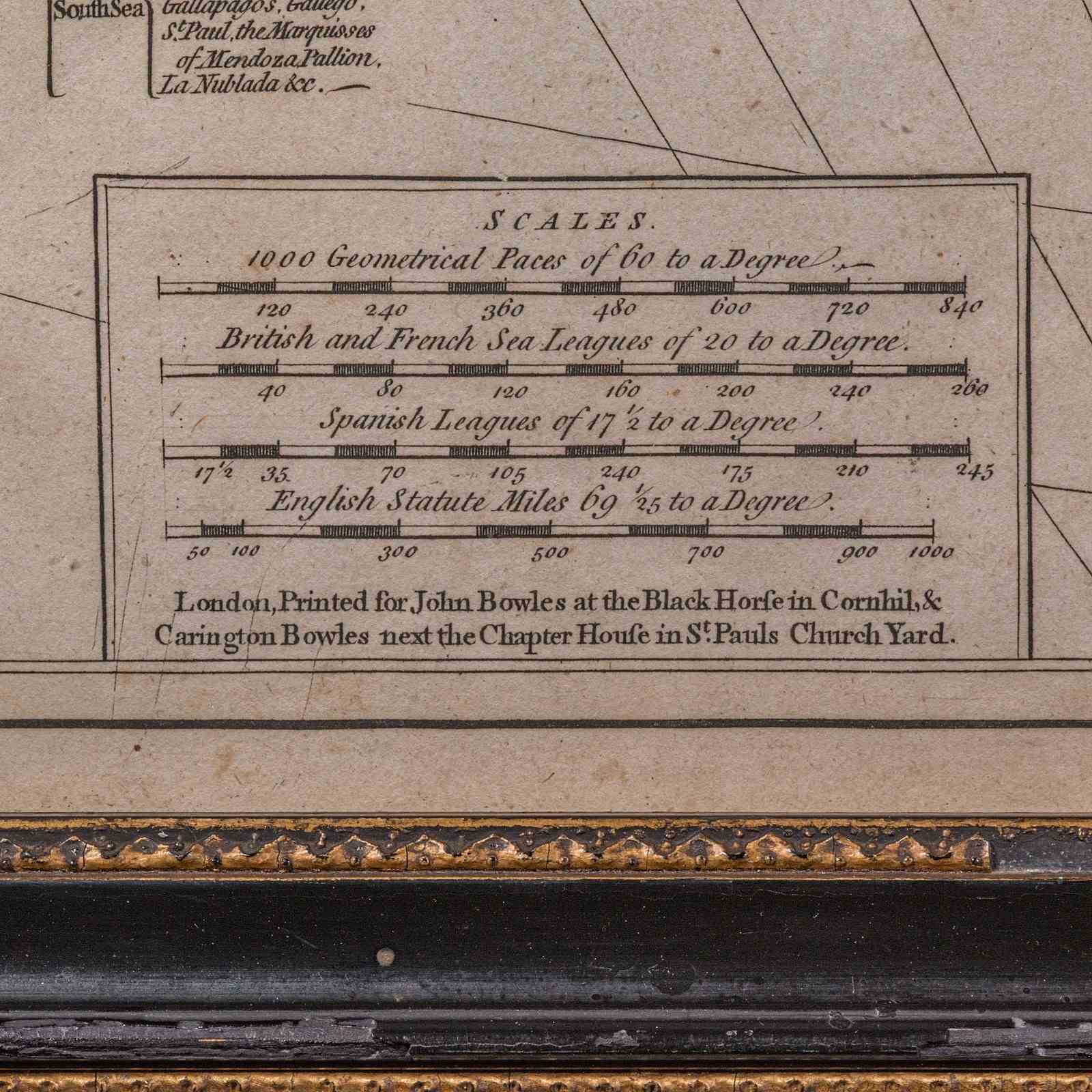
Engraved by De La Rochette and printed in London for John Bowles, publisher of fine maps and atlases
Drawn with reference to the acclaimed work of Jean-Baptiste Bourguignon d’Anville (1697–1782)
d'Anville was noted for his scientific precision and influence on 18th century geography
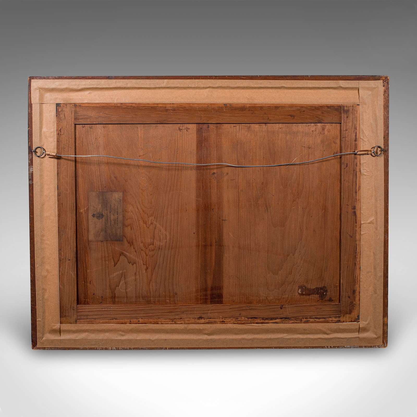
Set within a later antique frame, displaying a time-worn patina and gentle signs of age
Presented behind clear glazing for protection and clarity of viewing
Dressed to the rear with mounting wire, ready for ease of hanging and immediate display
Displays a fascinating level of detail, illustrating early territorial divisions, parallels, and natural features
A fine example of Georgian cartographic art, this antique South America map by De La Rochette offers a rare opportunity to appreciate both historic geography and period craftsmanship. Ideal for collectors and admirers of 18th century exploration. Delivered ready to display.
Dimensions:
Max Width: 73cm (28.75'')
Max Depth: 3cm (1.25'')
Max Height: 56cm (22'')
Map Width: 66cm (26'')
Map Height: 49cm (19.25'')
Item Info
Seller
Seller Location
Hele, Devon
Item Dimensions
H: 56cm W: 73cm D: 3cm
Period
1790s
Item Location
United Kingdom
Seller Location
Hele, Devon
Item Location
United Kingdom
Seller Contact No
+44 (0)207 1833511
More from LONDON FINE ANTIQUES