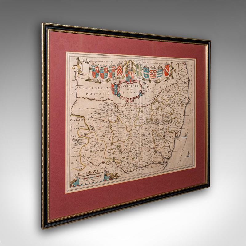
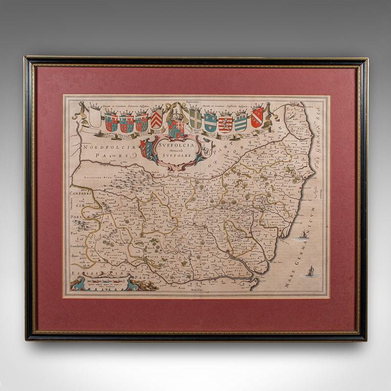


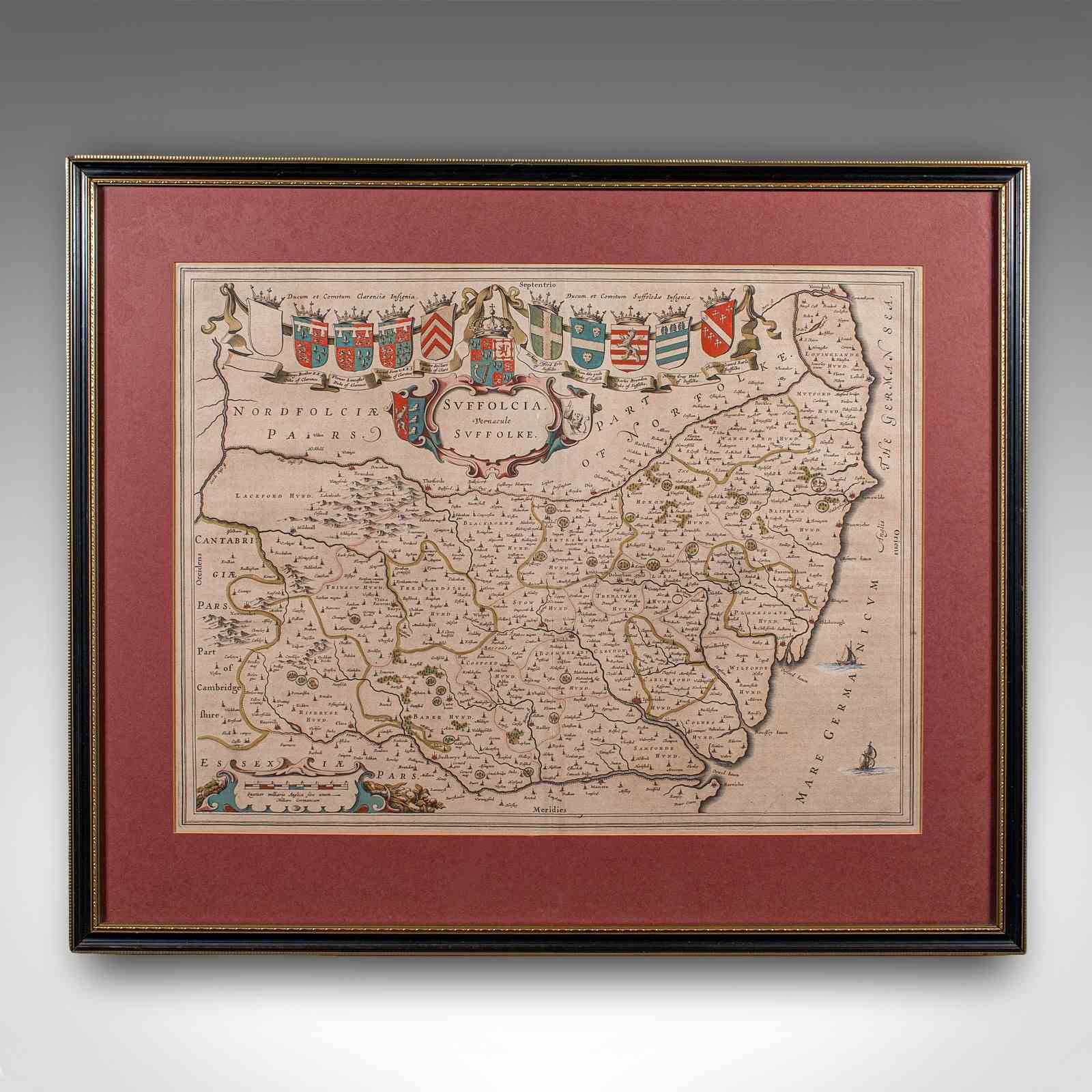
Antique Suffolk County Map, Dutch, Atlas Novus, Joan Blaeu, Cartography, C.1645
Stock No
25811
2024
- £925.00
- €1,084 Euro
- $1,237 US Dollar
Questions about this item?
Like this item?
Item Description
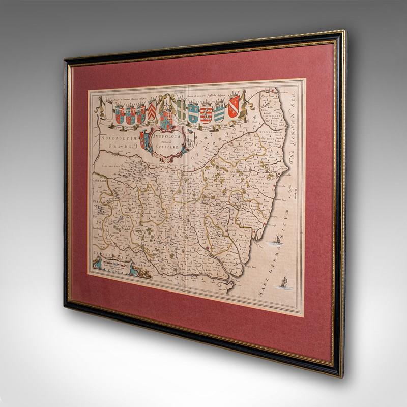
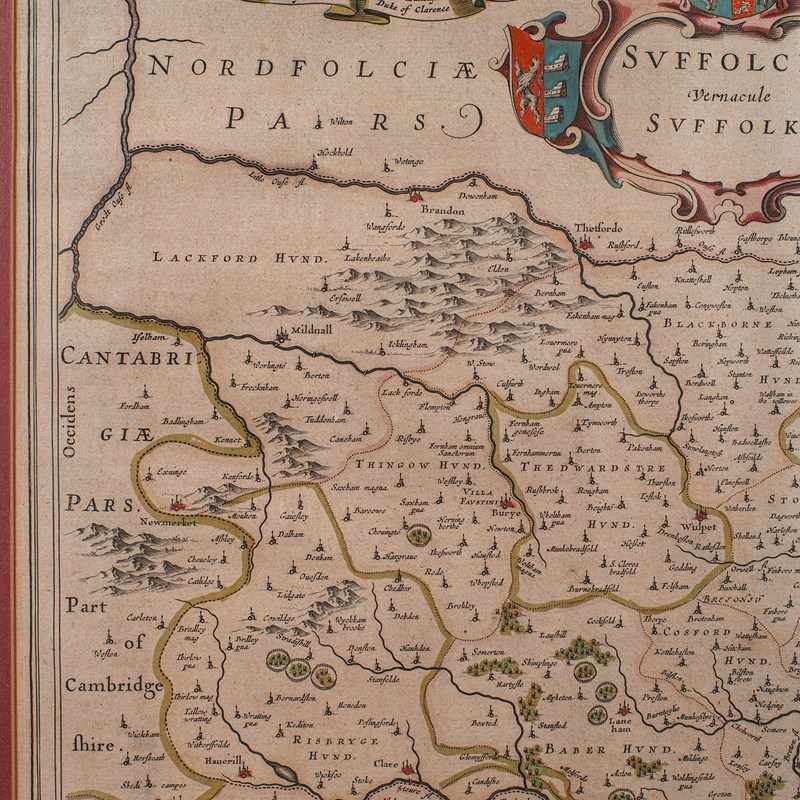
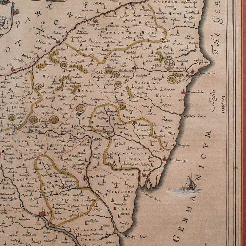
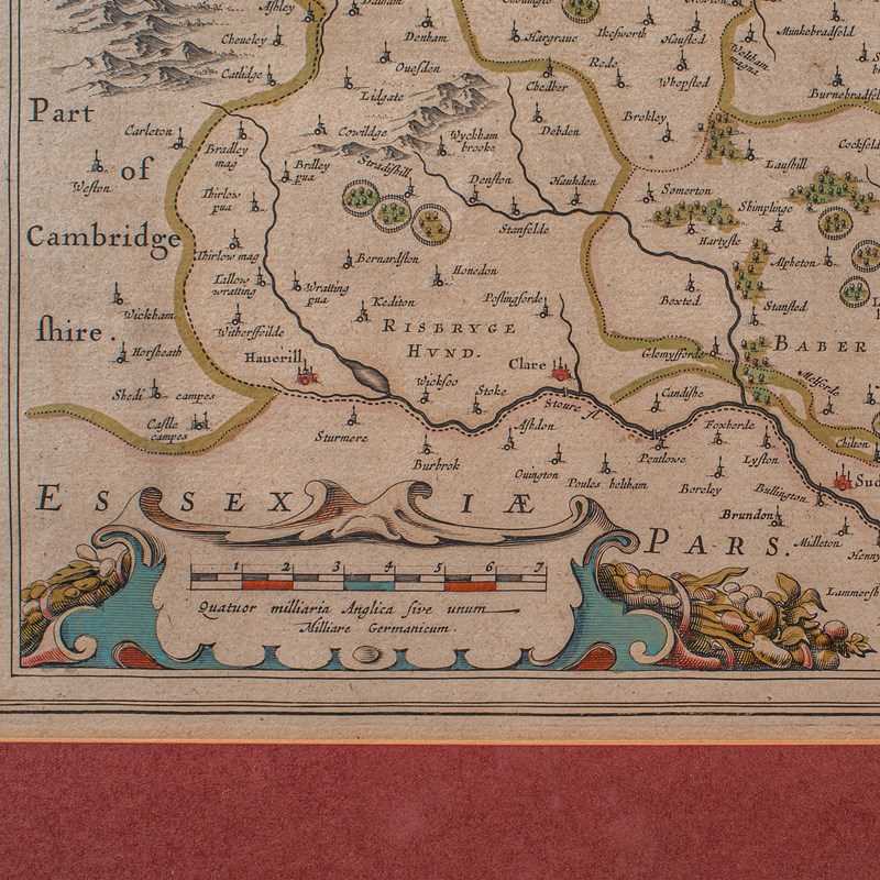
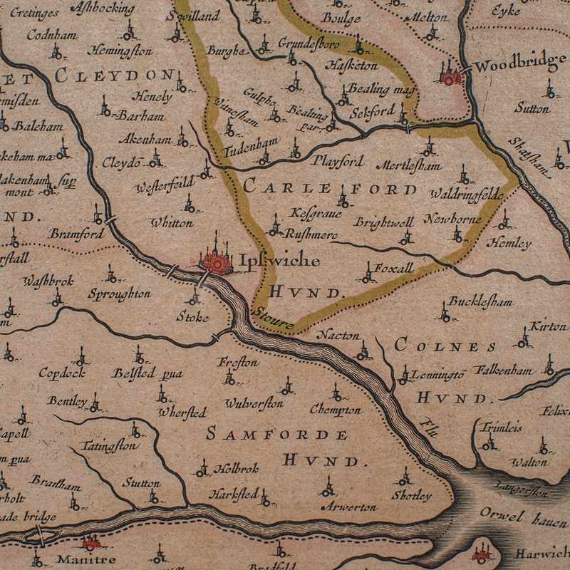
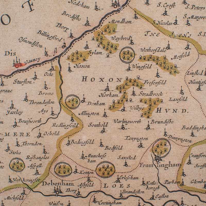
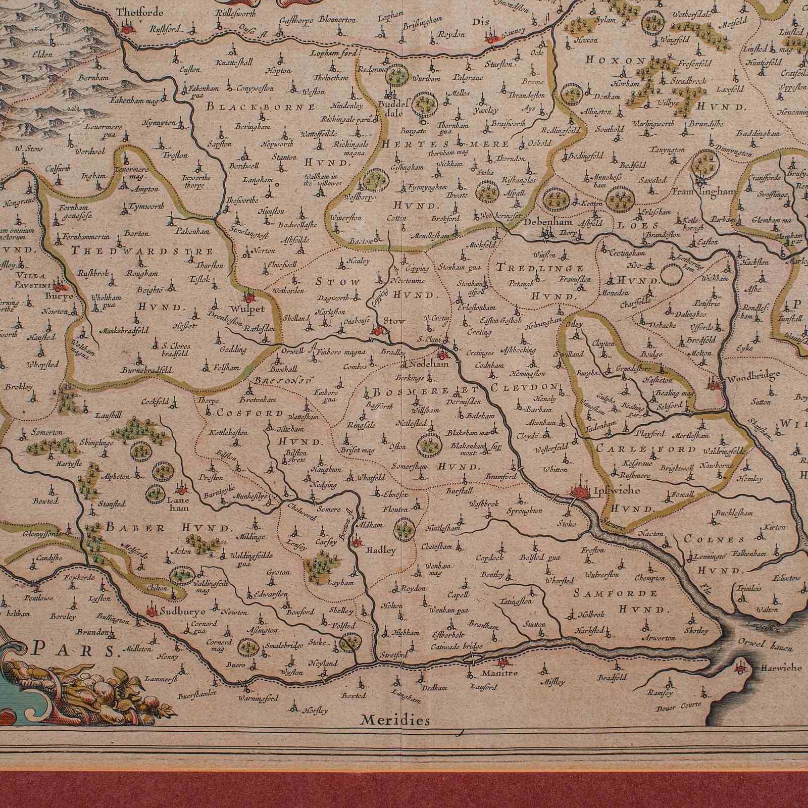
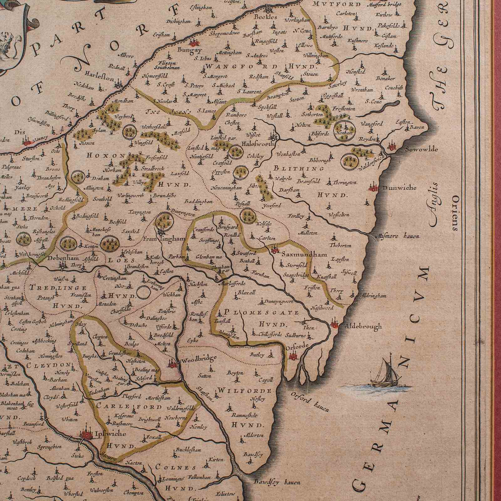
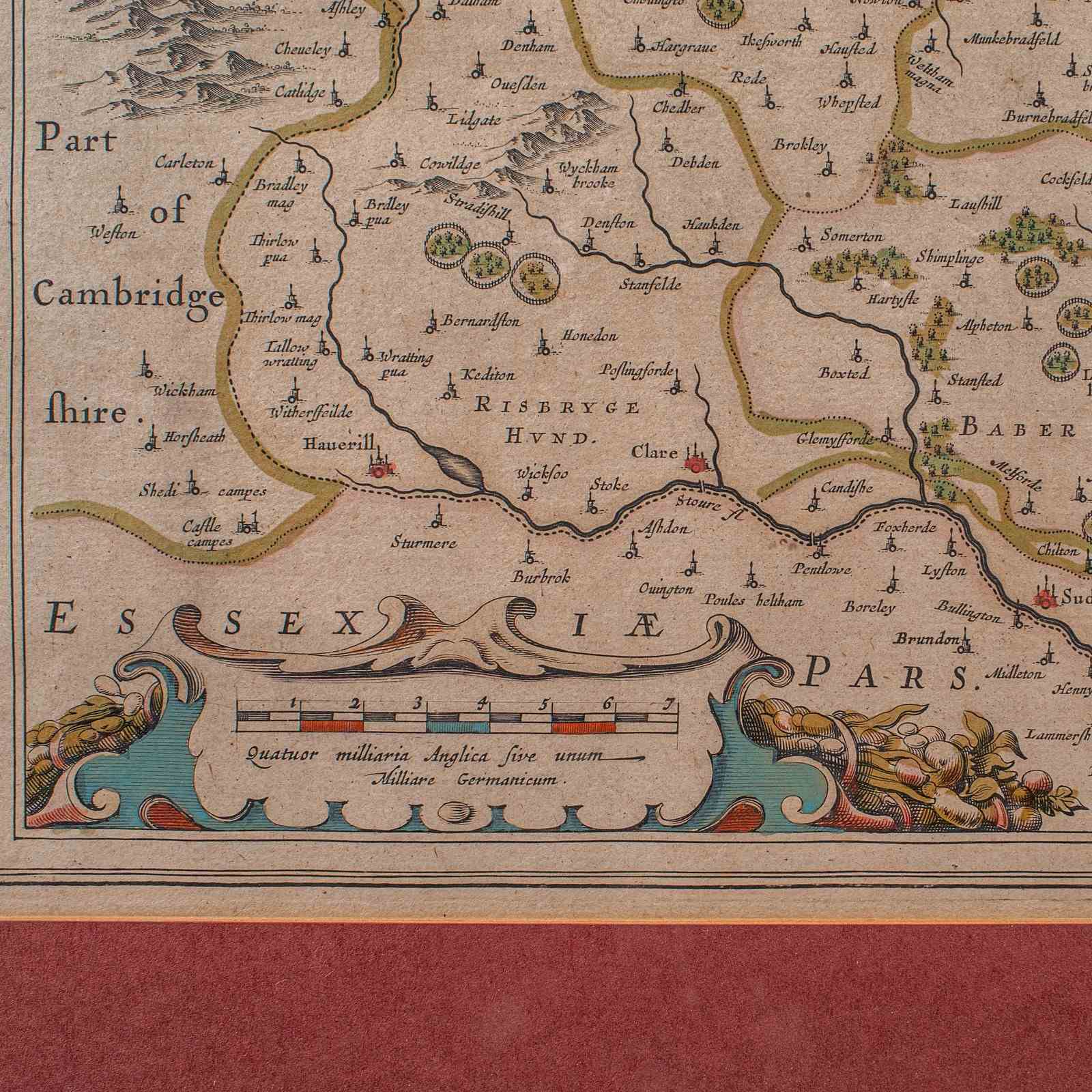
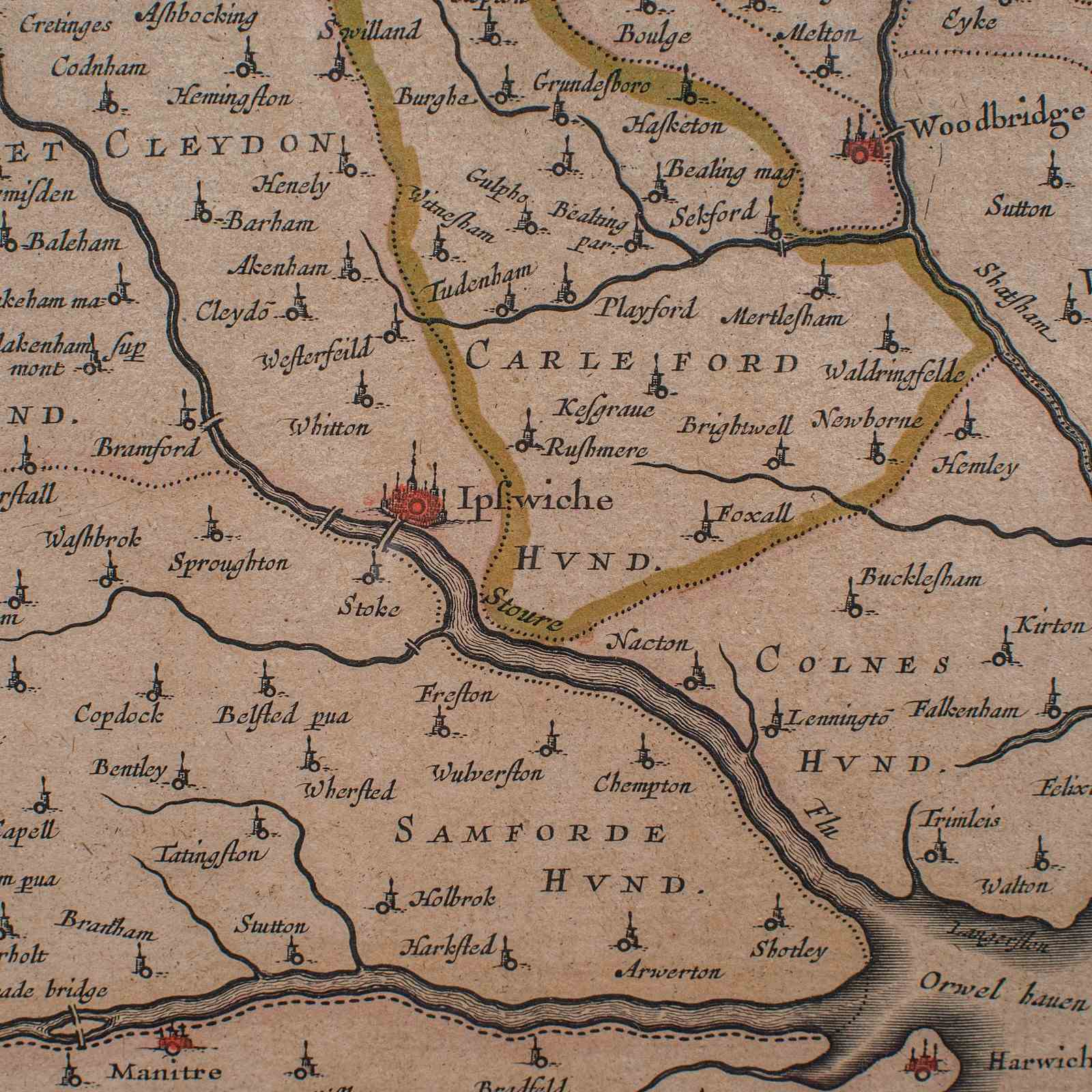
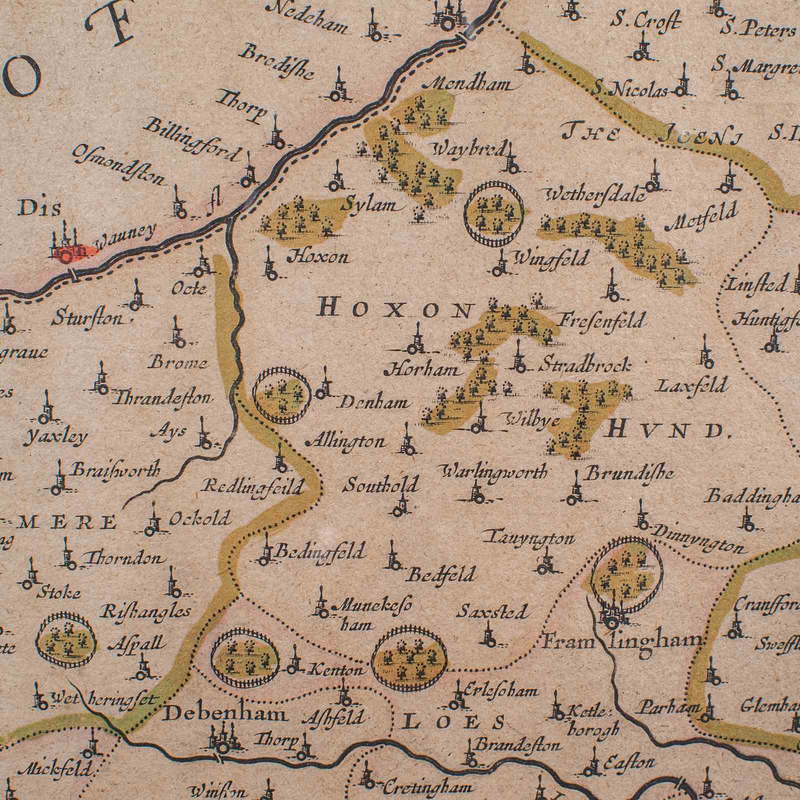
This is an antique county map of Suffolk. A Dutch, framed atlas engraving by Joan Blaeu, dating to the 17th century and later.
A treat for the collector or county native, with this superb map
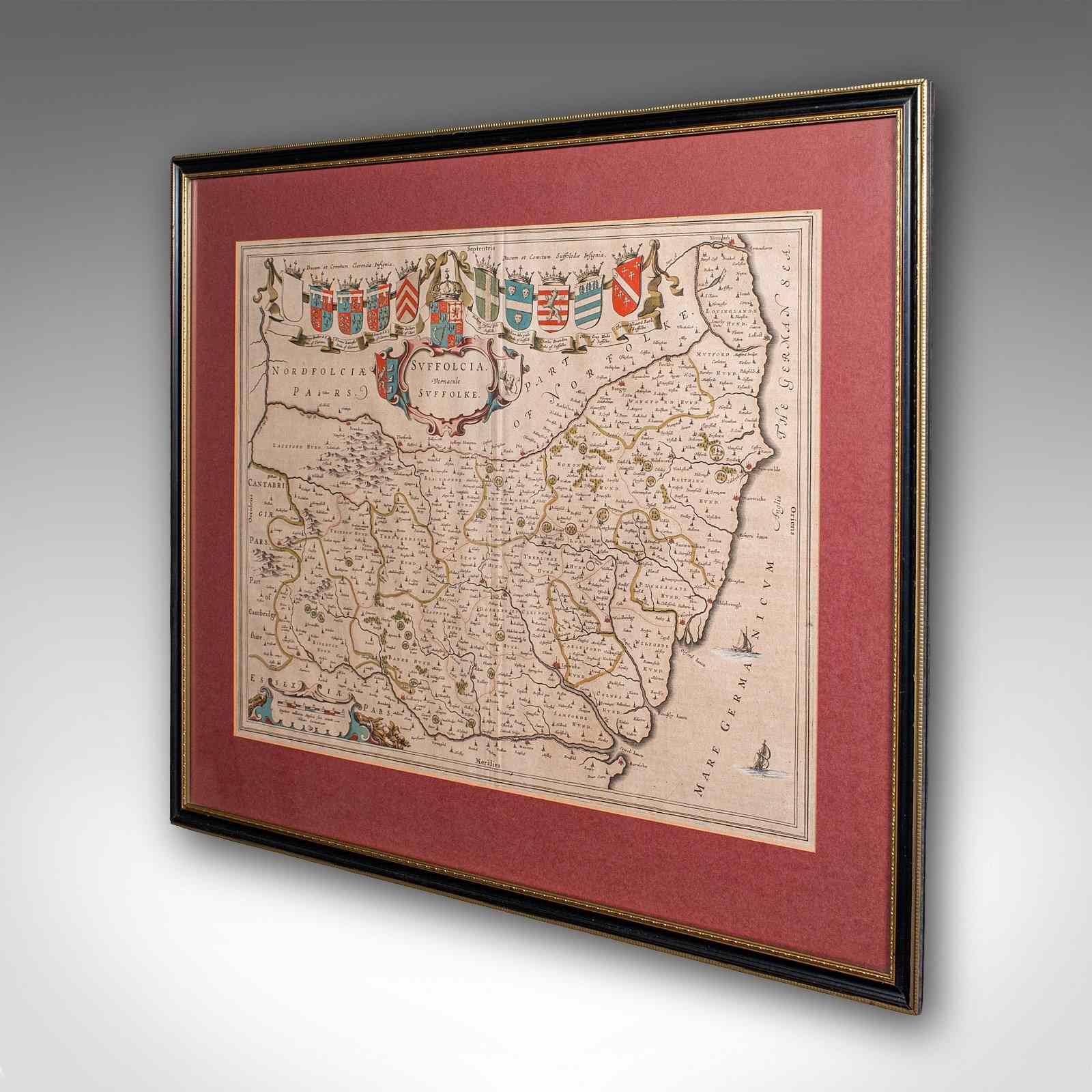
Displays a desirable aged patina within a later, quality frame
Skilfully charted by the Dutch cartographer Joan Blaeu (1596 - 1673)
Blaeu was the official cartographer of the Dutch East India Company
A quality excerpt from the cartographer's Atlas Novus of 1645
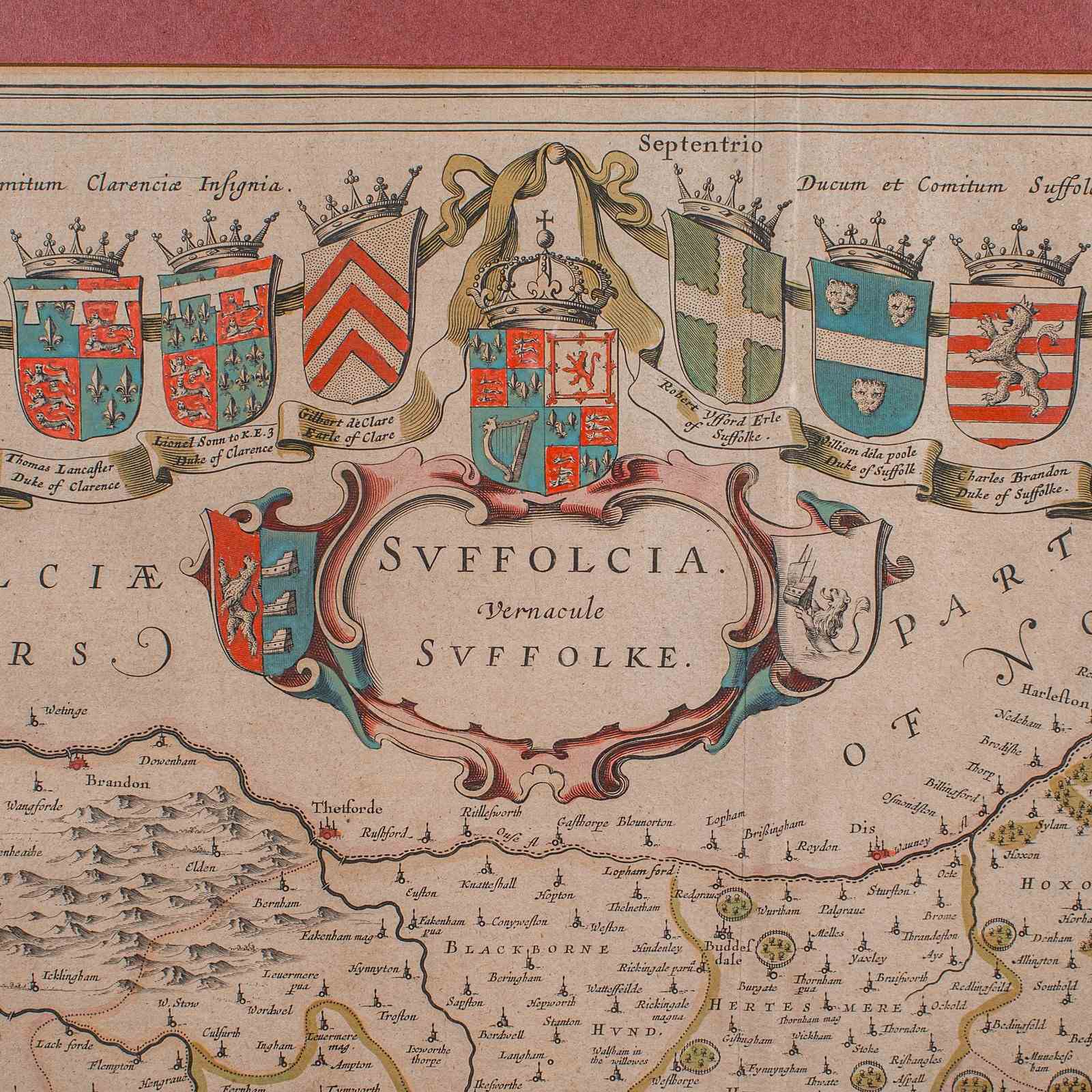
The title given in both Latin (Suffolcia) and vernacular English (Suffolke)
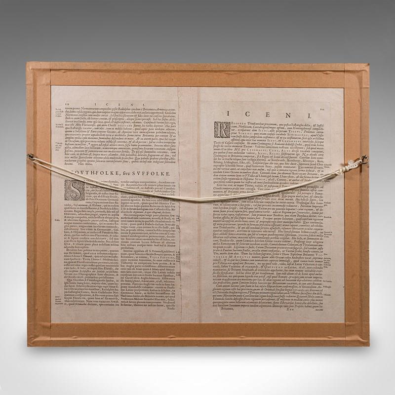
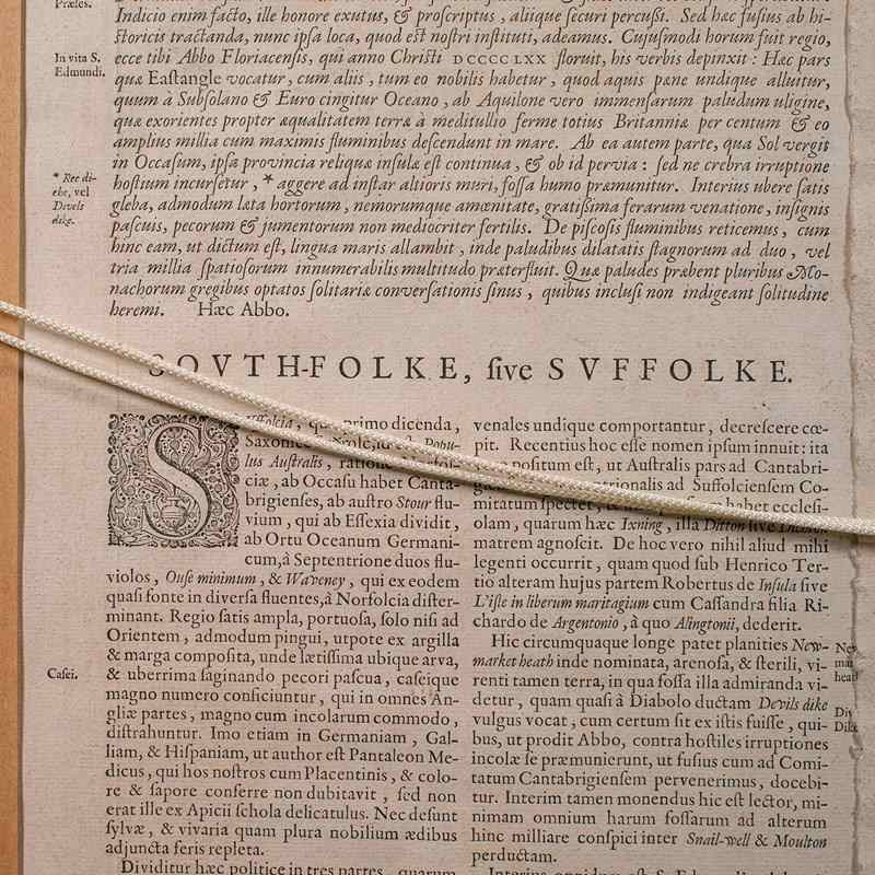
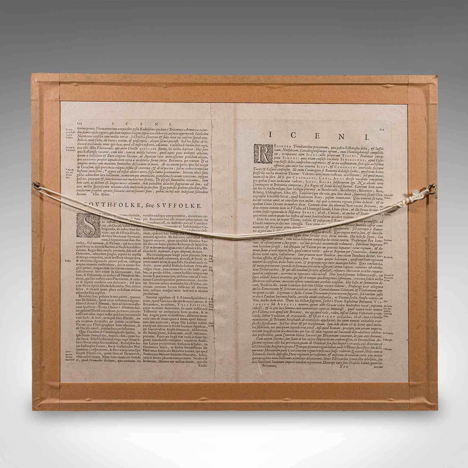
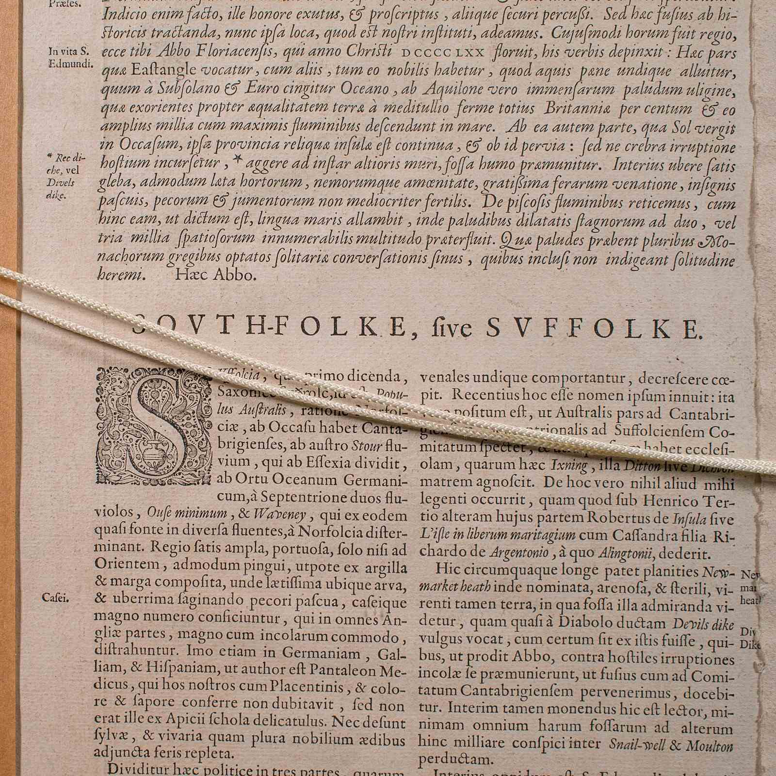
Reverse features the original Latin atlas text for further historical interest
Annotated with fascinating heraldic detail for prominent families within the county
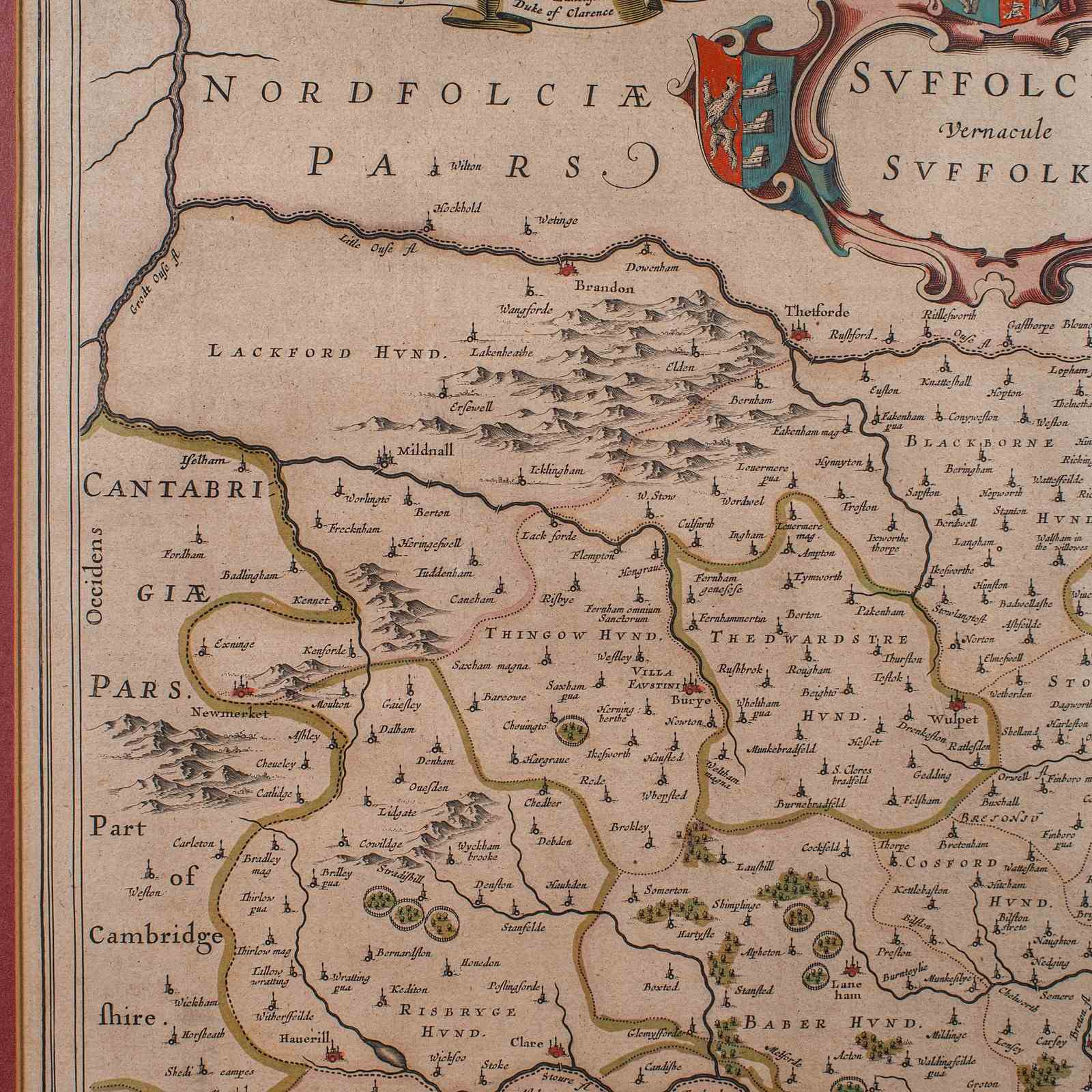
Charmingly illustrated distance scale, shown in 'Milliaria Anglica' - Latin for an English mile
Hand coloured finish adds an appealing decorative appearance to the map
Dressed to the rear with mounting braid for ease of hanging
This is a fascinating antique county map of Suffolk, with superb detail and mid-17th century cartographic interest. Delivered ready to display.
Dimensions:
Max Width: 65cm (25.5'')
Max Depth: 3.5cm (1.5'')
Max Height: 54.5cm (21.5'')
Map Width: 51cm (20'')
Map Height: 39cm (15.25'')
Item Info
Seller
Seller Location
Hele, Devon
Item Dimensions
H: 54.5cm W: 65cm D: 3.5cm
Period
1640s
Item Location
United Kingdom
Seller Location
Hele, Devon
Item Location
United Kingdom
Seller Contact No
+44 (0)207 1833511
More from LONDON FINE ANTIQUES