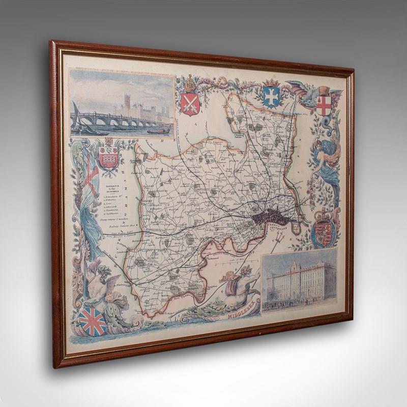


Vintage Middlesex County Map, English, Framed, After Thomas Moule, Cartography
Stock No
25579
2024
Questions about this item?
Like this item?
Item Description
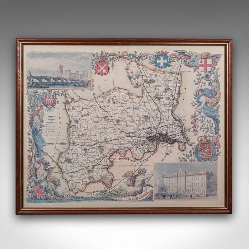
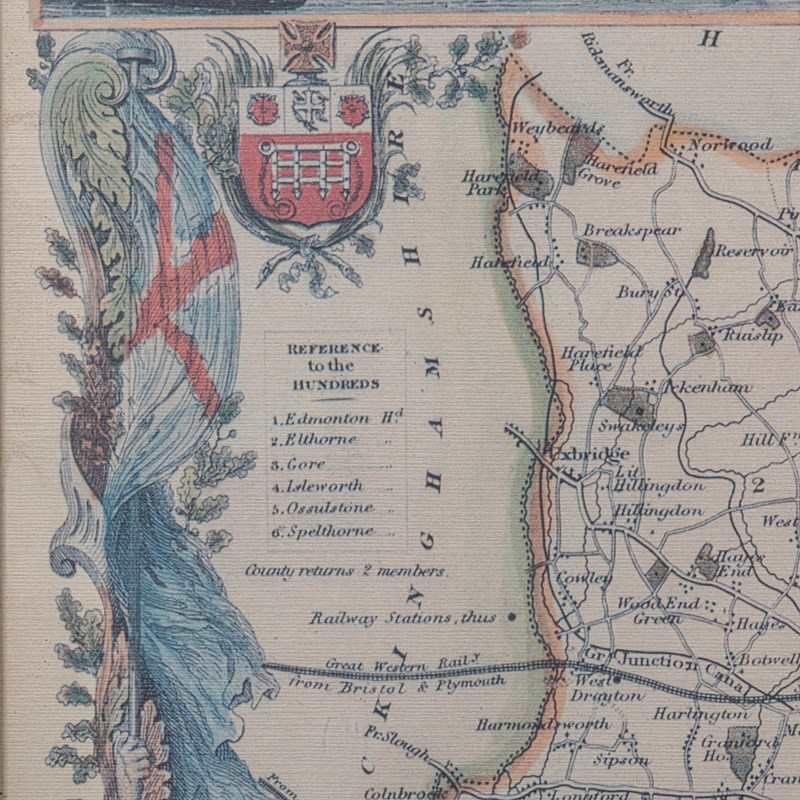
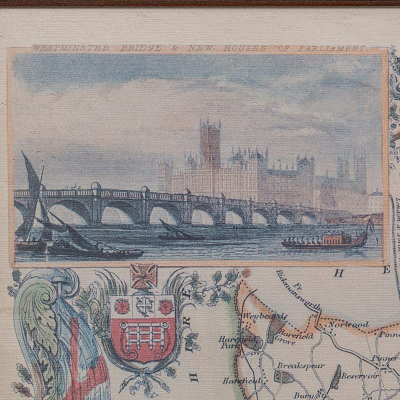
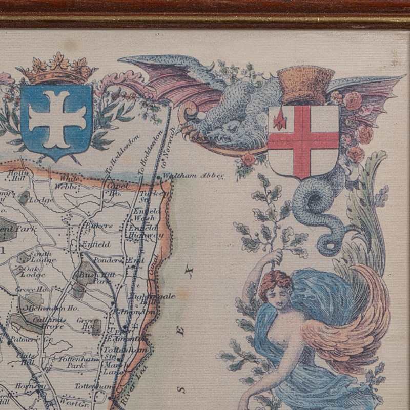
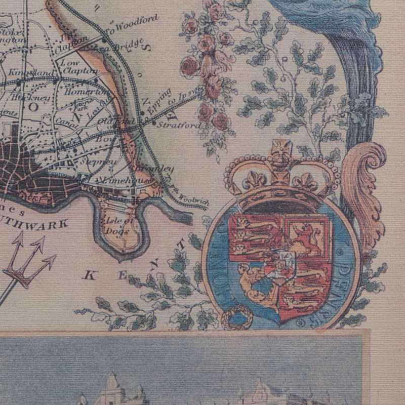
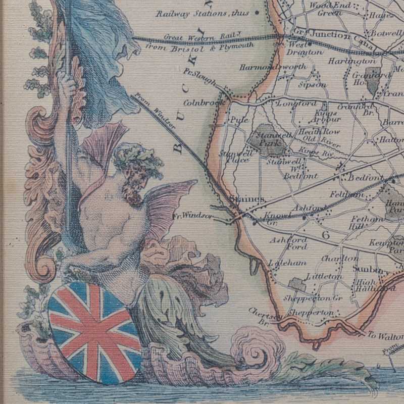
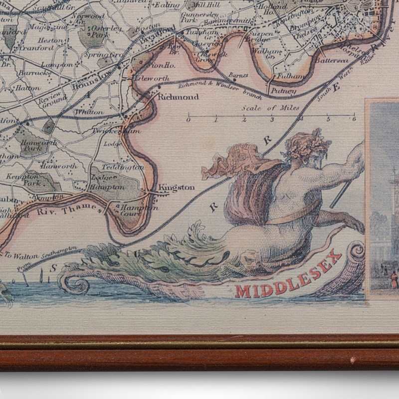
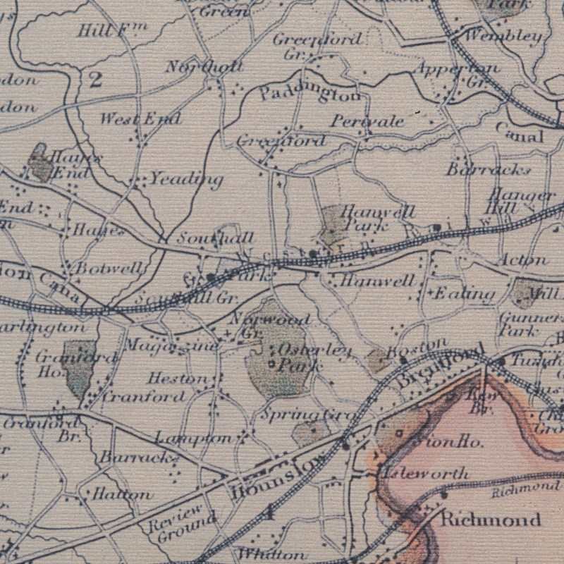
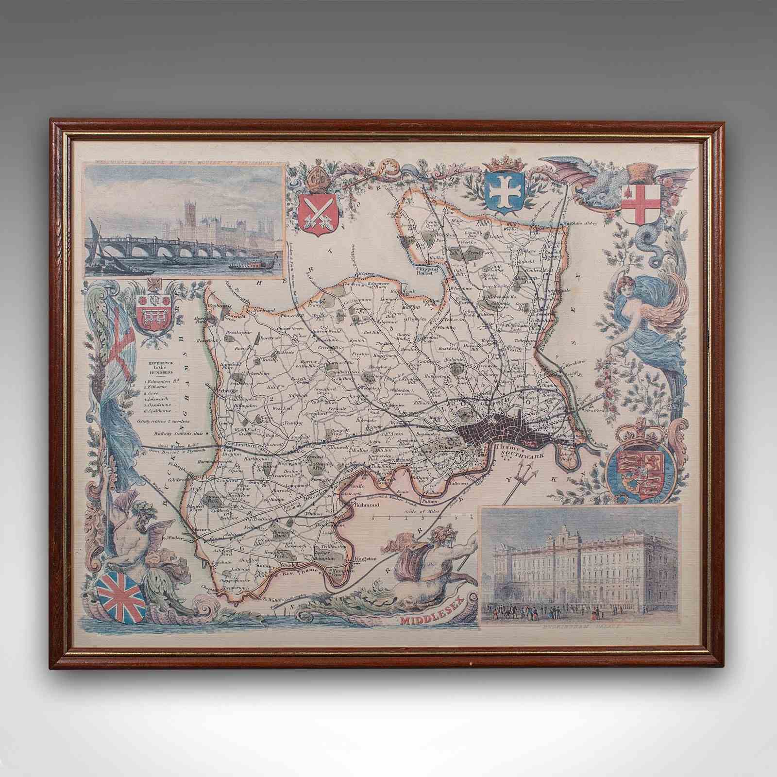
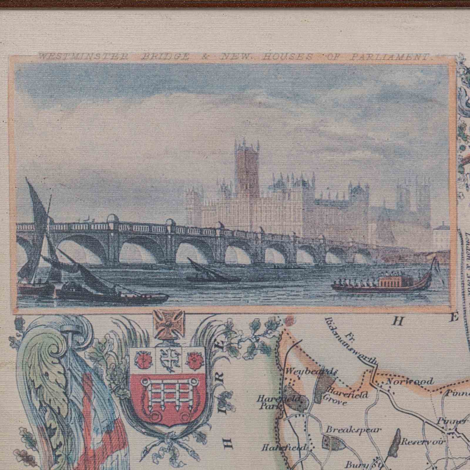
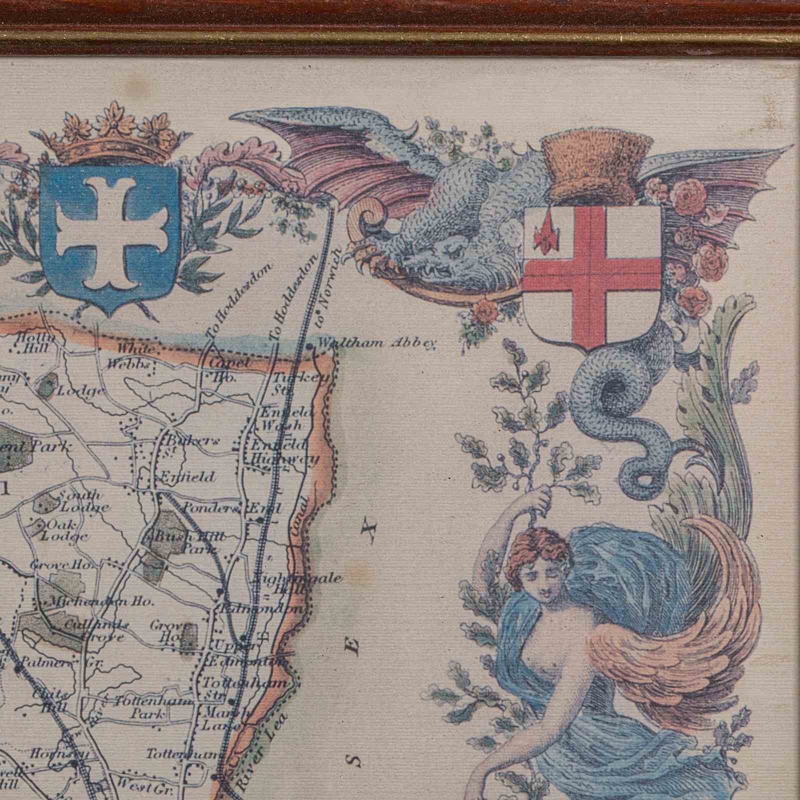
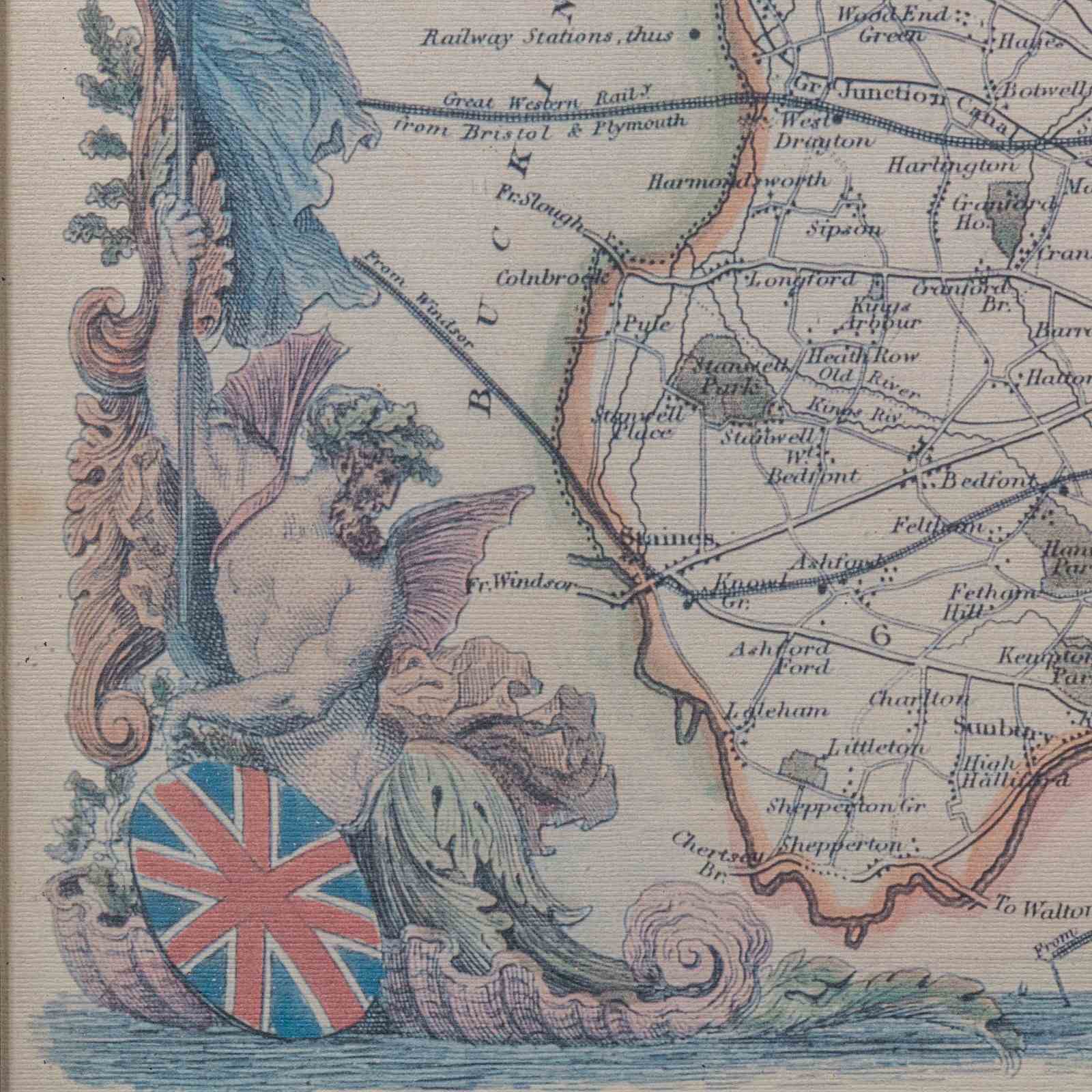
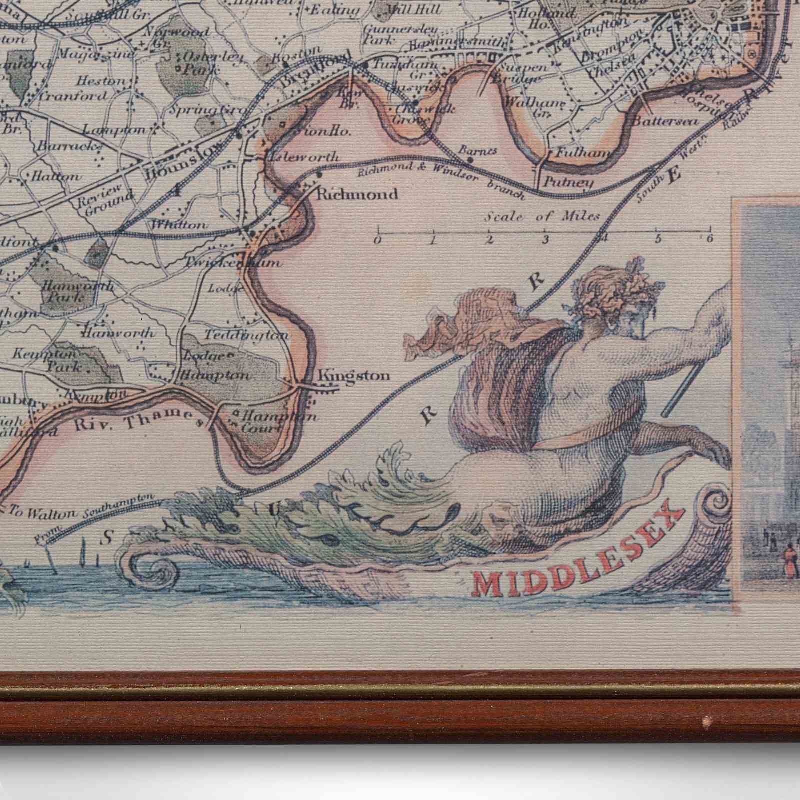
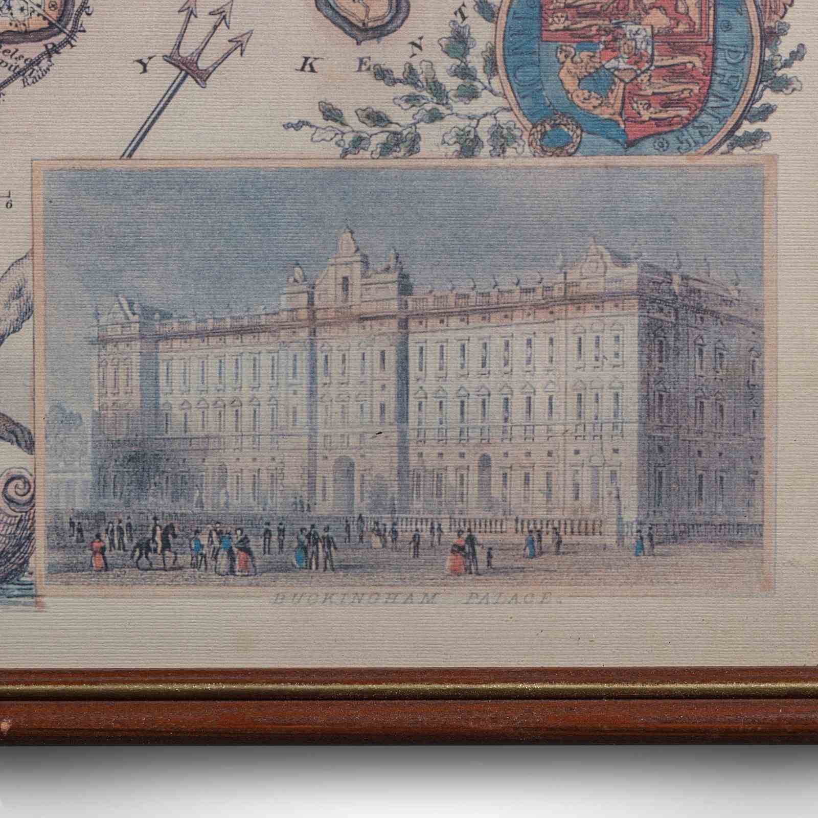
This is a vintage Middlesex county map. An English, framed reproduction of the 19th century original by Thomas Moule (1784 - 1851), dating to the late 20th century, circa 1980. A quality reproduction capturing the decorative charm and intricate detail of Moule’s celebrated cartographic work.
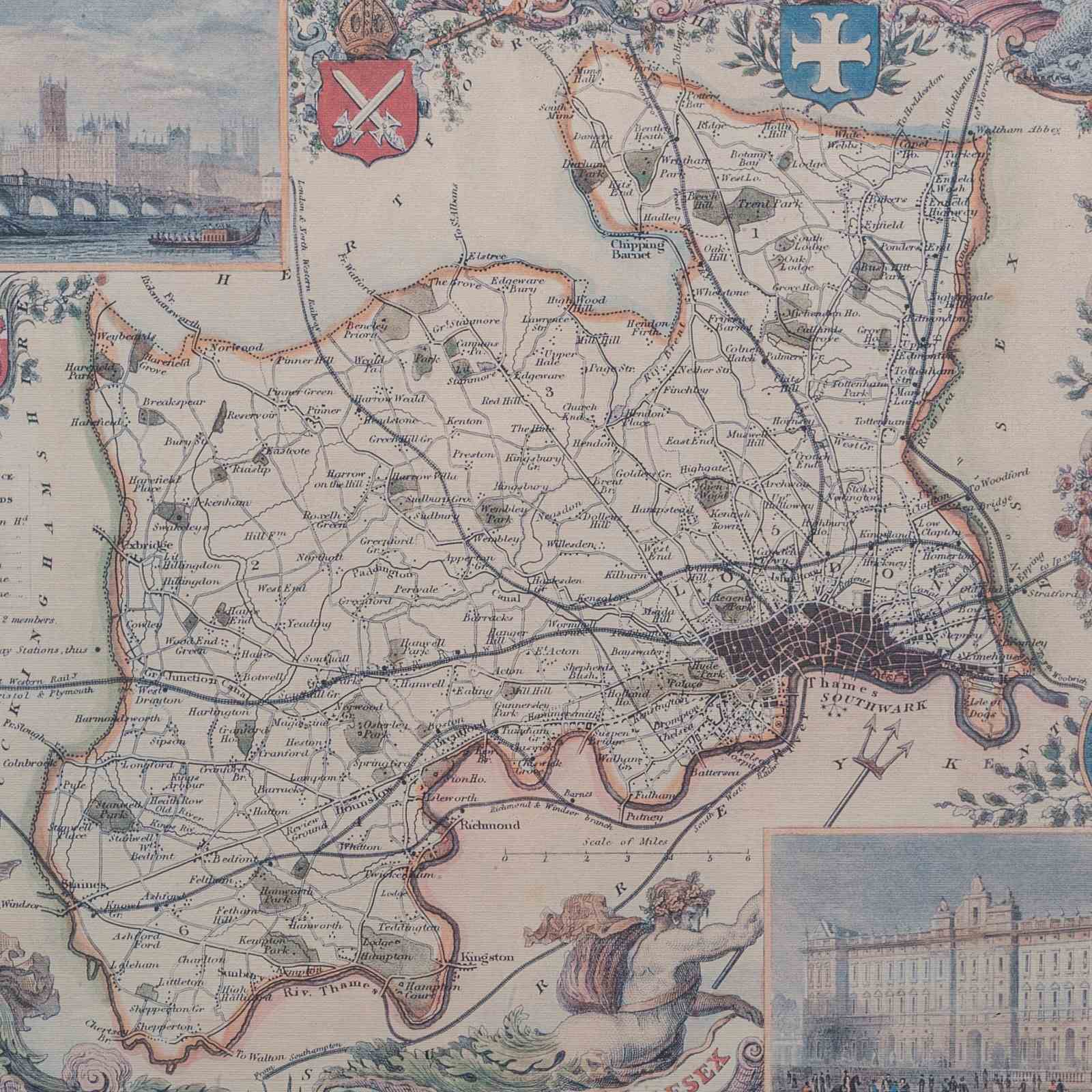
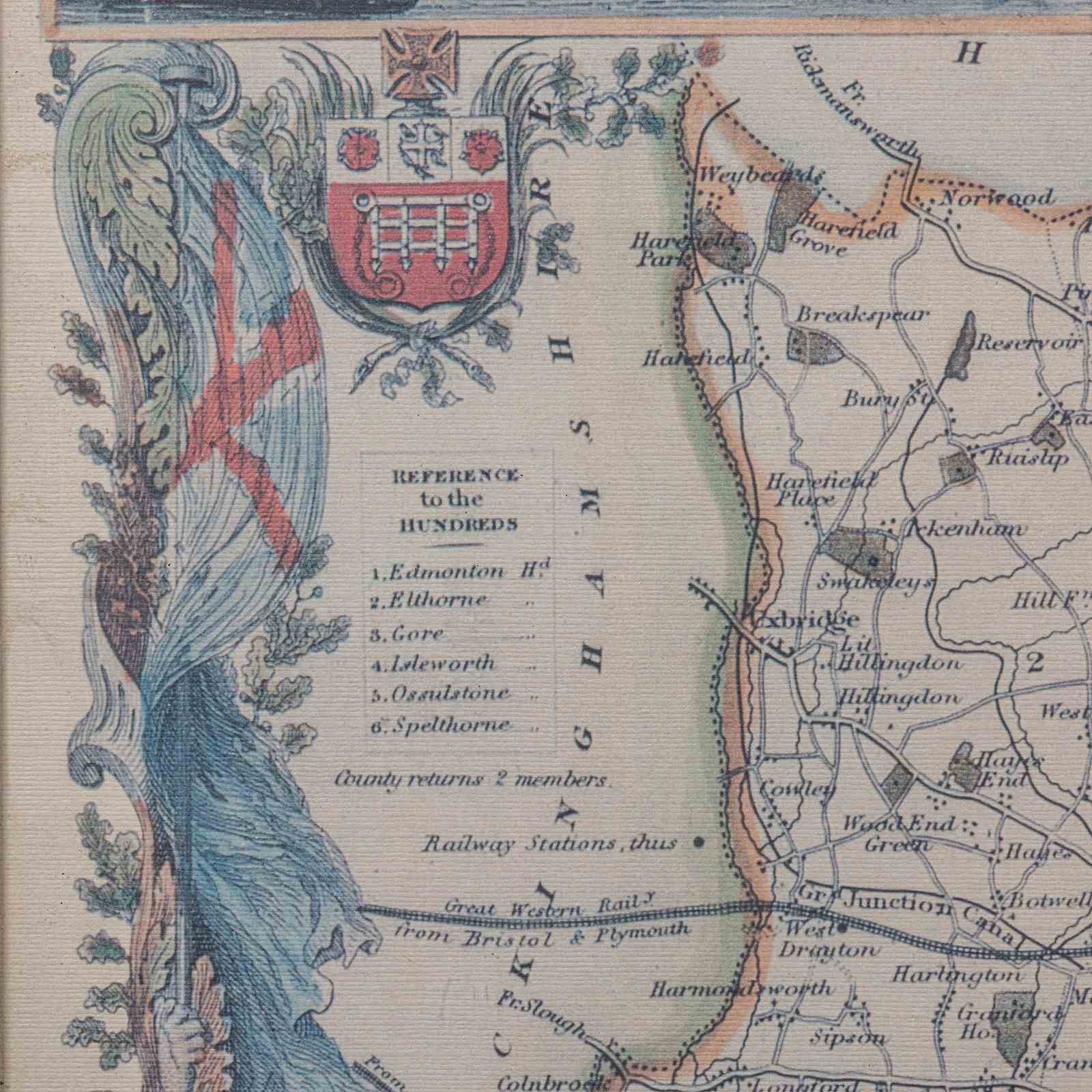
Faithful reproduction of Thomas Moule’s 19th century map of Middlesex, originally published circa 1845
Depicts the county of Middlesex in period, complete with administrative hundreds, rail routes, and London’s urban sprawl
Illustrative vignettes present delightful engravings of Buckingham Palace and Westminster Bridge
Embellished with the Royal Coat of Arms and patriotic allegorical figures, reflecting Victorian pride
Printed on quality paper, offering a warm parchment hue that enhances period authenticity
Mounted and displayed behind clear glazing, within a sympathetic later frame
Dressed to the rear with mounting wire, ready to hang and enjoy
In good order throughout, with light tonality consistent with tasteful vintage presentation
This is a charming vintage reproduction of Thomas Moule’s Middlesex county map, offering fine decorative appeal and historical cartographic interest. Delivered ready to display.
Dimensions:
Max Width: 54cm (21.25'')
Max Depth: 1cm (.5'')
Max Height: 43.5cm (17.25'')
Map Width: 50cm (19.75'')
Map Height: 40.5cm (16'')
Item Info
Seller
Seller Location
Hele, Devon
Item Dimensions
H: 43.5cm W: 54cm D: 1cm
Period
1980s
Item Location
United Kingdom
Seller Location
Hele, Devon
Item Location
United Kingdom
Seller Contact No
+44 (0)207 1833511
More from LONDON FINE ANTIQUES