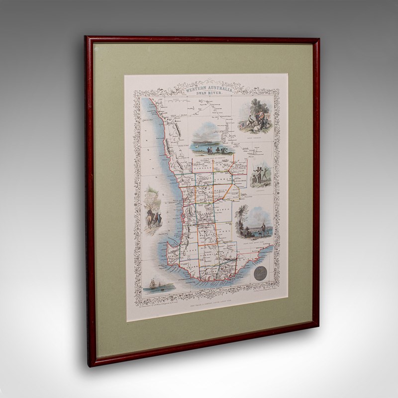


Vintage Western Australia Map, Framed Print, Swan River, John Tallis Cartography
Stock No
25574
2024
- £295.00
- €346 Euro
- $394 US Dollar
Questions about this item?
Like this item?
Item Description
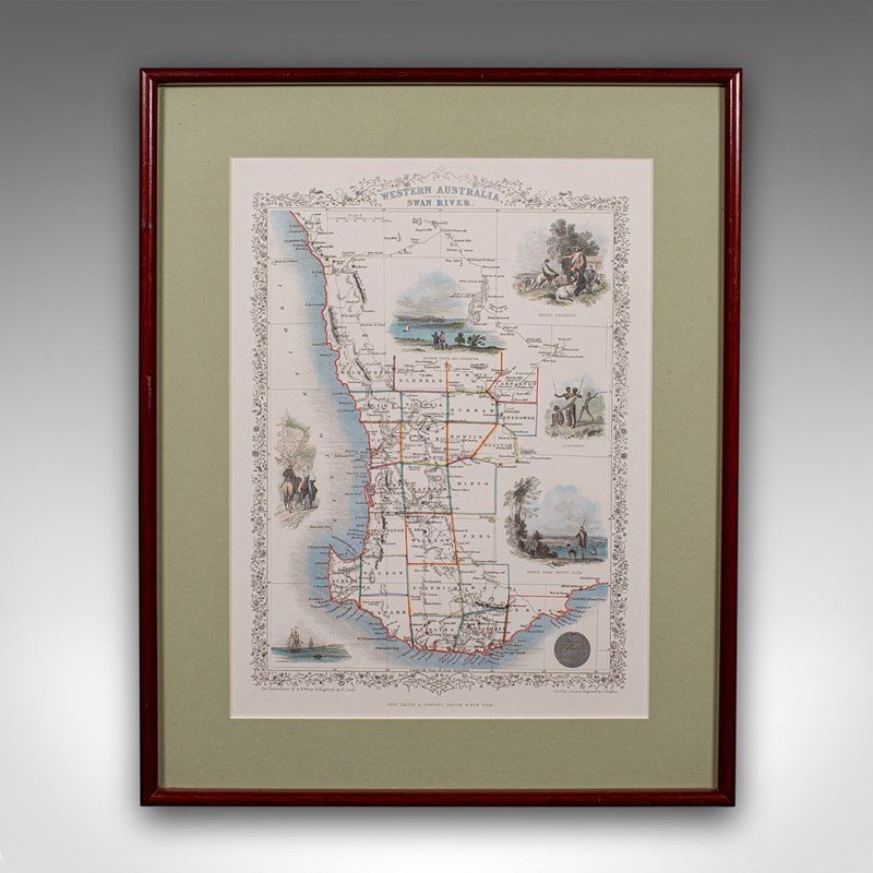
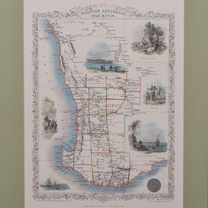
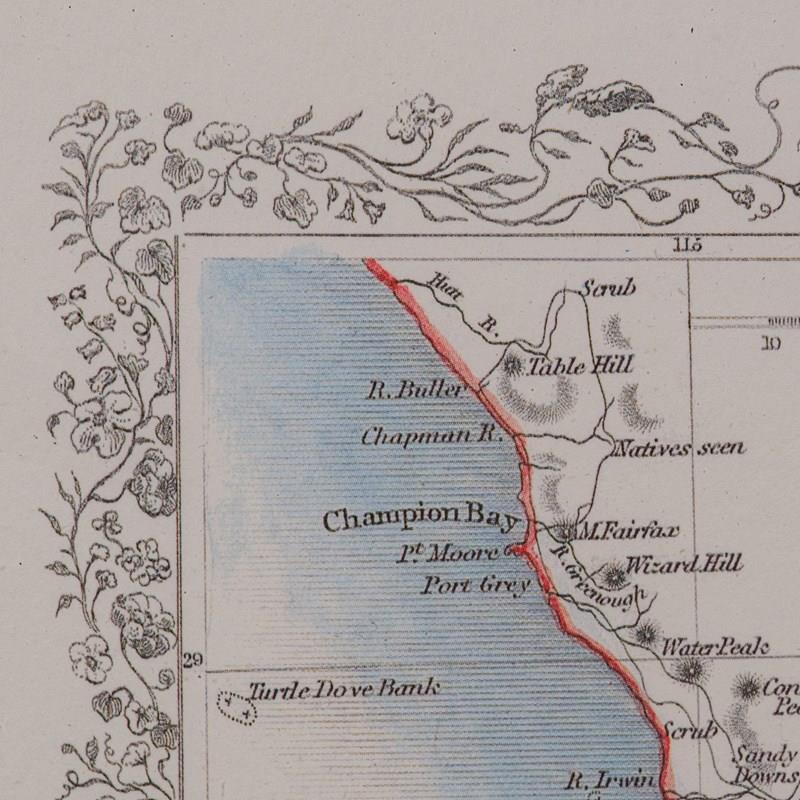
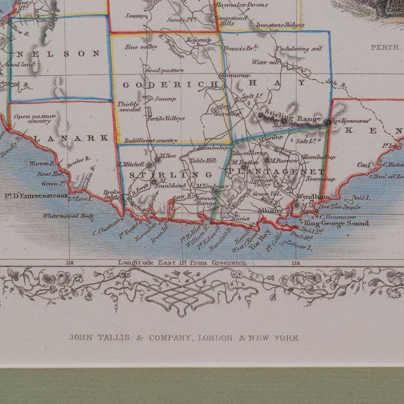
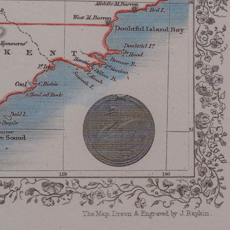
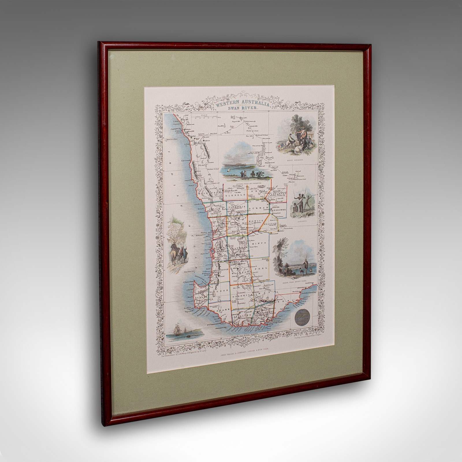
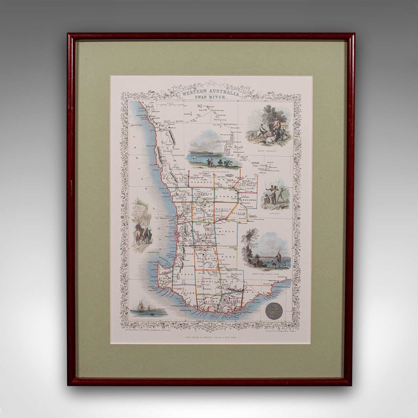
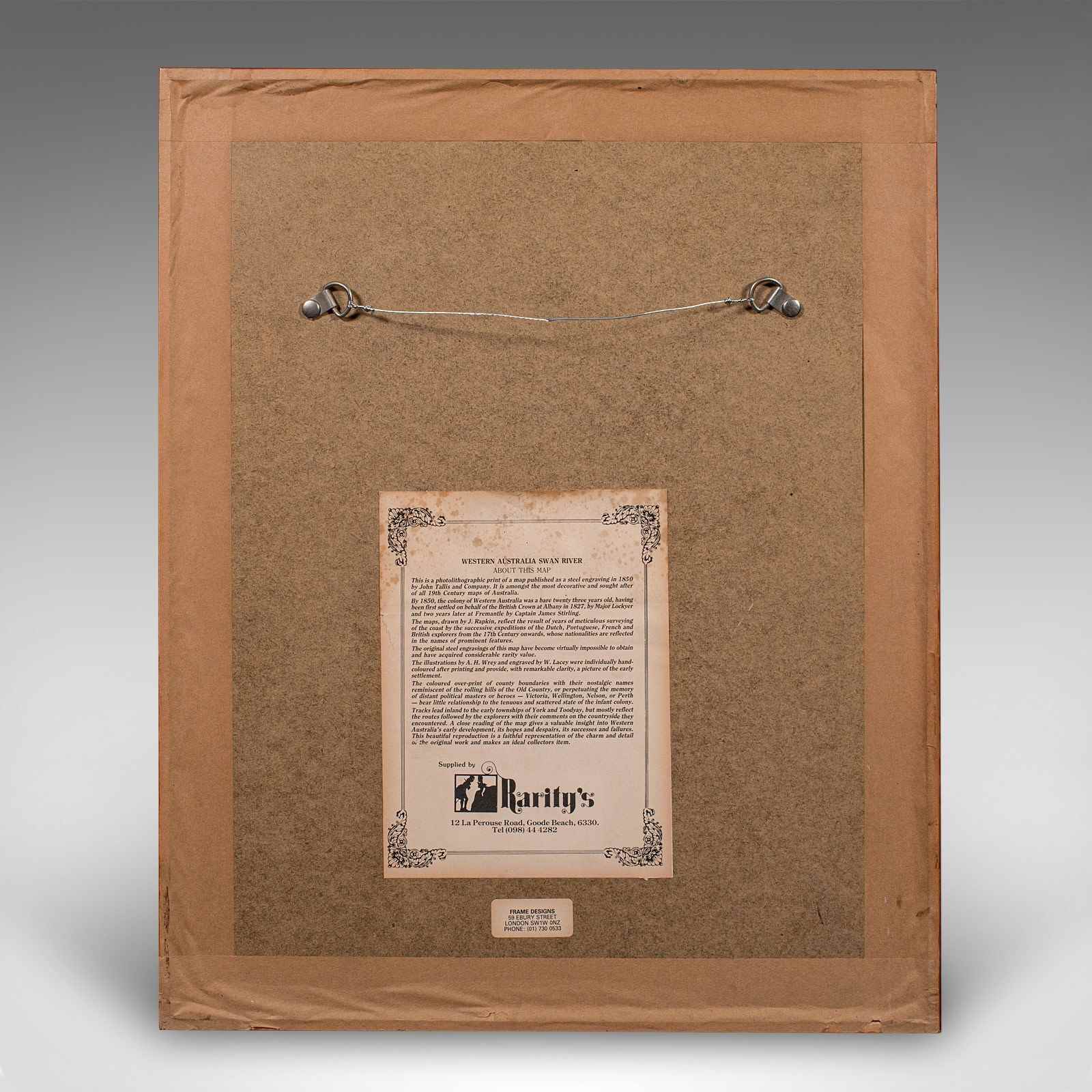
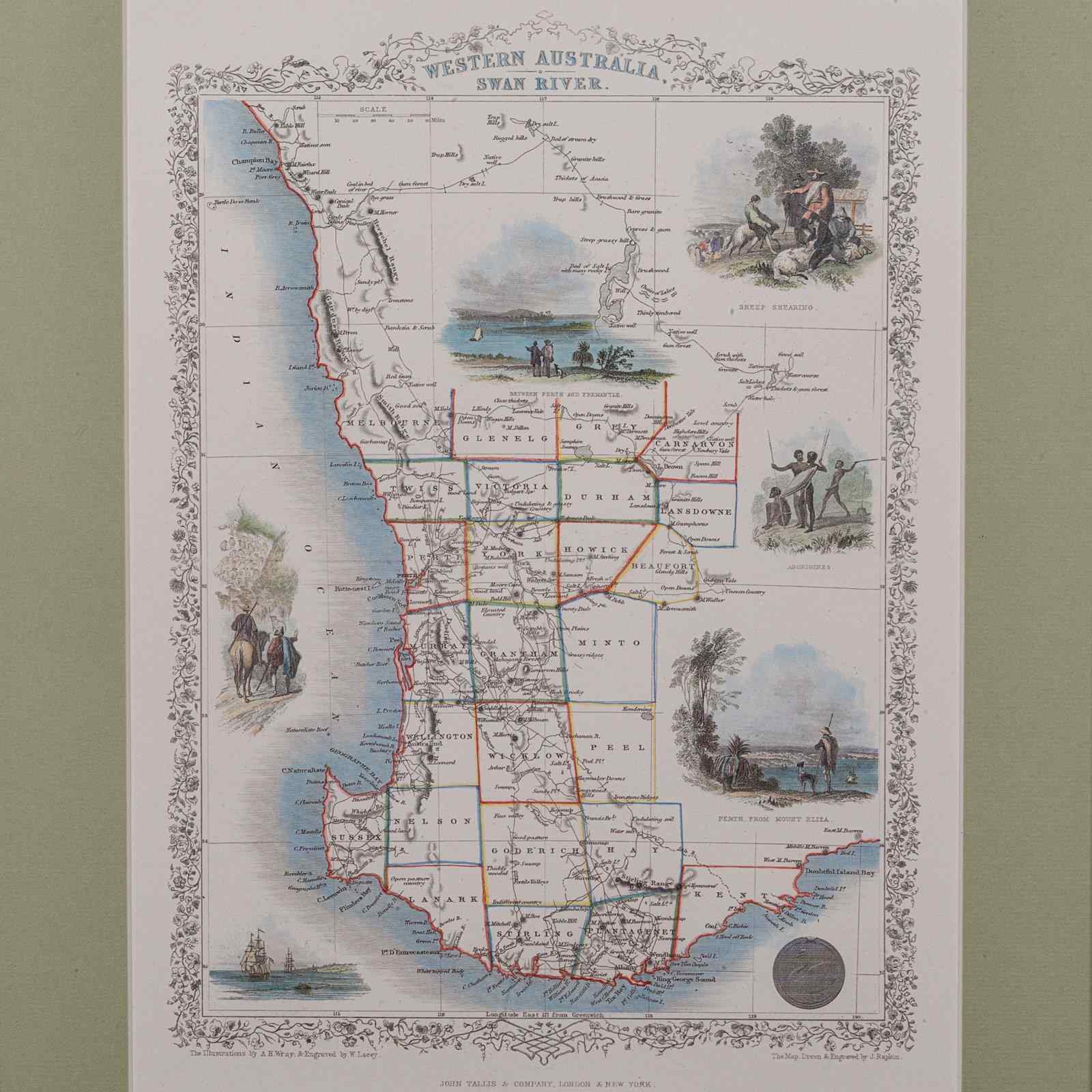
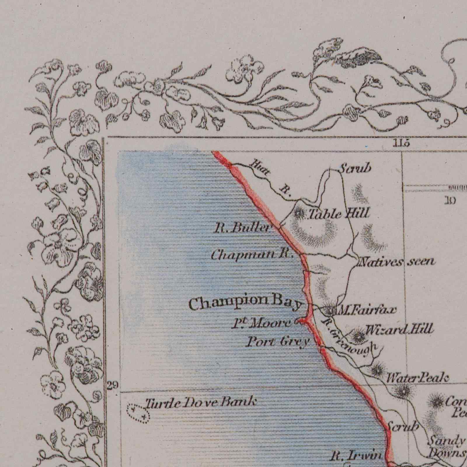
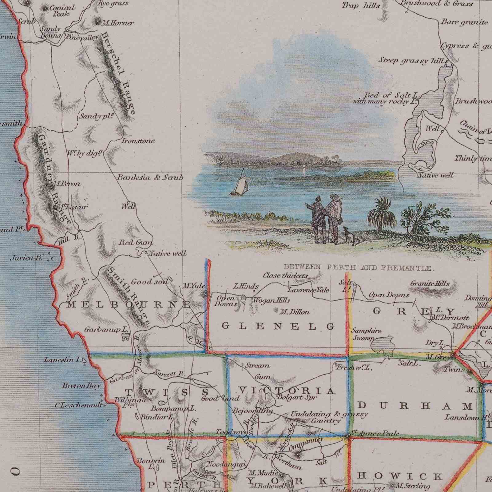
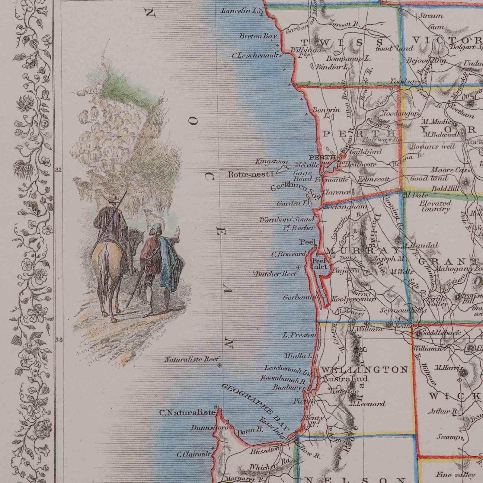
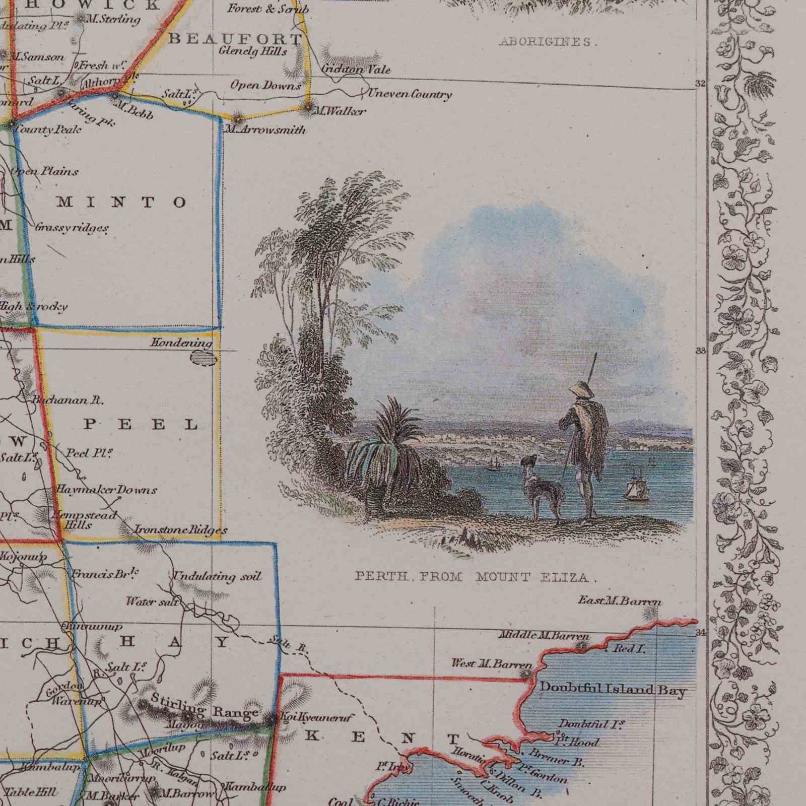
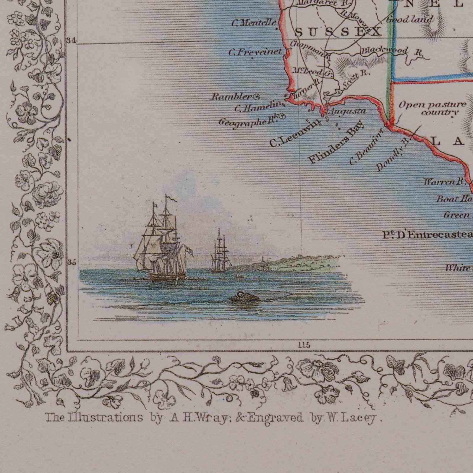
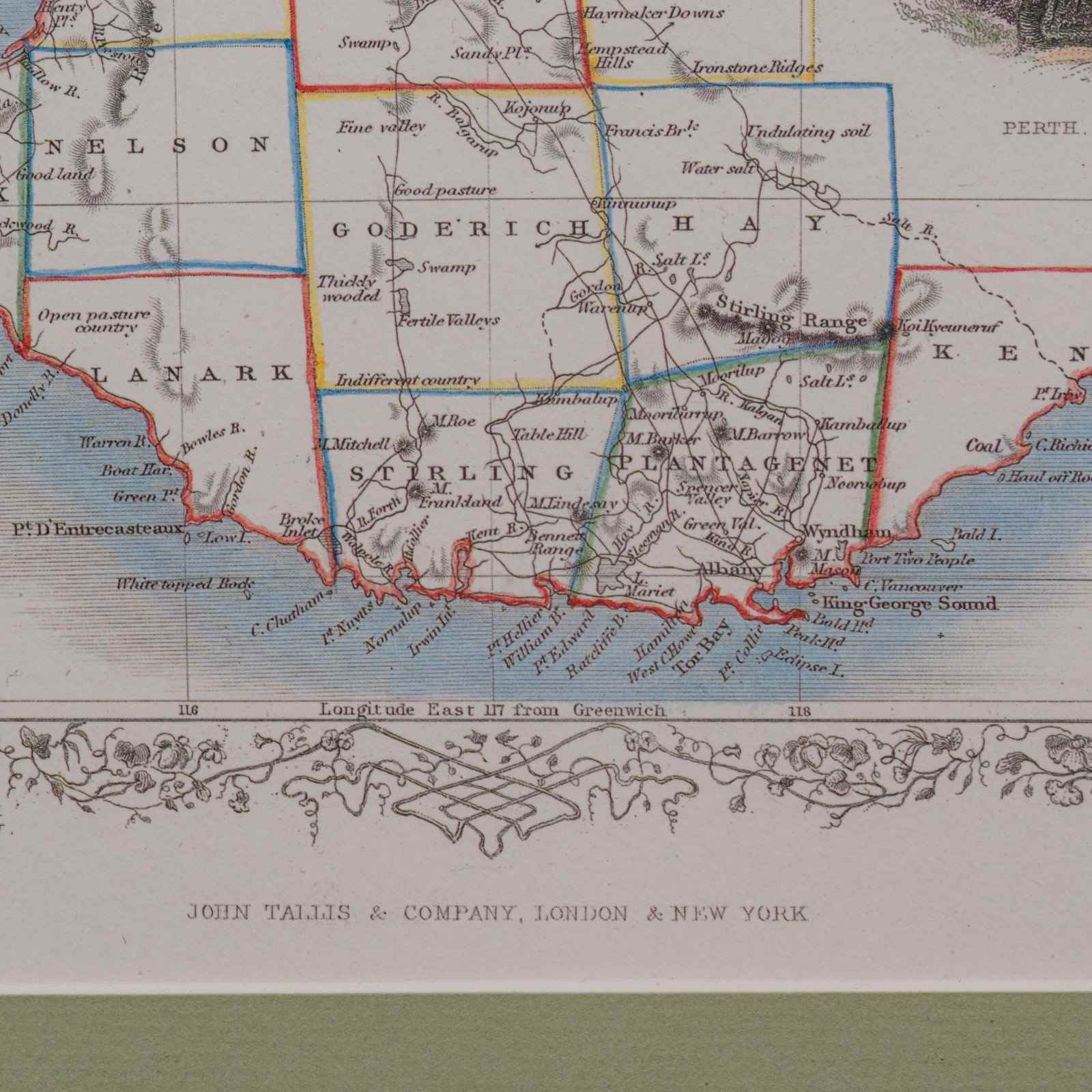
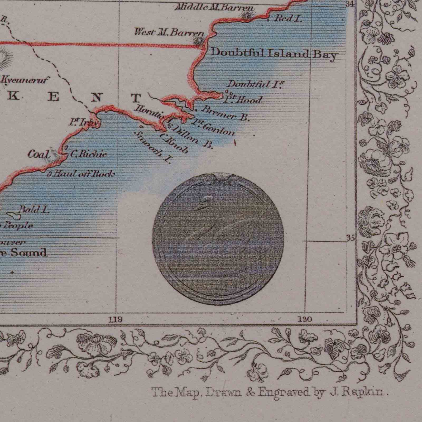
This is a vintage Western Australia map. A late 20th century reproduction of John Tallis’ original 1850 steel engravings, dating to the late 20th century, circa 1990.
Fascinating reproduction map of Western Australia's Swan River region, honouring Tallis’ celebrated 19th century work
Based upon the original mapping by John Rapkin (1813- 1899)
Presented in a tasteful frame behind glass, complementing the vintage aesthetic
Dressed to the rear with a hanging wire, allowing for easy wall display
Originally engraved by John Tallis, circa 1850, renowned for his decorative cartography
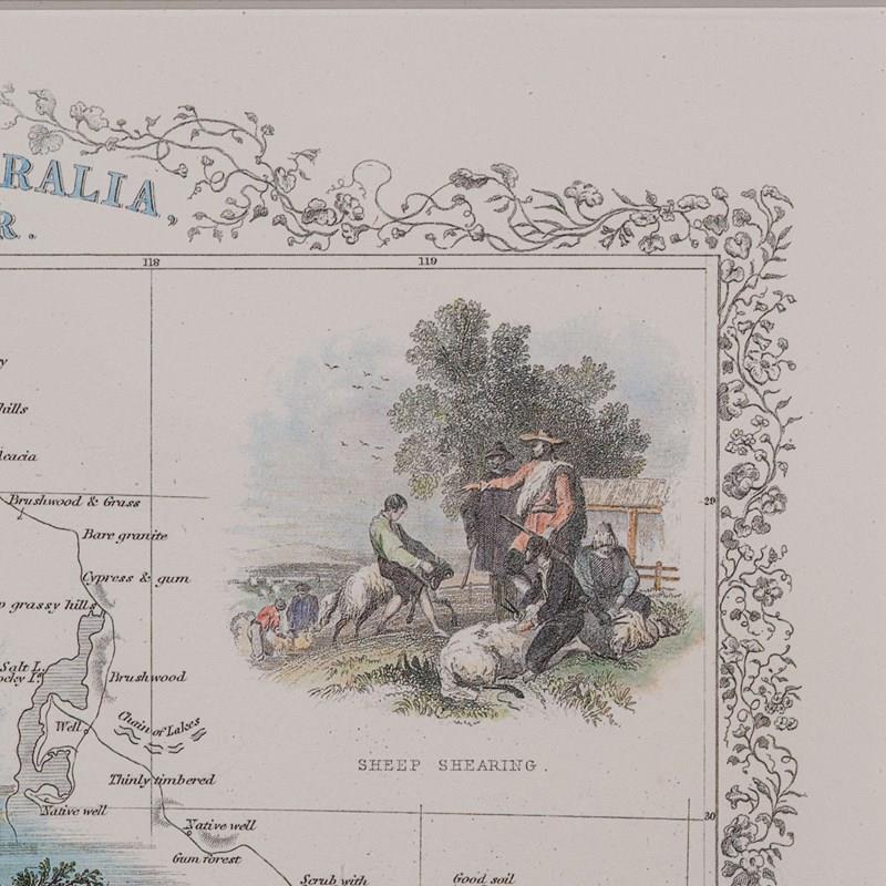
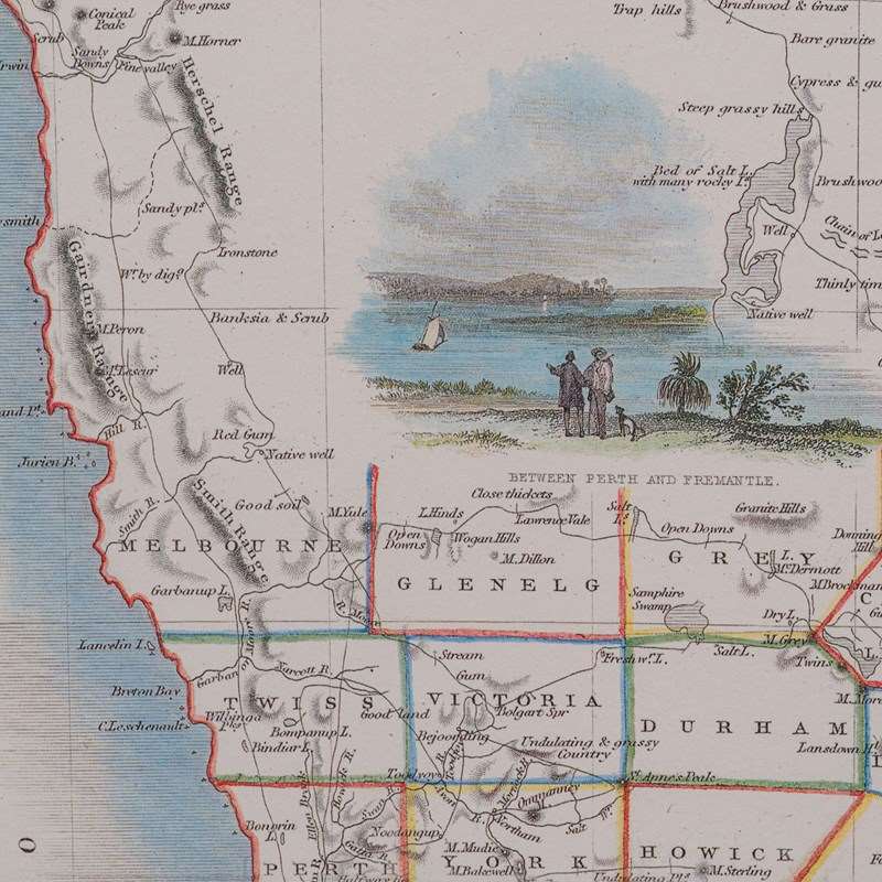
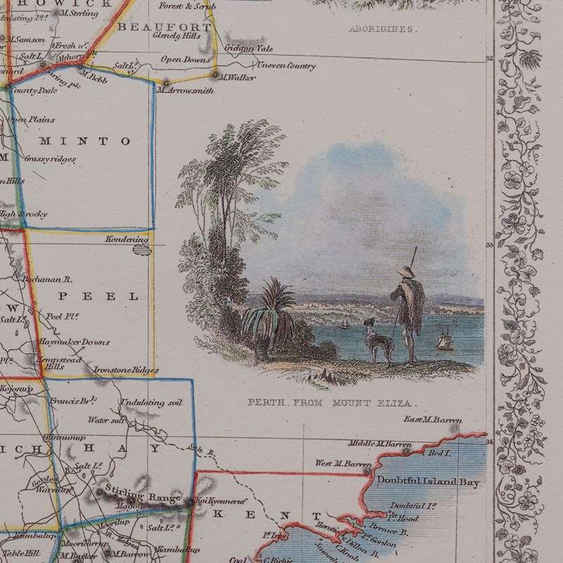
Embellished with decorative vignettes, including indigenous peoples and sheep shearing
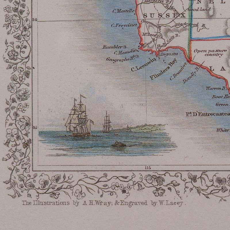
Period Illustrations originally by an A.H. Wray and engraved by a W. Lacey
Colourful borders accentuate the individual regions in the area
This nicely presented Western Australia map reproduction provides a captivating glimpse into mid 19th century geography, perfect for collectors of vintage maps, Australiana, or traditional wall décor. Delivered ready to display.
Dimensions:
Max Width: 38.5cm (15.25'')
Max Depth: 1cm (.5'')
Max Height: 47.5cm (18.75'')
Map Width: 27cm (10.75'')
Map Height: 36cm (14.25'')
Item Info
Seller
Seller Location
Hele, Devon
Item Dimensions
H: 47.5cm W: 38.5cm D: 1cm
Period
1990s
Item Location
United Kingdom
Seller Location
Hele, Devon
Item Location
United Kingdom
Seller Contact No
+44 (0)207 1833511
More from LONDON FINE ANTIQUES