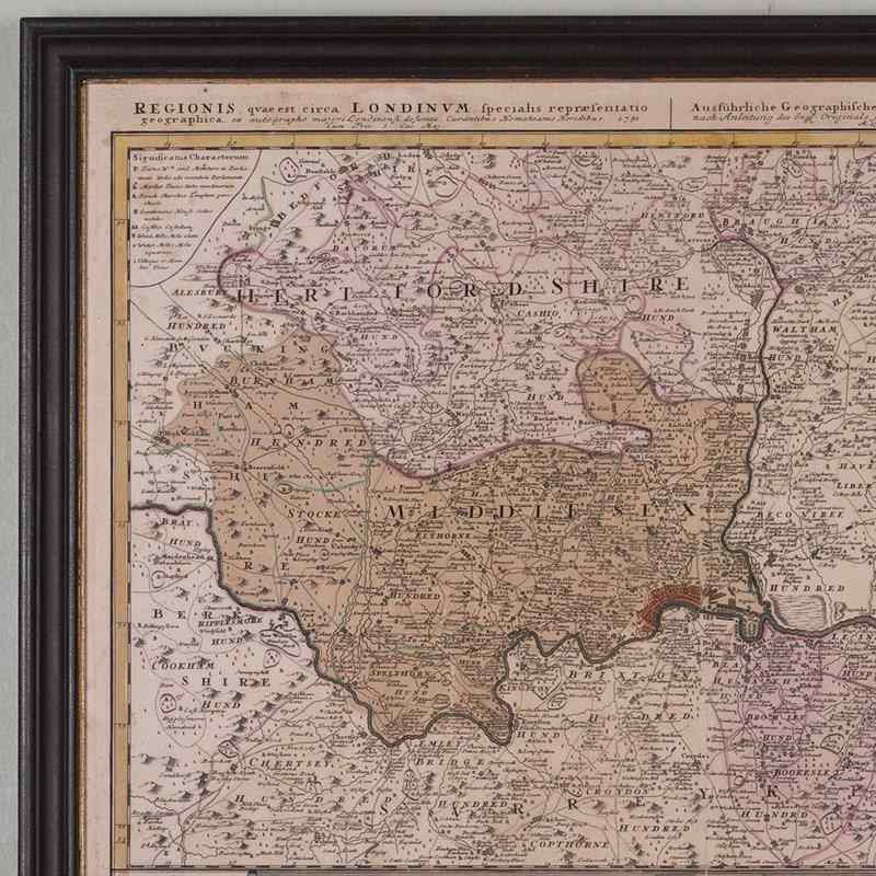
A Good Looking Large Framed View And Map Of London 1741
Stock No
4968
2015
- £625.00
- €732 Euro
- $836 US Dollar
Questions about this item?
Like this item?
Item Description
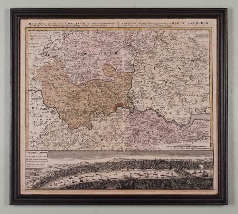
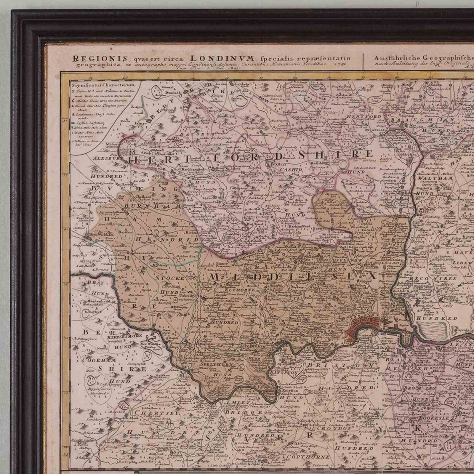
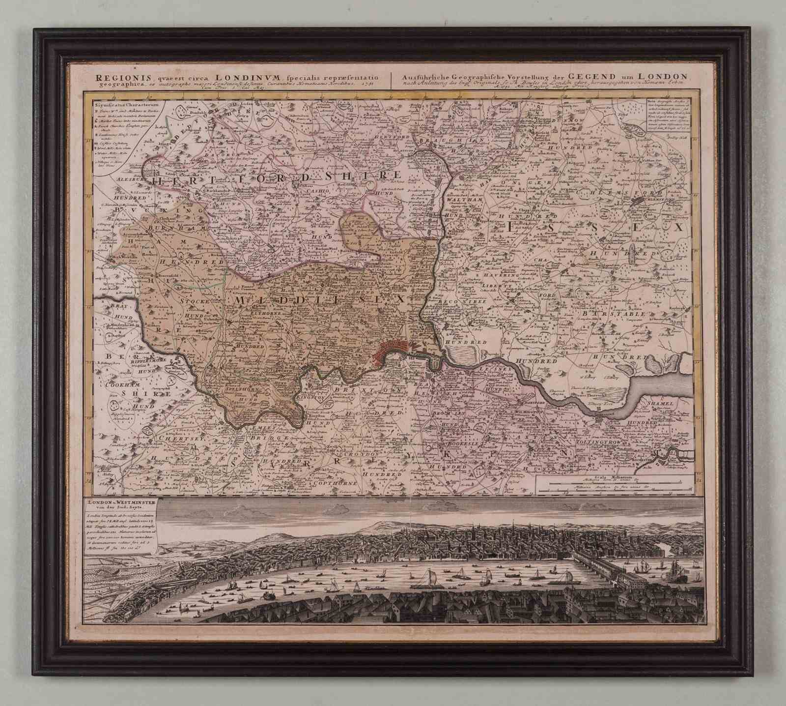
A good looking map of London and the surrounding counties published by Homann in 1741; based very largely on a similar map of the region by Thomas Bowles. London is at the centre of the sheet, coloured red, a band along the base shows a bird’s eye view of the Thames busy with a mass of barges and boats; larger shipping kept to the east by London Bridge.
The Homann map publishing house was established by Johann Baptist Homann at the end of the 17th century, passing to his son, Johann Christoph following his death in 1724. J.C in turn left the publishing house to his two principal managers, Johann Georg Ebersberger and Johann Michael Franz in 1730. Maps produced under their management are identified with the name Homann Heirs (or the suchlike), and in the present case; ‘Homanianis Heredibus 1741’.
With original colour and now within a replica eighteenth century print frame, ebonized and with a gilt sight.
o.s:25.75 in x 23.25 in
Item Info
Seller
Seller Location
London, London
Period
18th Century & Earlier
Item Location
United Kingdom
Seller Location
London, London
Item Location
United Kingdom
Seller Contact No
+44 (0)207 7275263
+44 (0)7831 561042
More from WALPOLES