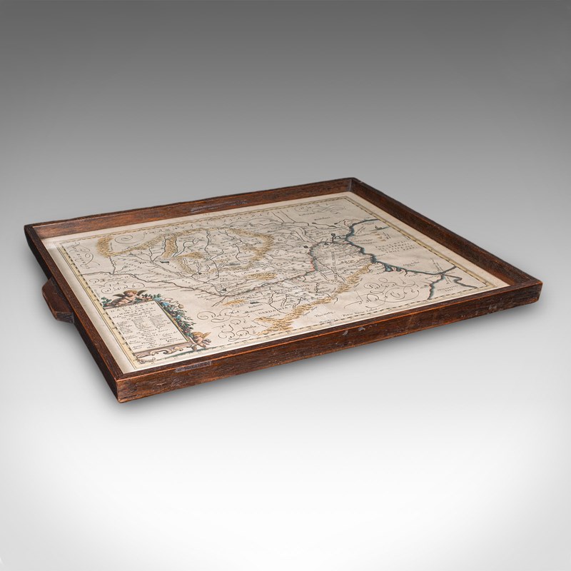
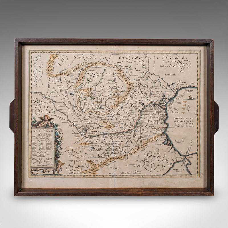


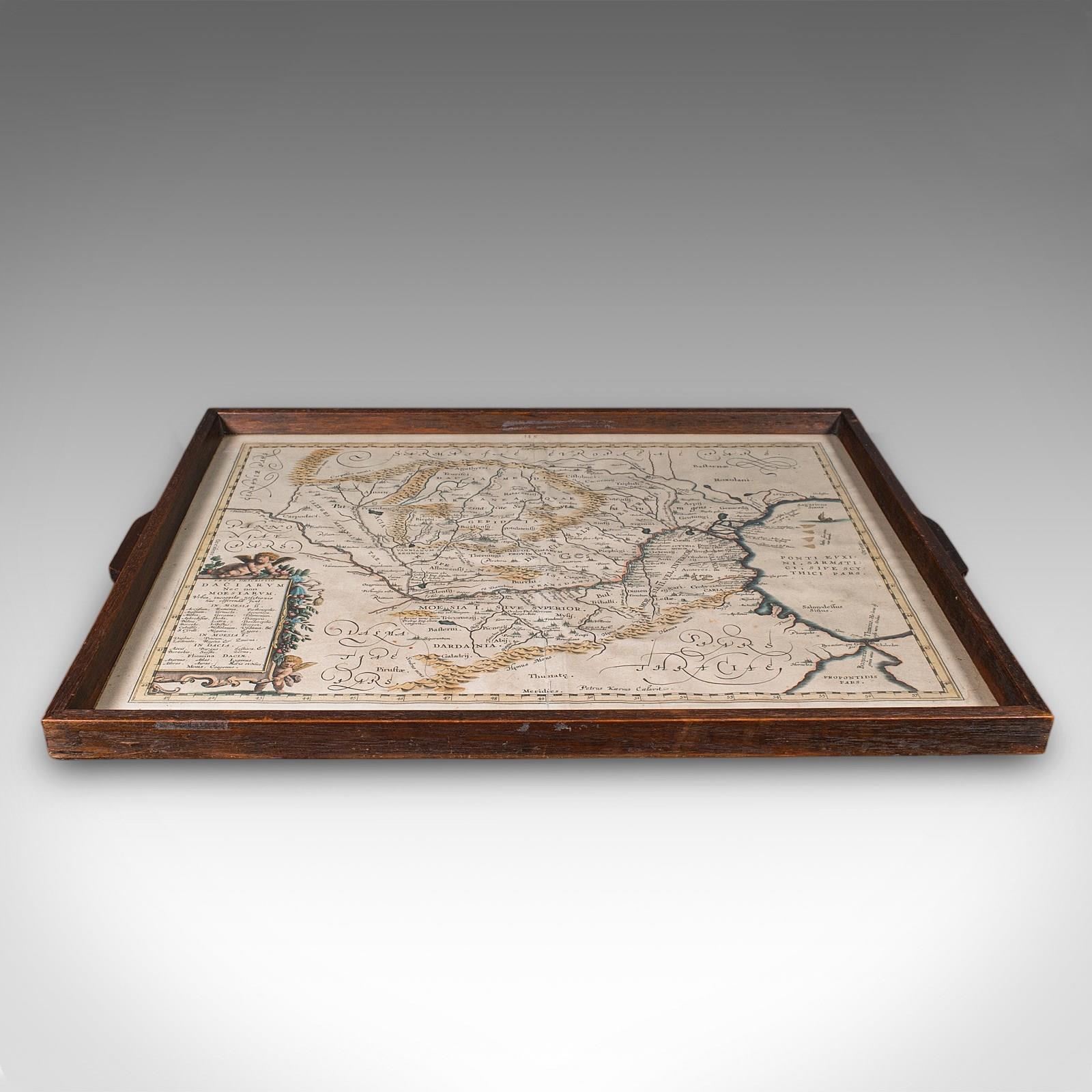
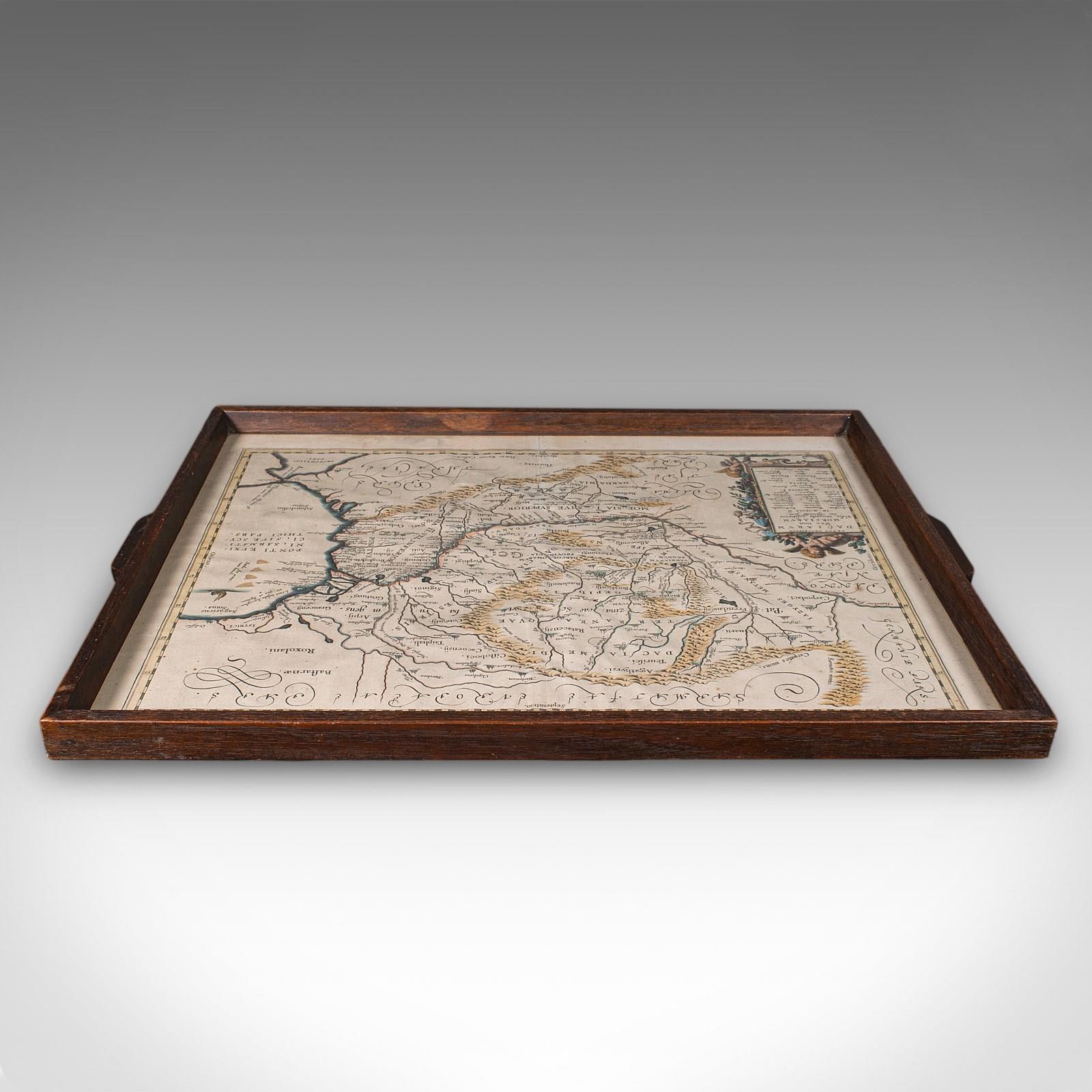
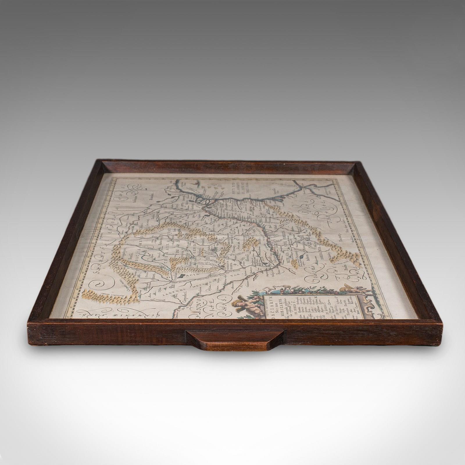
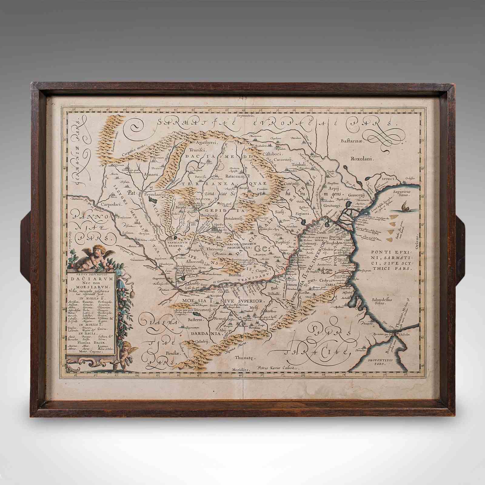
Antique Cartographer's Serving Tray, English, Platter, European Map, Edwardian
Stock No
25688
2024
- £895.00
- €1,050 Euro
- $1,194 US Dollar
Questions about this item?
Like this item?
Item Description
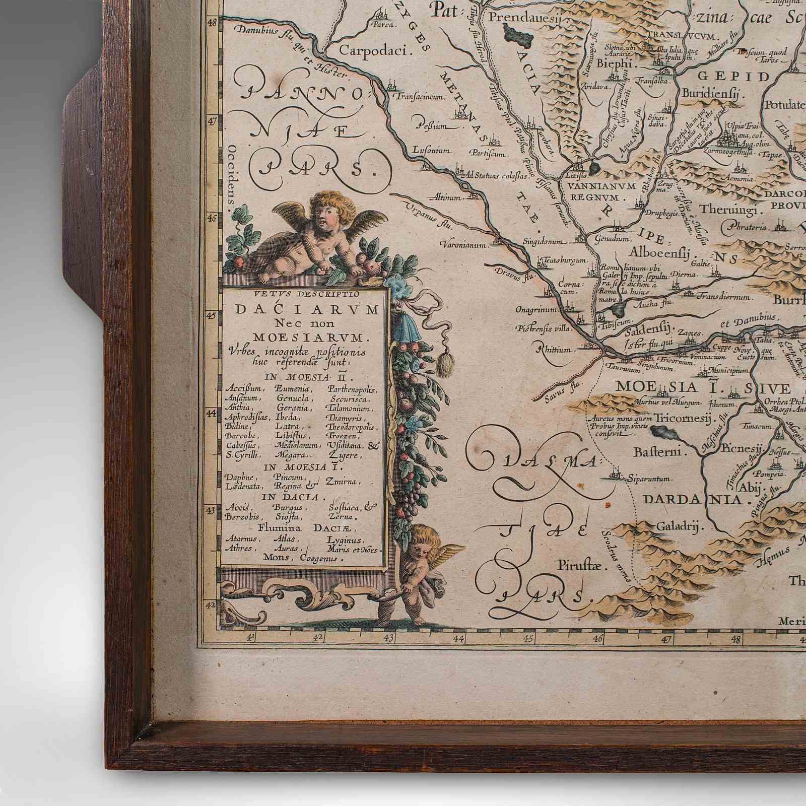
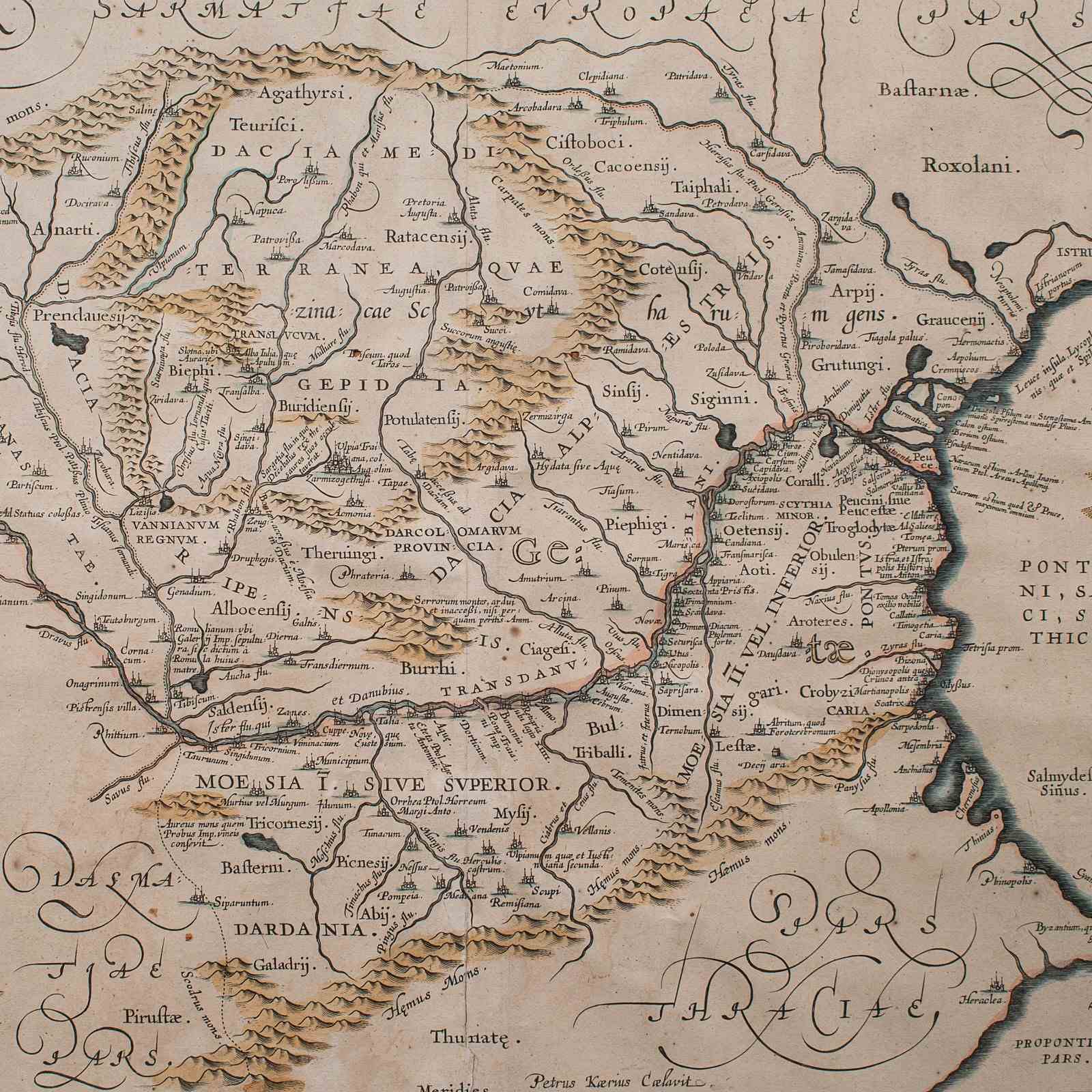
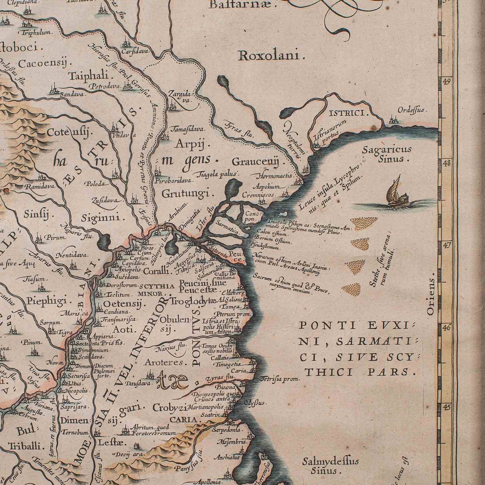
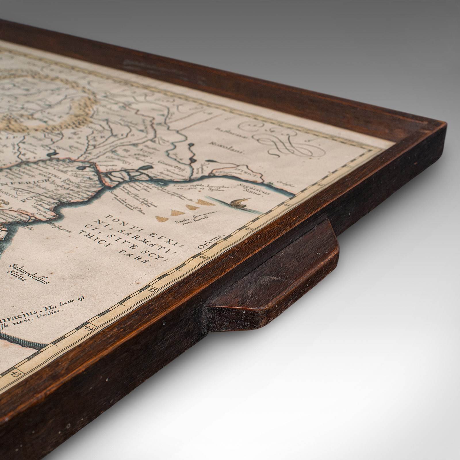
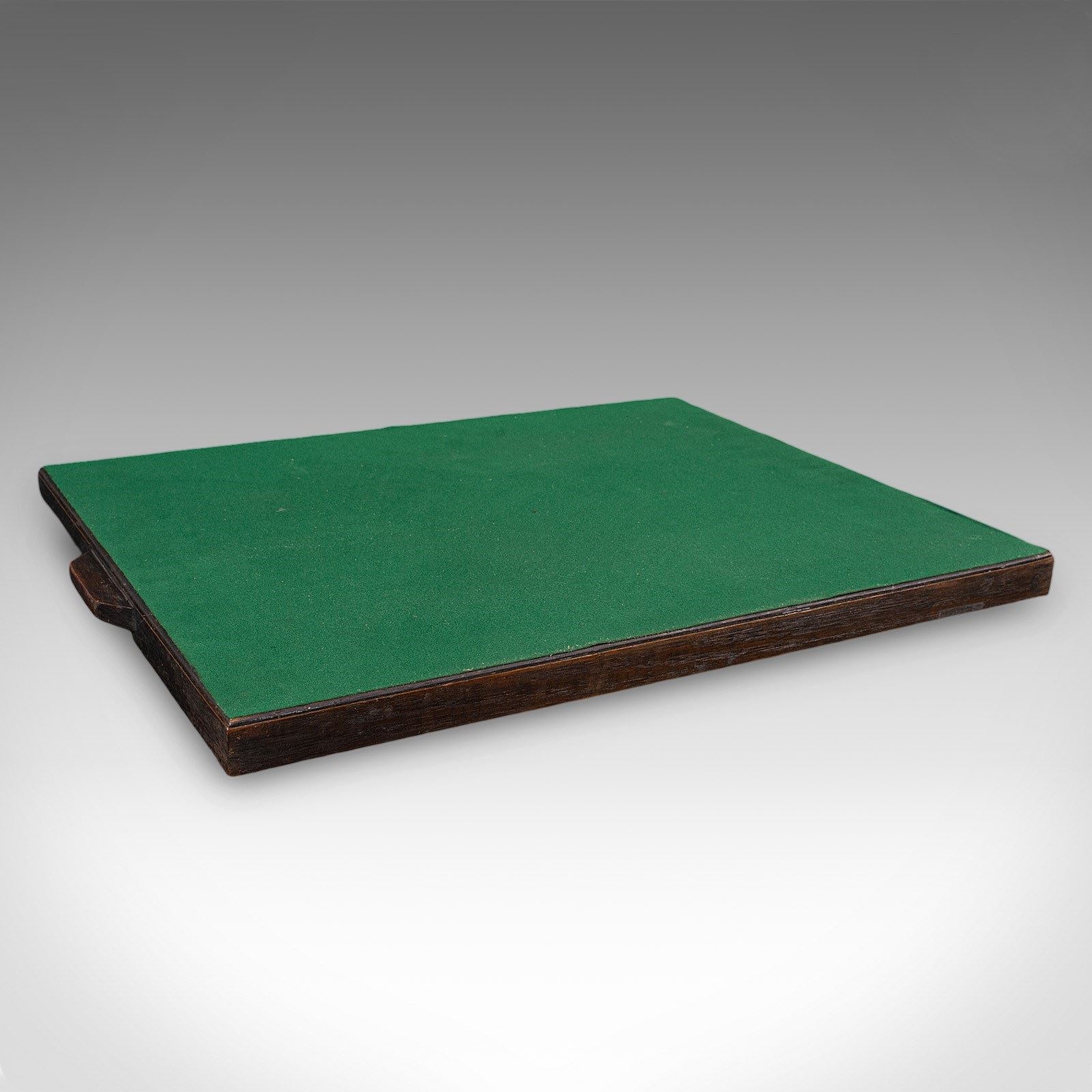
This is an antique cartographer's serving tray. An English, drinks platter with inlaid map of South East Europe, dating to the Edwardian period, and earlier, circa 1910.
A fascinating example, with a 17th century atlas excerpt mounted beneath glass
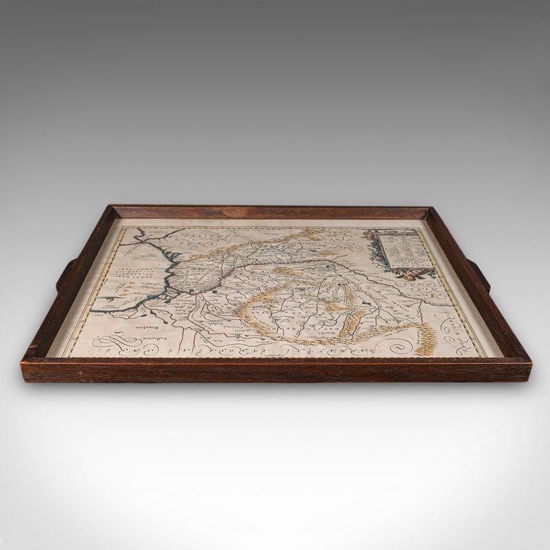
Crafted in the Edwardian period from oak with deep caramel hues
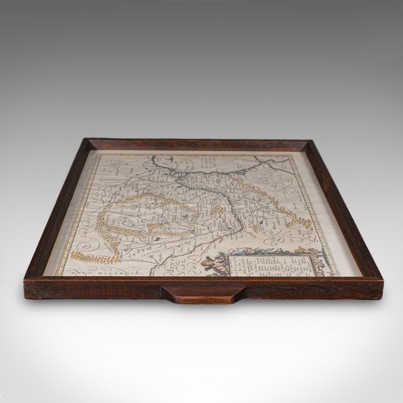
Dressed to the base with a protective emerald green baize
Pair of carry handles for ease of moving from the kitchen to the drawing room or lounge
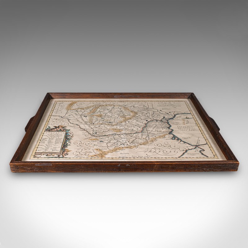
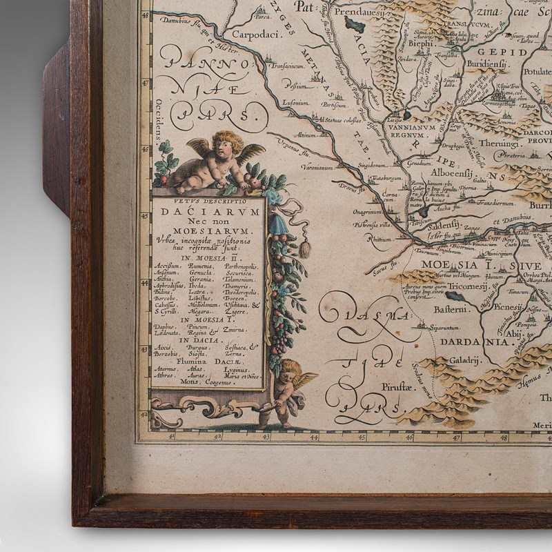
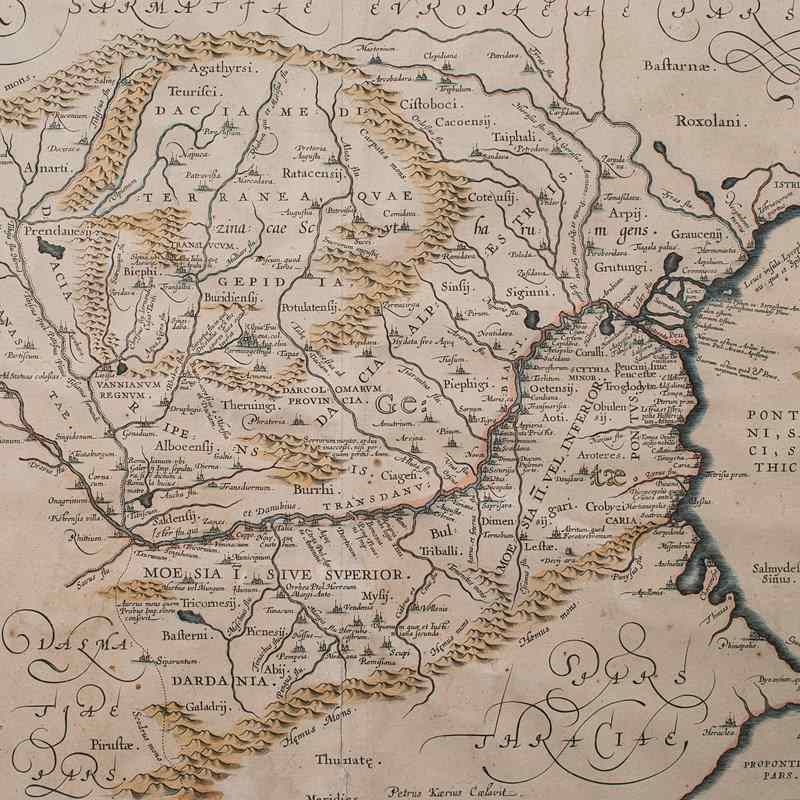
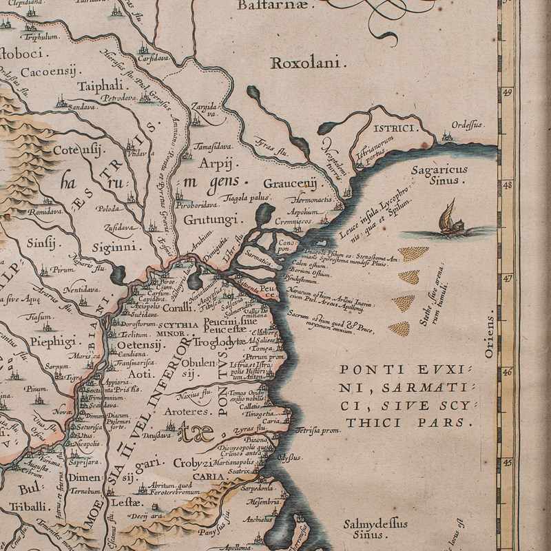
Mounted atlas excerpt as published by Johannes Janssonius circa 1660
Depicts the ancient Dacia and Moesia regions, with Latin annotation
In the modern age, the map corresponds with Romania, Bulgaria and surrounding regions
Engraved in fine detail by Petrus Kaerius (1571- 1646), a Flemish publisher and globe maker
Hand coloured borders and incidental detail enhances the appealing map
Replete with mountain ranges, rivers and information panel for further detail
This is a superb antique cartographer's serving tray, a distinctive addition to the drawing room or lounge of an avid map collector or traveller to the region. Solid joints and construction, delivered ready for the home.
Dimensions:
Max Width: 58cm (22.75'')
Max Depth: 43cm (17'')
Max Height: 3cm (1.25'')
Internal Width: 51.5cm (20.25'')
Internal Depth: 40cm (15.75'')
Internal Height: 15cm (6'')
Item Info
Seller
Seller Location
Hele, Devon
Item Dimensions
H: 3cm W: 58cm D: 43cm
Period
1900s
Item Location
United Kingdom
Seller Location
Hele, Devon
Item Location
United Kingdom
Seller Contact No
+44 (0)207 1833511
More from LONDON FINE ANTIQUES