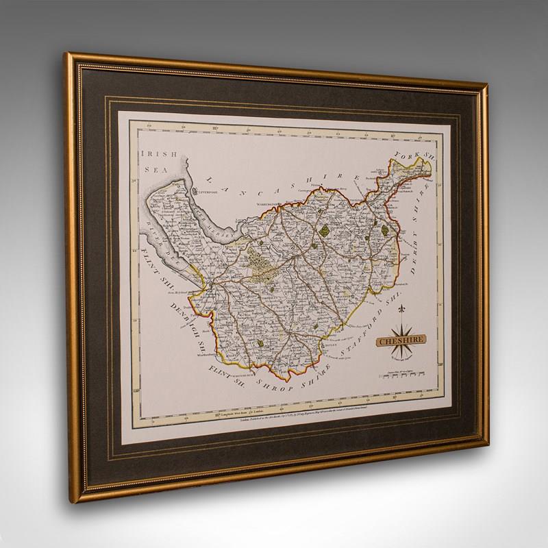
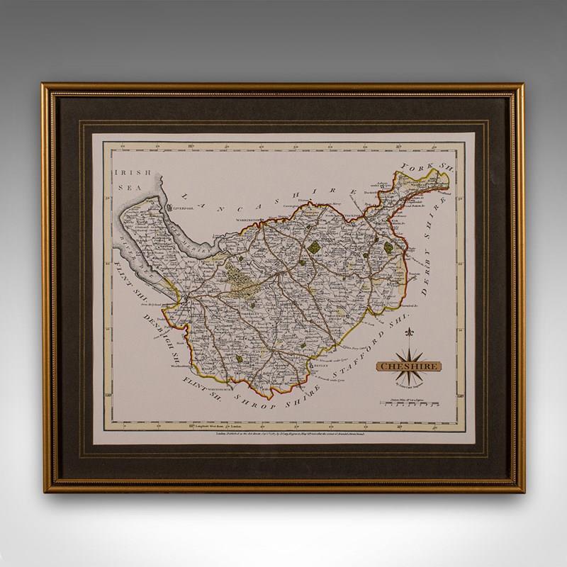
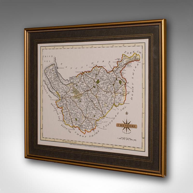
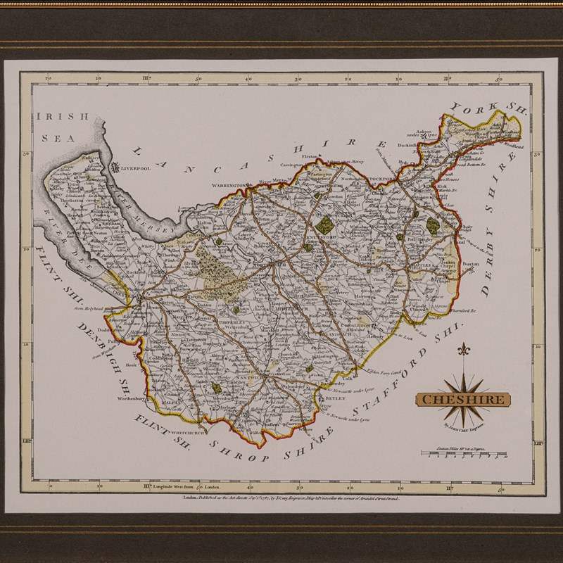
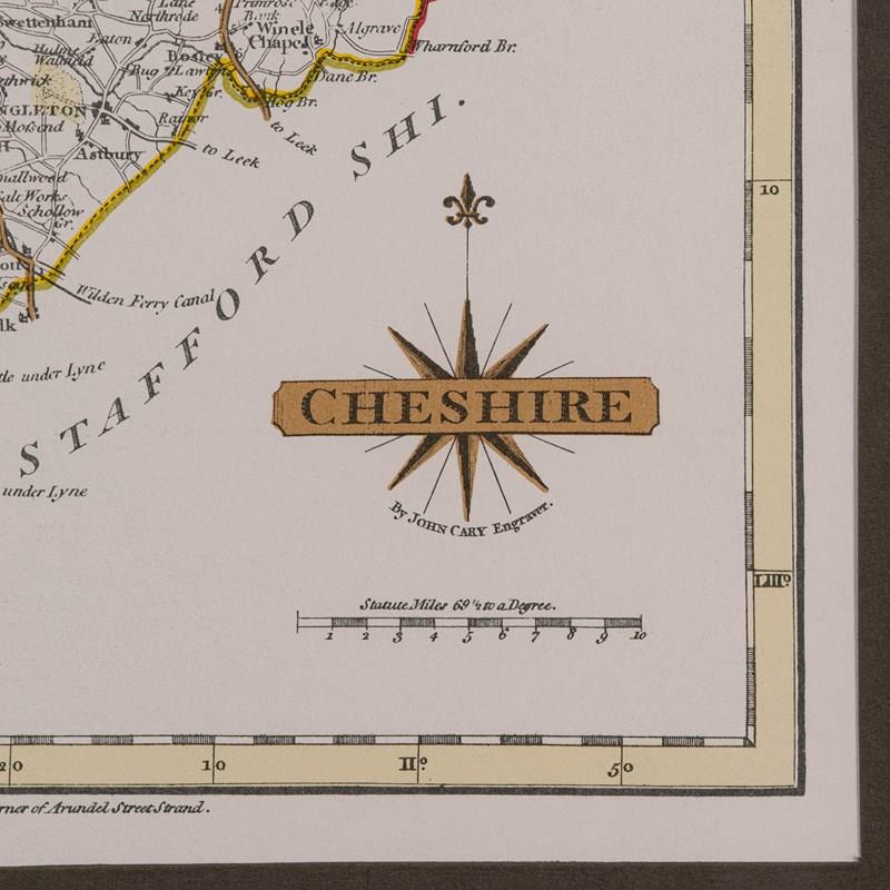
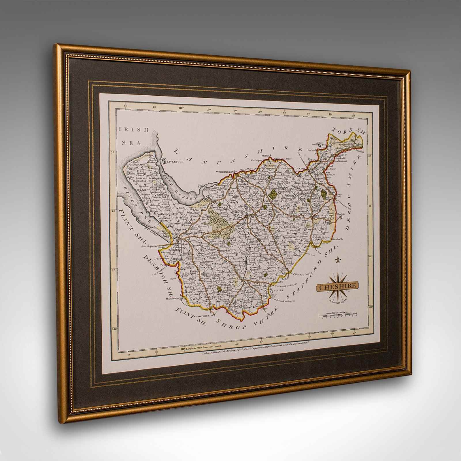
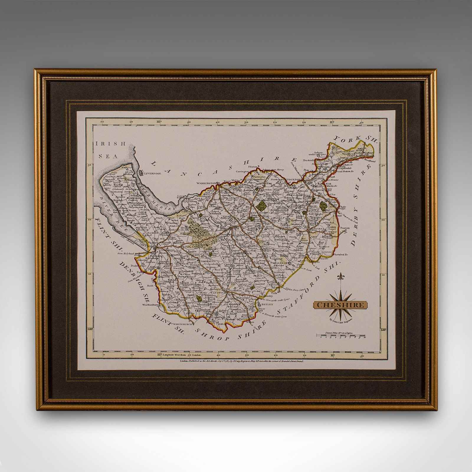

Vintage County Map Of Cheshire, English, After John Cary, Cartography Interest
Stock No
25577
2024
- £595.00
- €697 Euro
- $796 US Dollar
Questions about this item?
Like this item?
Item Description
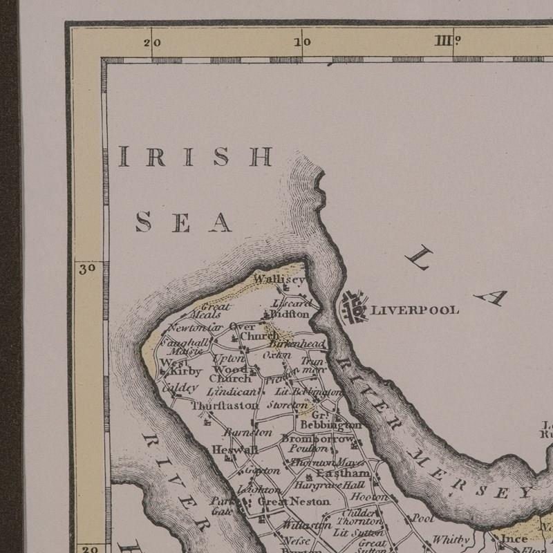
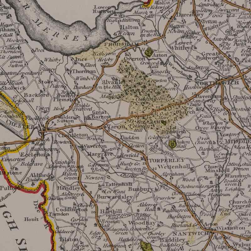
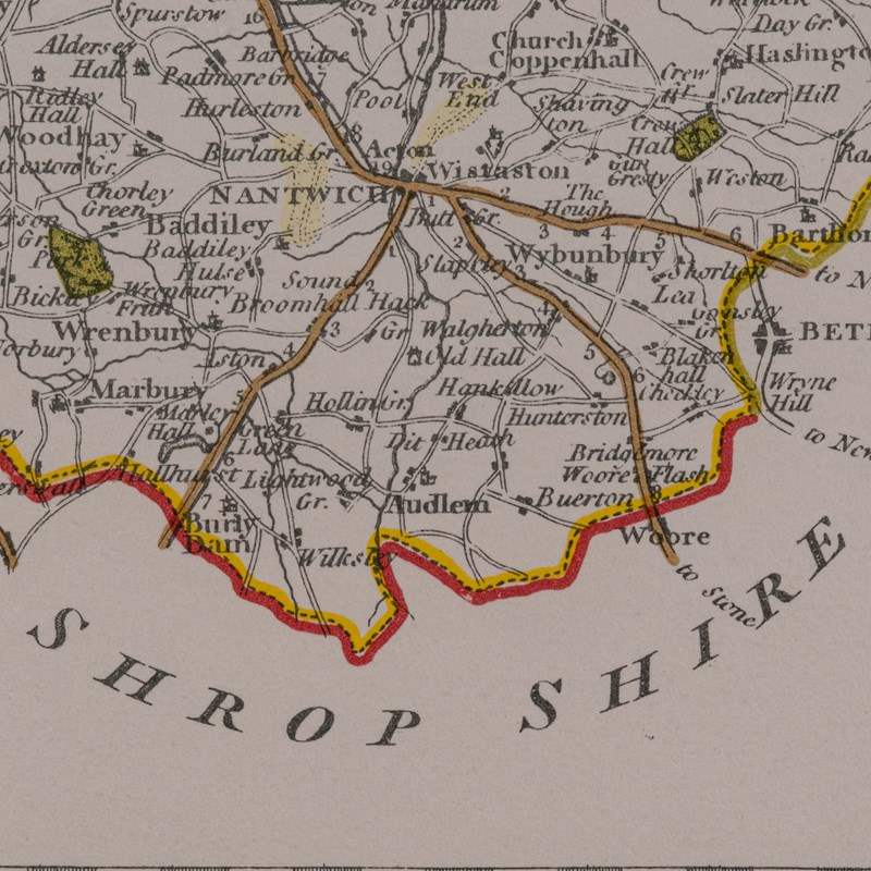
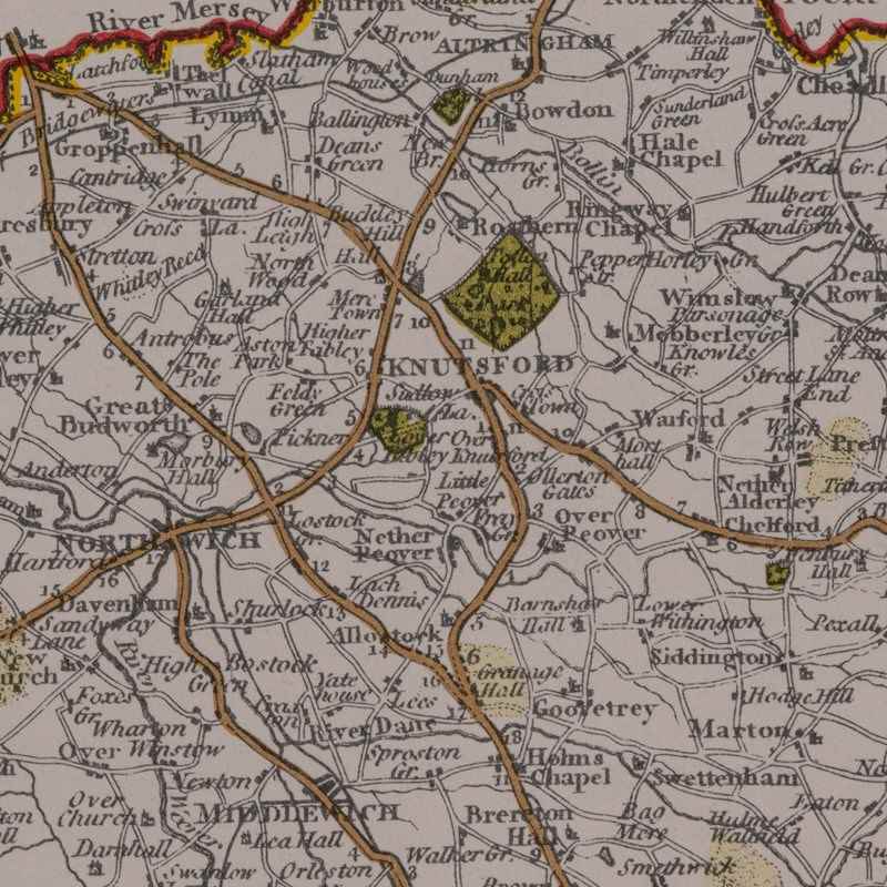
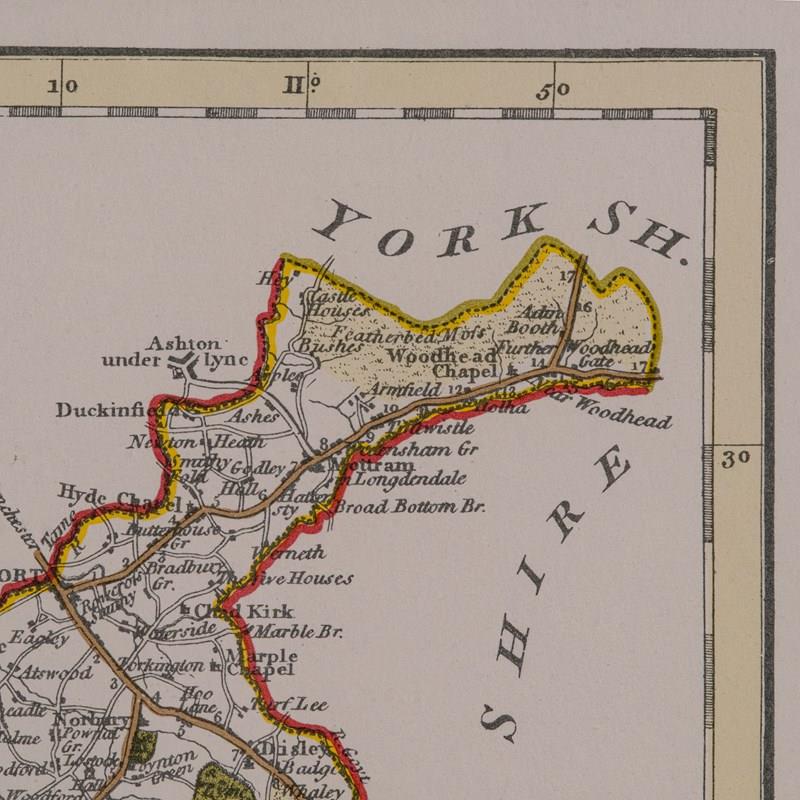
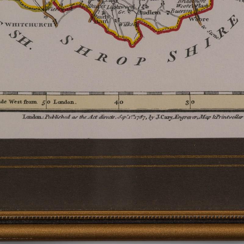
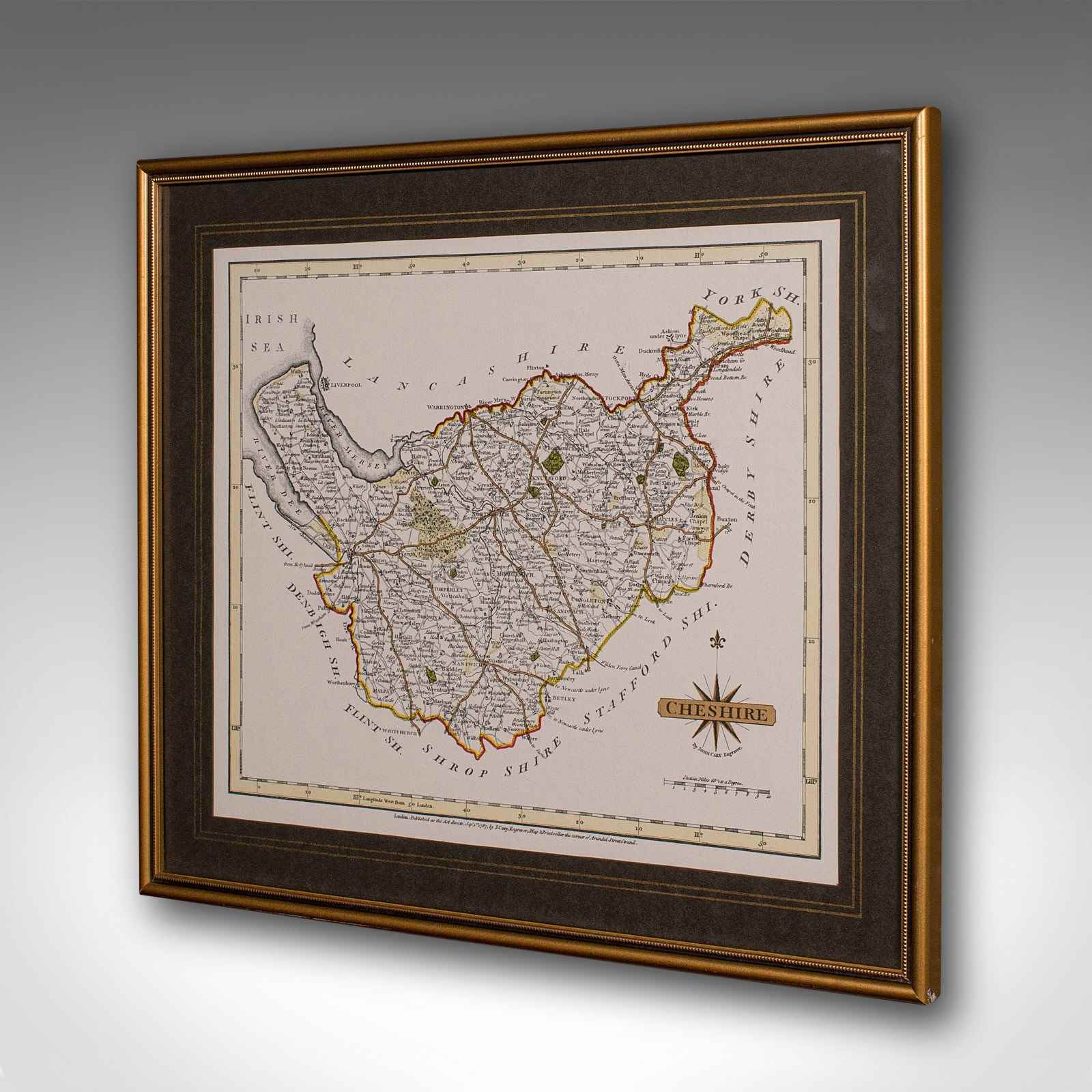
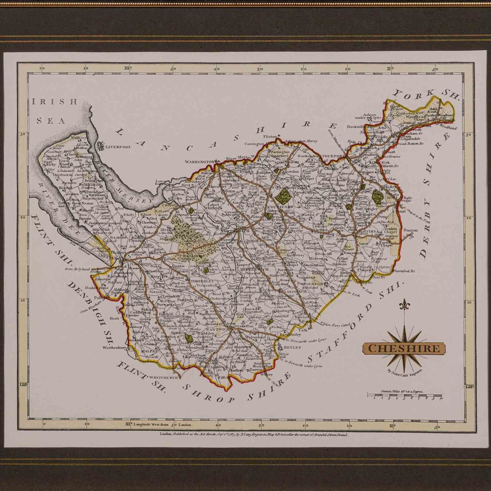
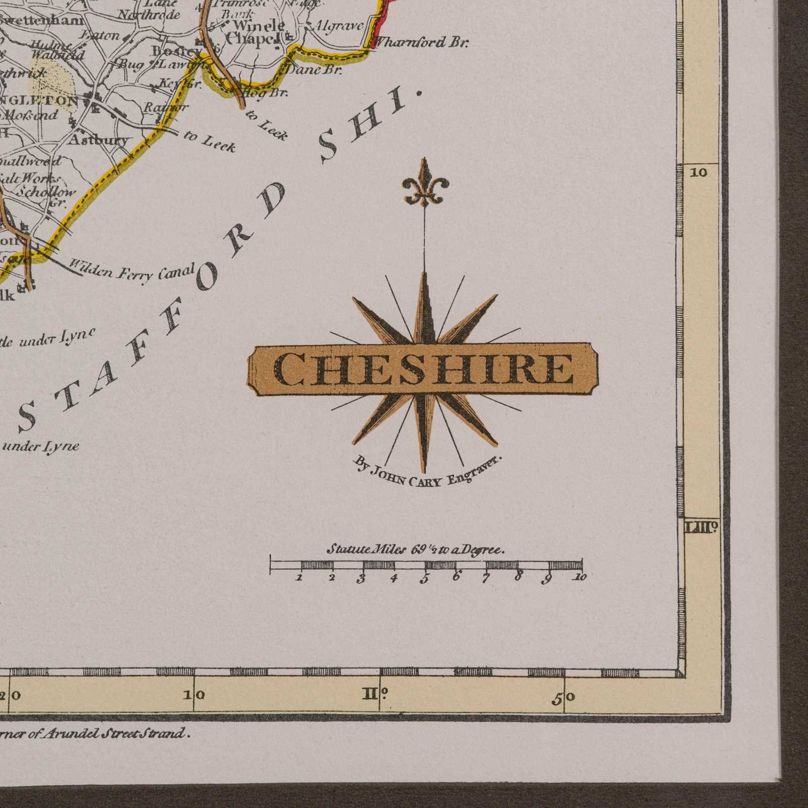
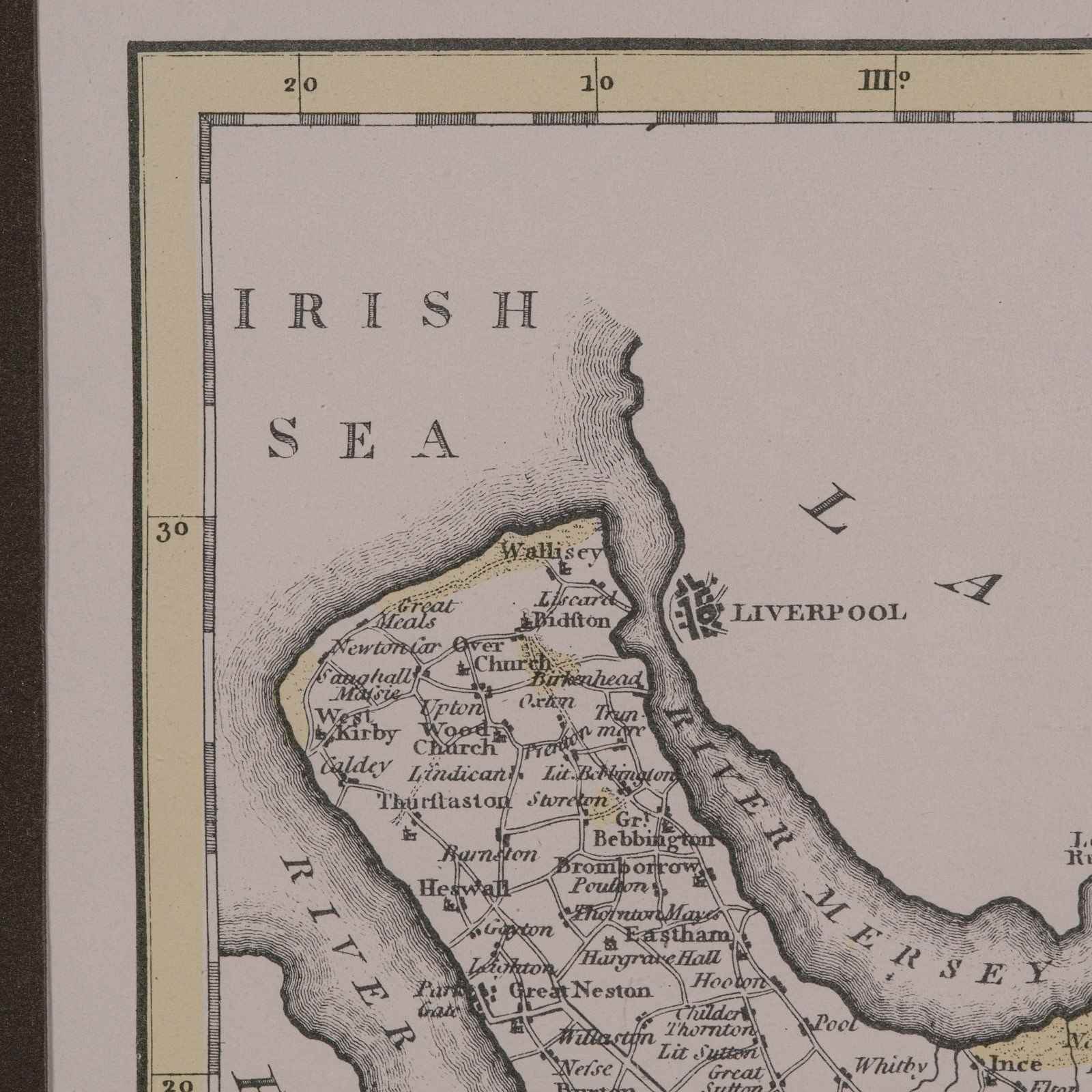
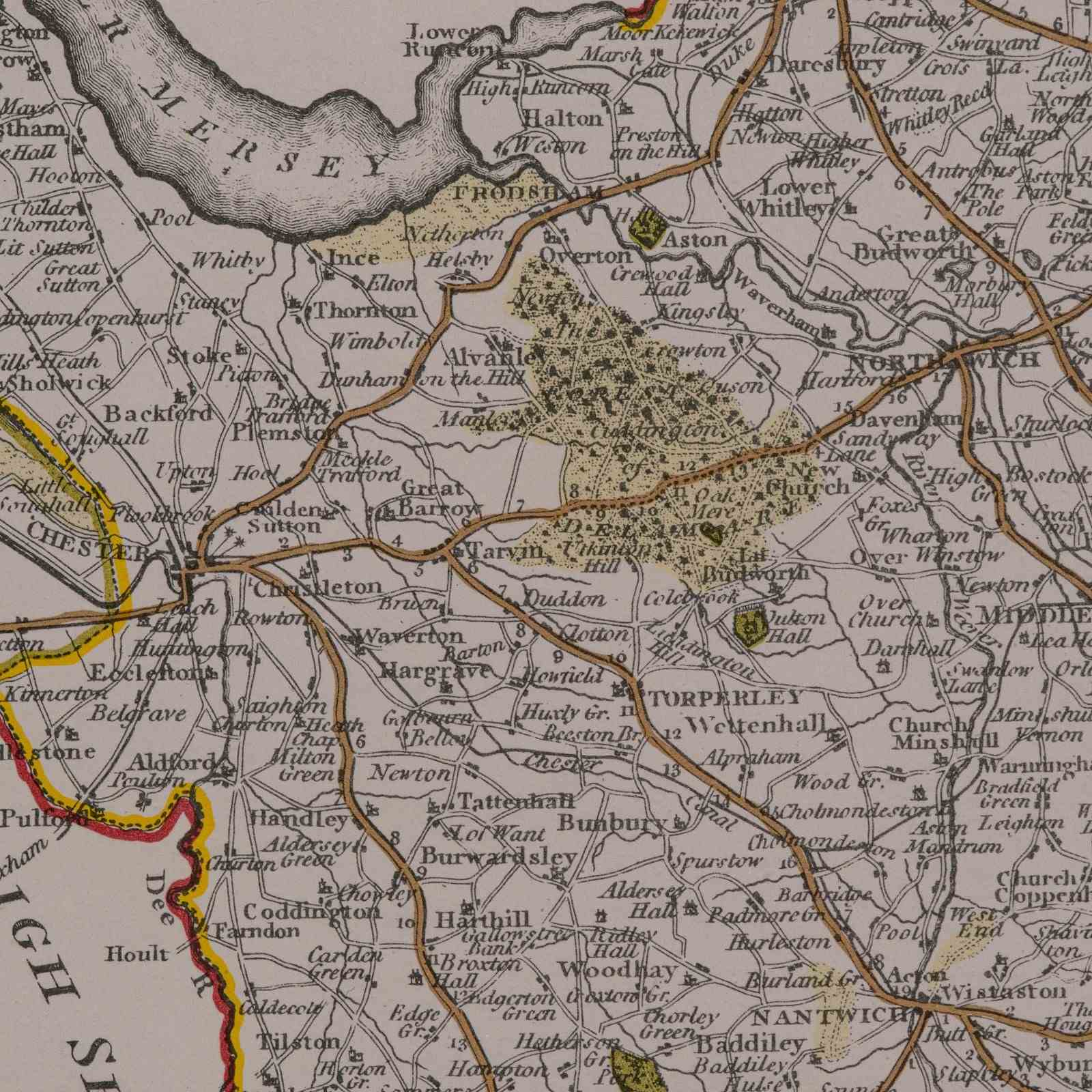
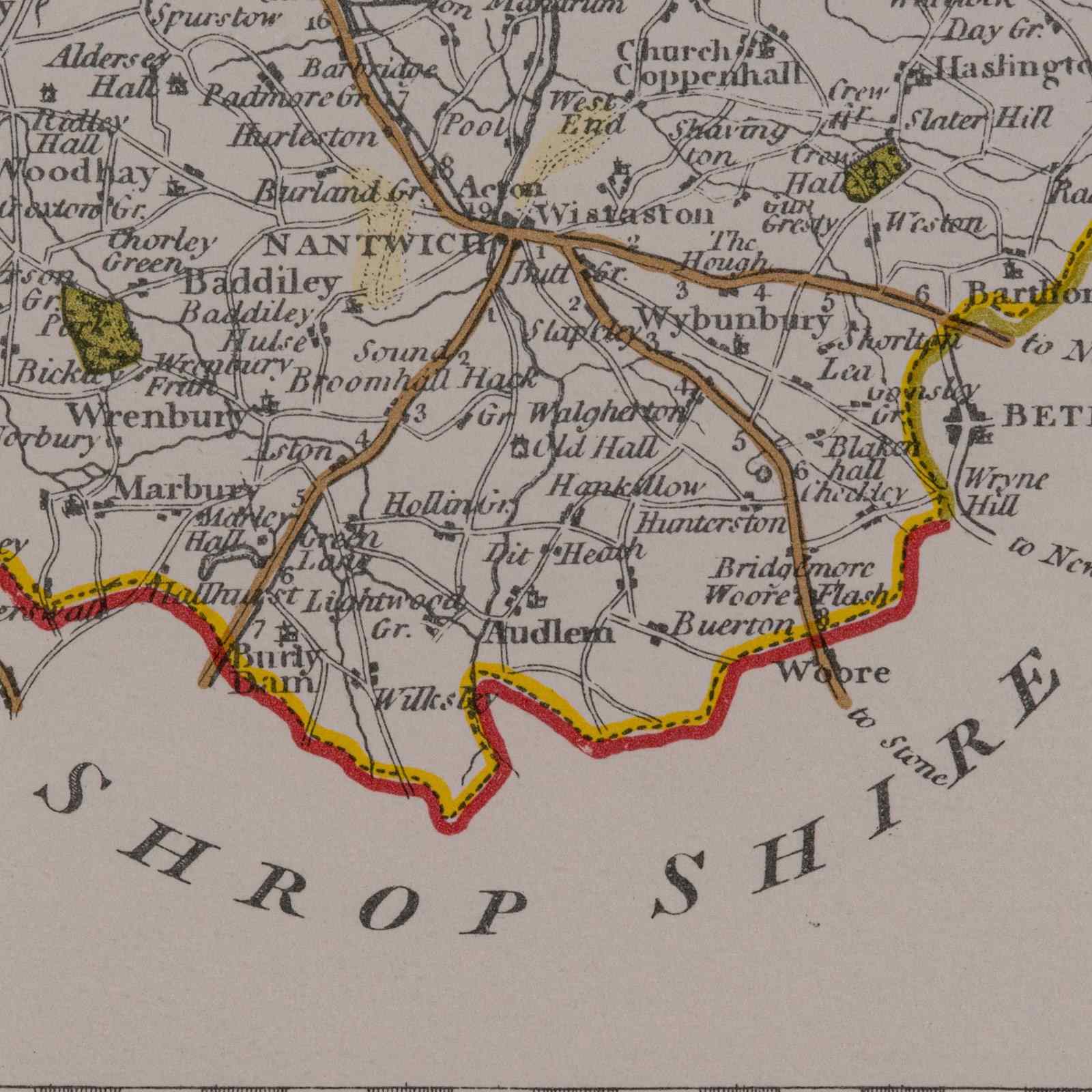
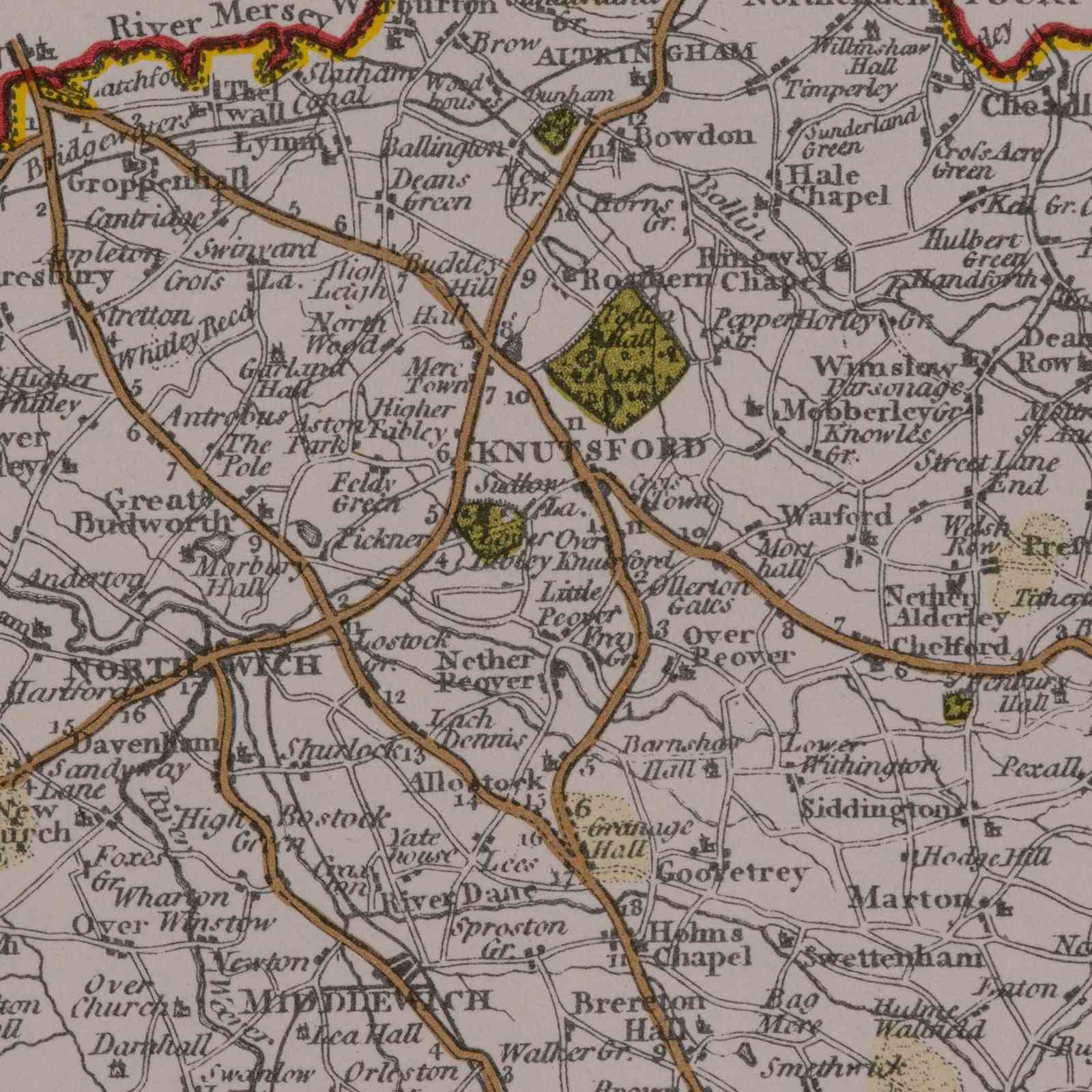
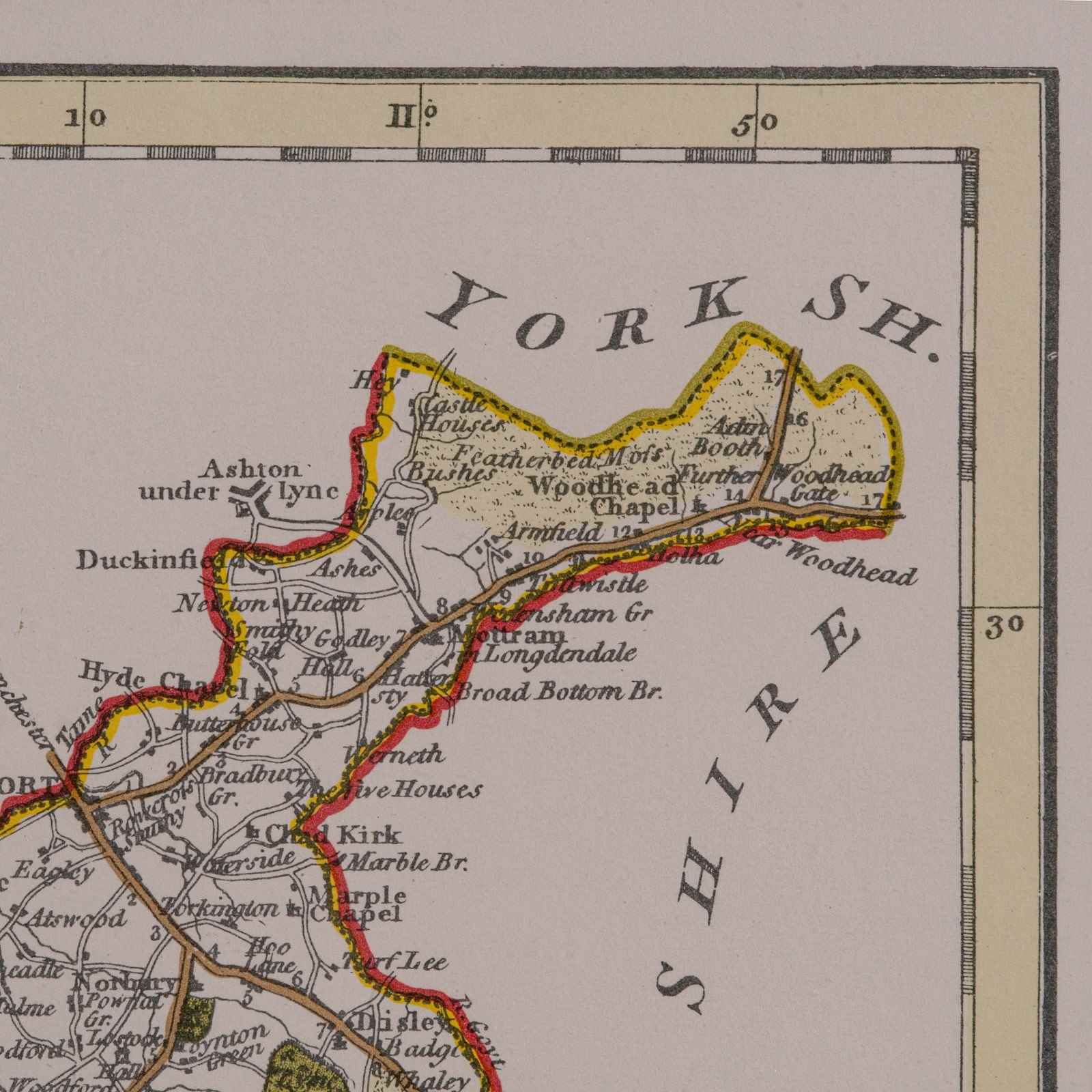
This is a vintage Cheshire map, a fine reproduction of John Cary’s late 18th century cartography, and presented within a smart glazed frame.
Superb county map of Cheshire, offering fine cartographic interest
Faithful reproduction of the original work by John Cary, circa September 1787
Attractive hand coloured palette, highlighting boundaries and topographic detail
Fascinating detail throughout, with period place names and transport routes
Displays a desirable aged patina, adding character and charm
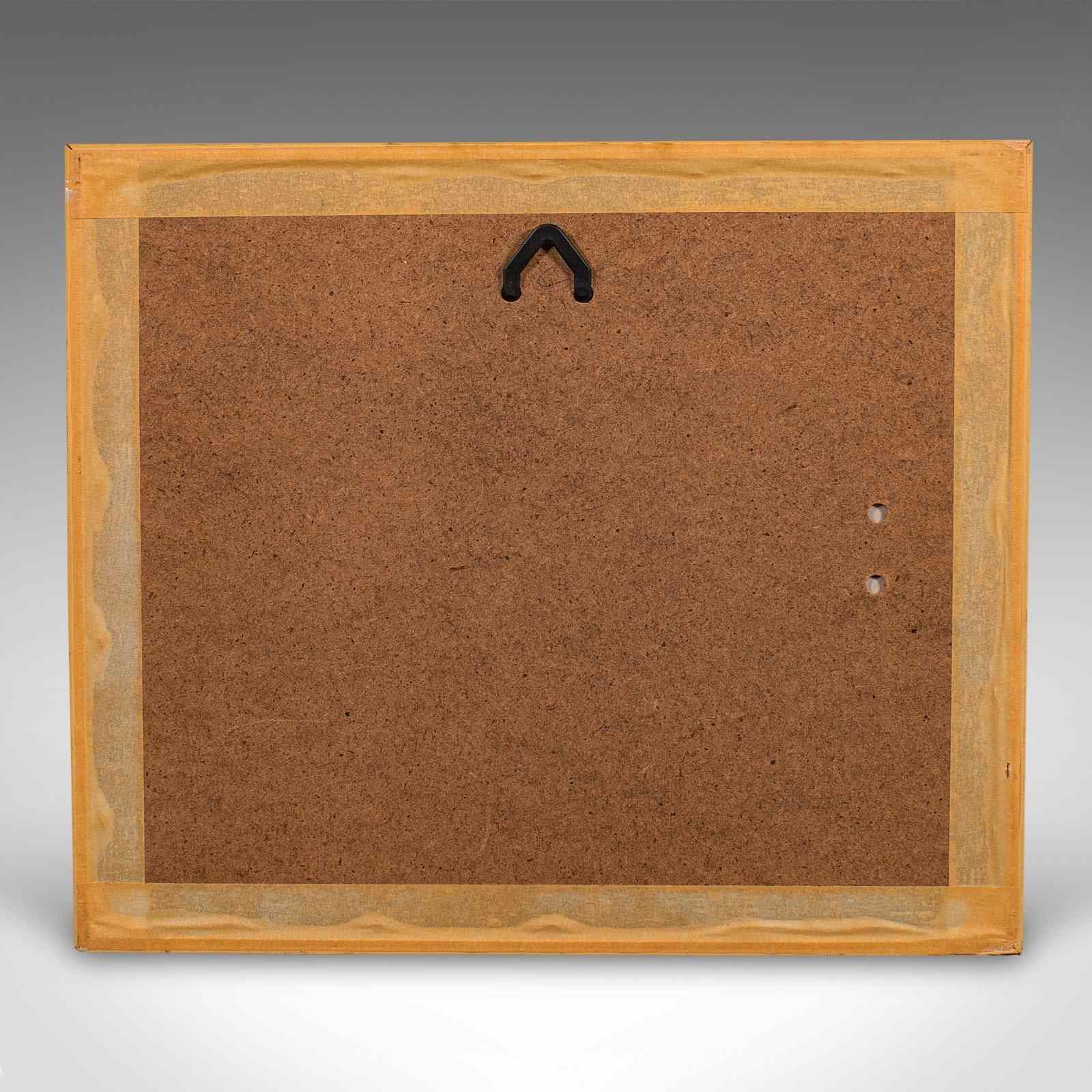
Set within a quality glazed frame, both protective and presentational
Dressed to the rear with a hanging loop, for immediate wall display
Delivered ready to enjoy, ideal for study, hallway, or traditional décor themes
A tasteful and informative addition to any interior, this vintage framed map of Cheshire captures the essence of historic English cartography, and makes a superb gift or collector’s piece. Delivered ready to display.
Dimensions:
Max Width: 35cm (13.75'')
Max Depth: 1cm (.5'')
Max Height: 30cm (11.75'')
Map Width: 27.5cm (10.75'')
Map Height: 22.5cm (8.75'')
Item Info
Seller
Seller Location
Hele, Devon
Item Dimensions
H: 30cm W: 35cm D: 1cm
Period
1980s
Item Location
United Kingdom
Seller Location
Hele, Devon
Item Location
United Kingdom
Seller Contact No
+44 (0)207 1833511
More from LONDON FINE ANTIQUES