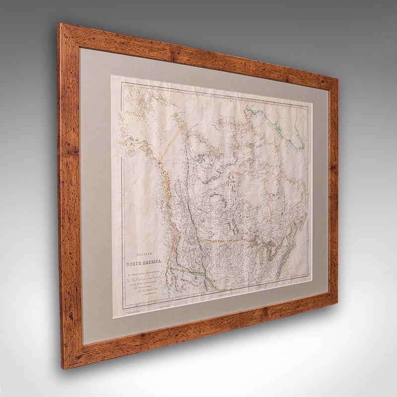

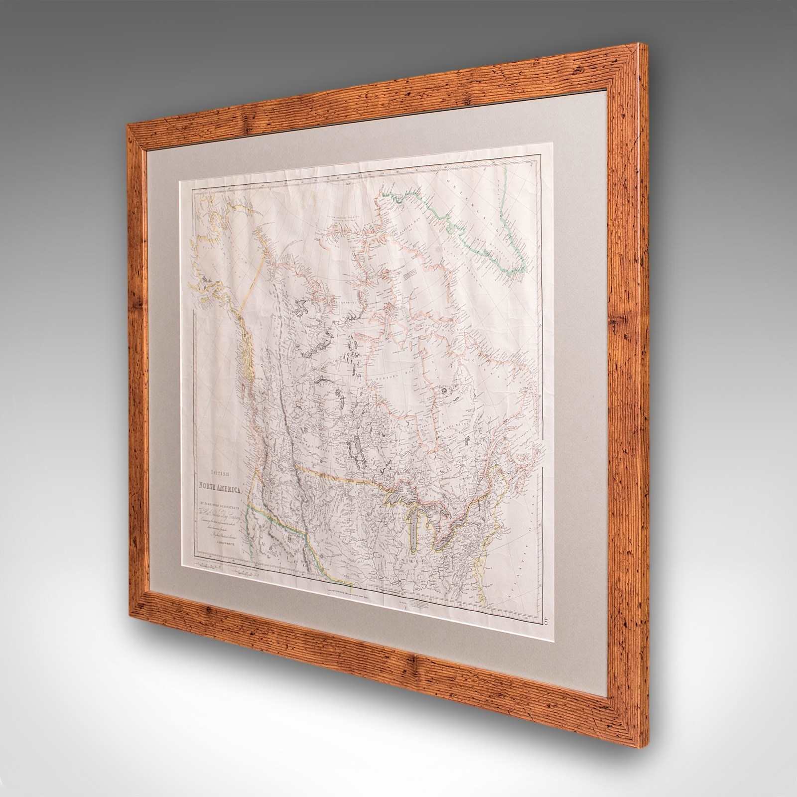
Vintage Map, British North America, Canadian, Reproduction, Framed Cartography
Stock No
26025
2024
- £895.00
- €1,048 Euro
- $1,191 US Dollar
Questions about this item?
Like this item?
Item Description
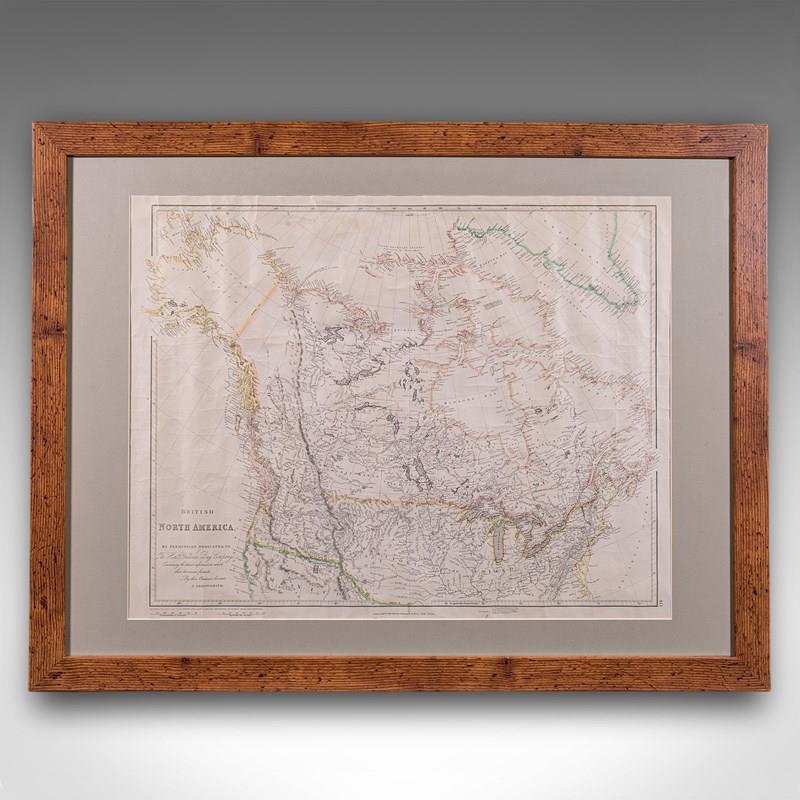
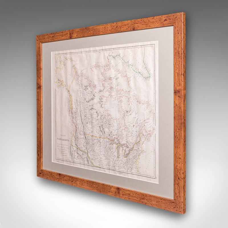
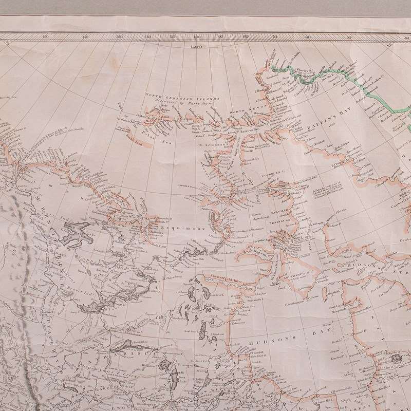
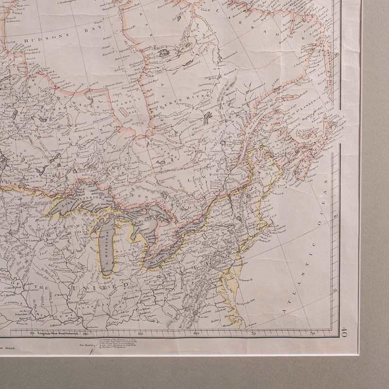
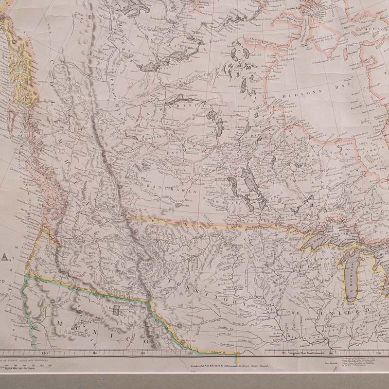
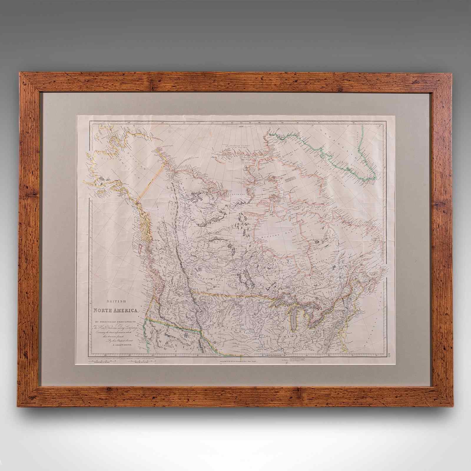
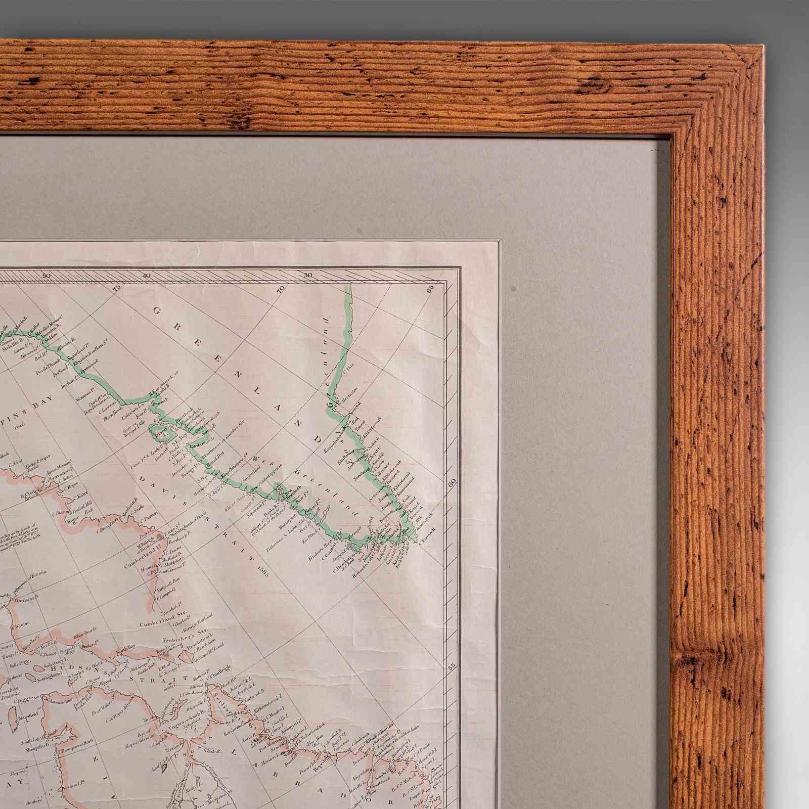
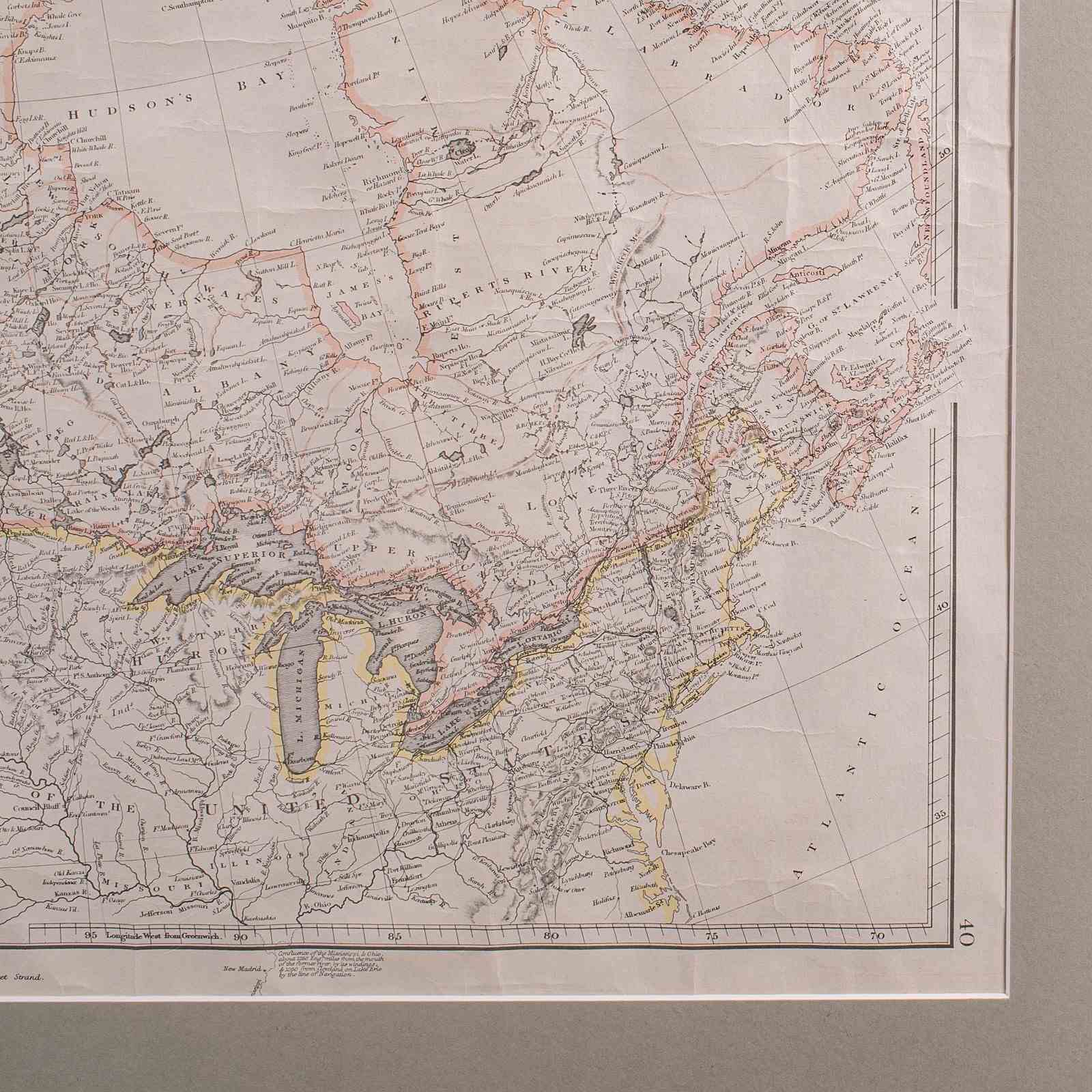
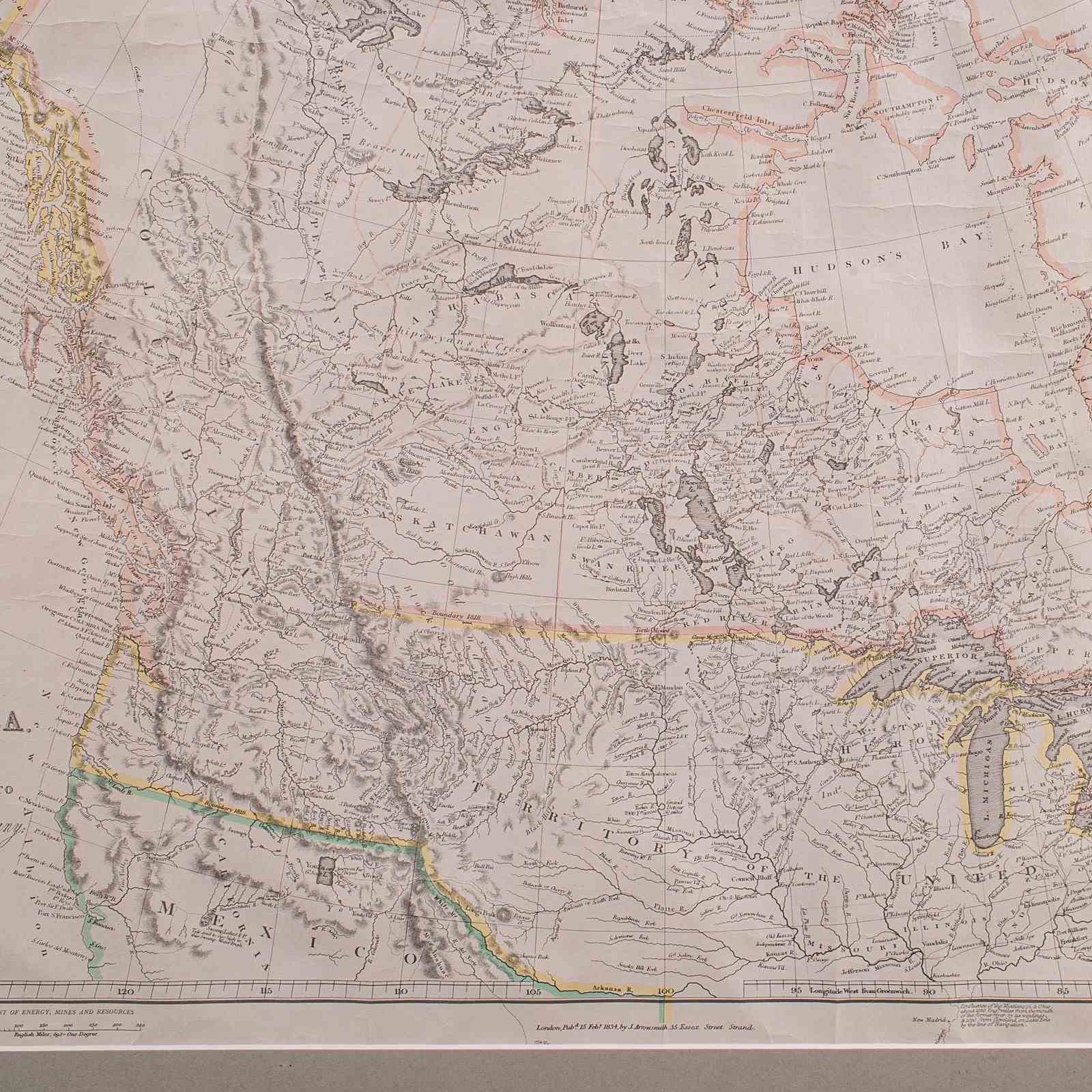
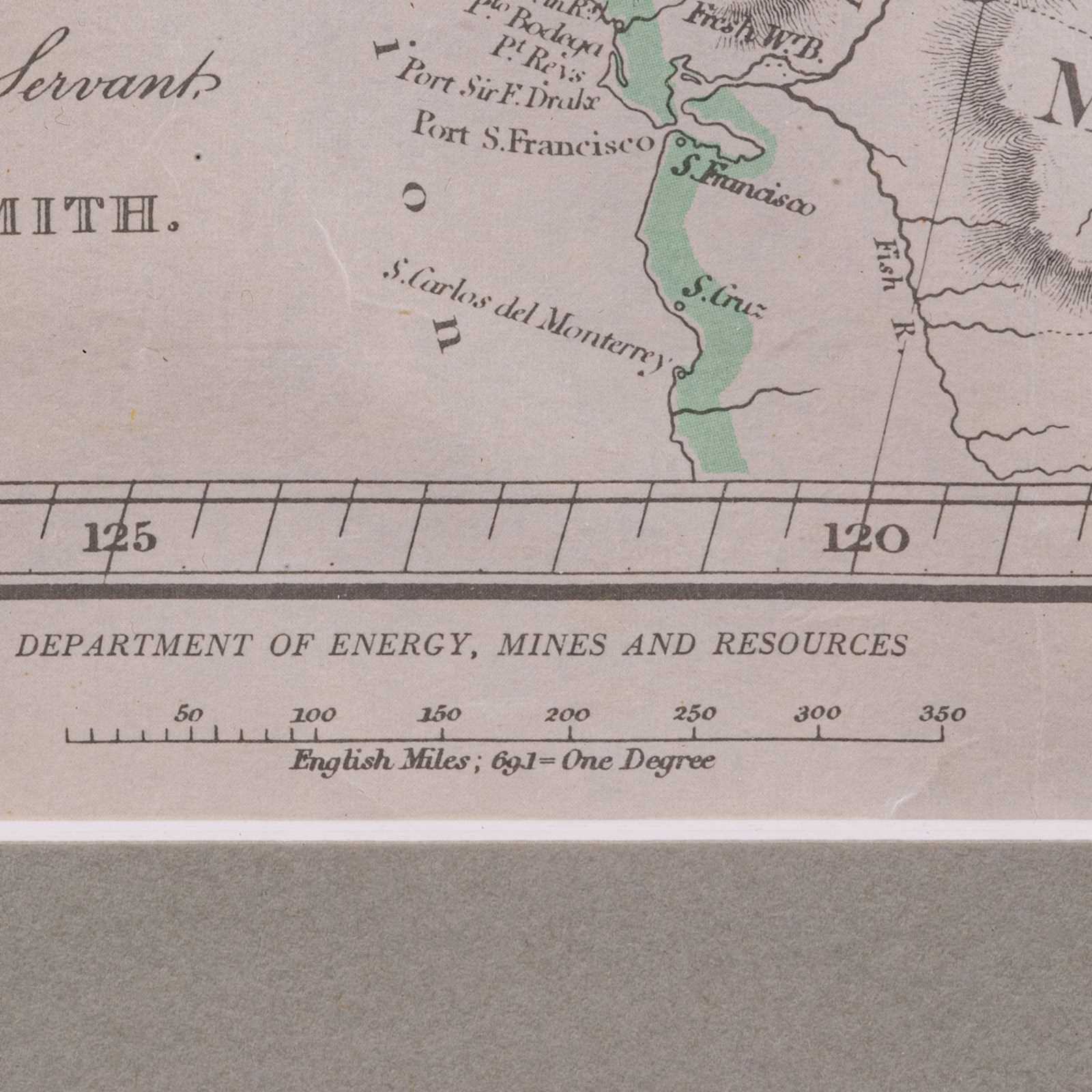
This is a large vintage map of British North America. A Canadian, official department reproduction of the 19th century original by John Arrowsmith, dating to the mid 20th century, circa 1960.
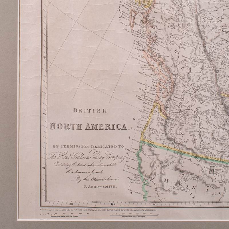
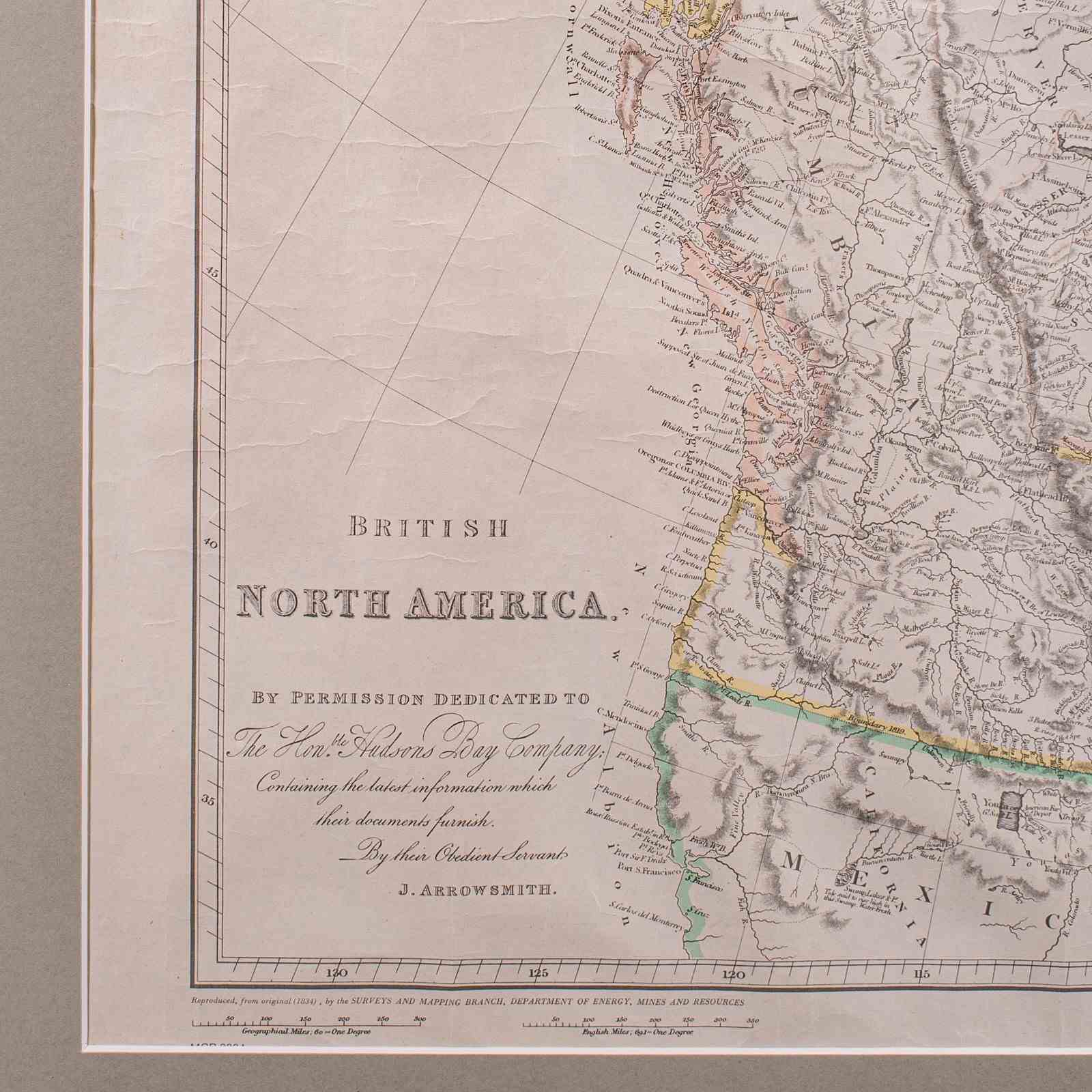
Full Title: British North America - By Permission Dedicated To The Honourable Hudsons Bay Company, Containing the Latest Information which their Documents Furnish — by their Obedient Servant, J. Arrowsmith.
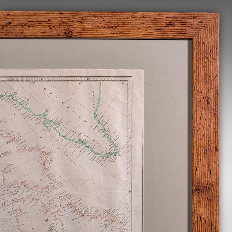
Charming state issued reproduction with field-used appeal
Displays a desirable aged patina, mounted from a lightly used example
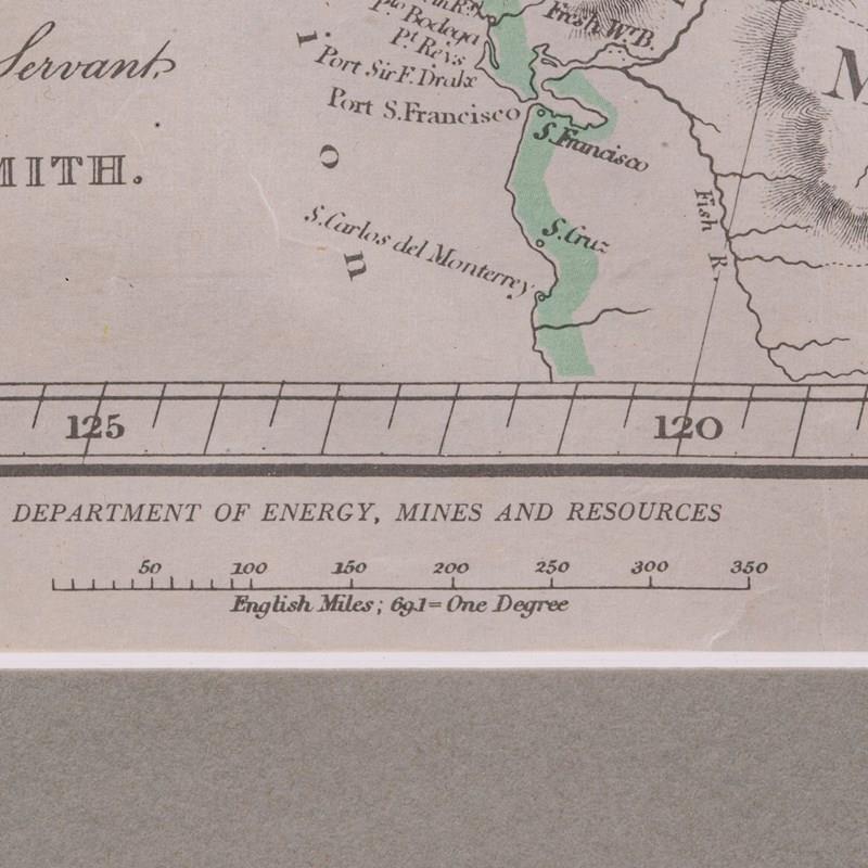
Supplied by the Canadian Department of Energy, Mines and Resources
Tasteful later frame, in pine with warm caramel hues
Quality braided metal hanging wire to the rear for ease of mounting
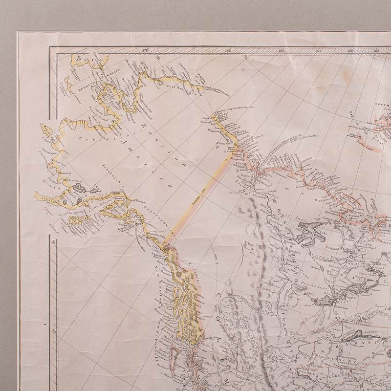
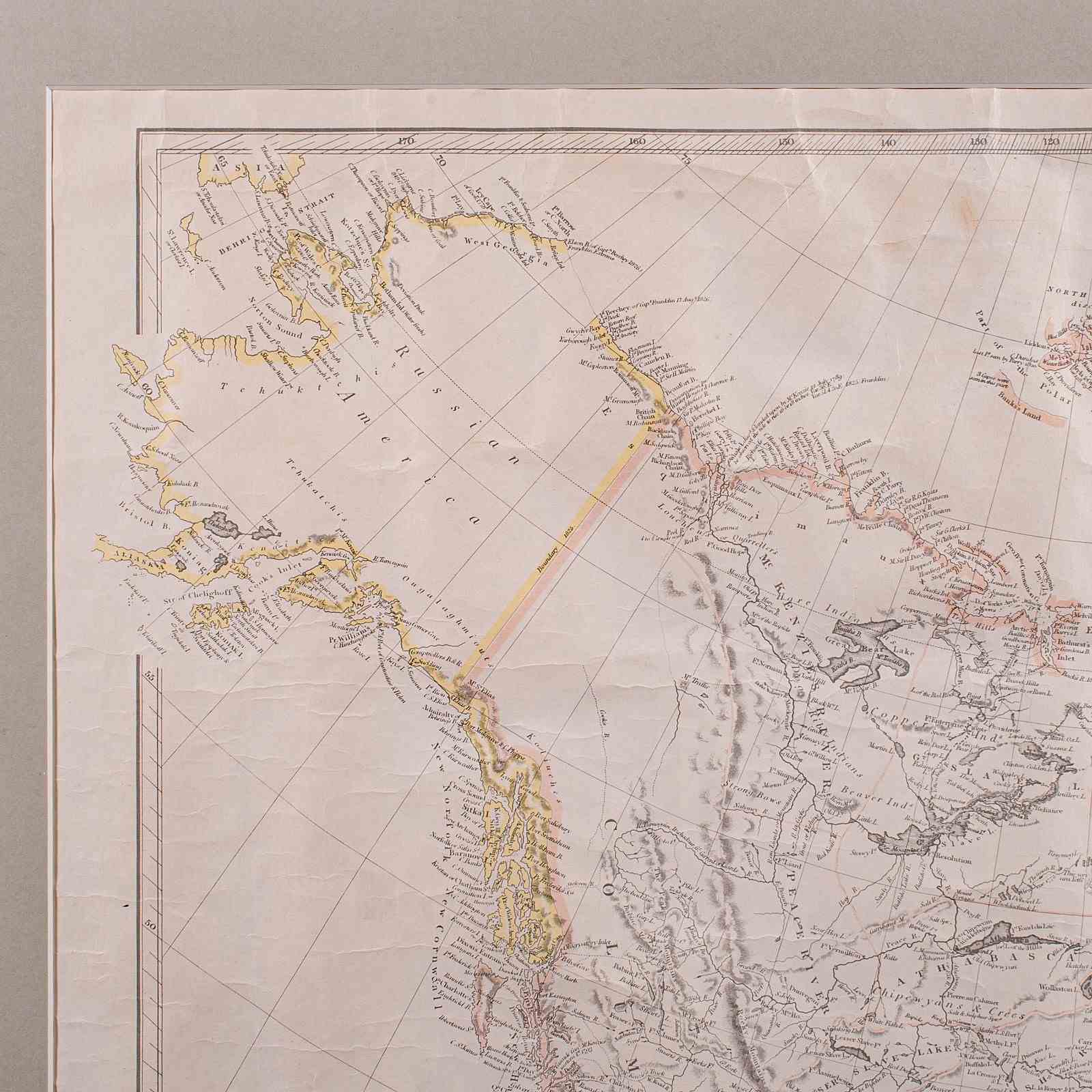
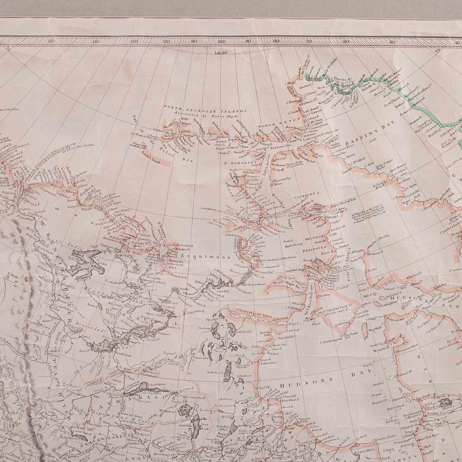
Gives impressive detail, being one of the first maps to accurate display the Northwest Passage
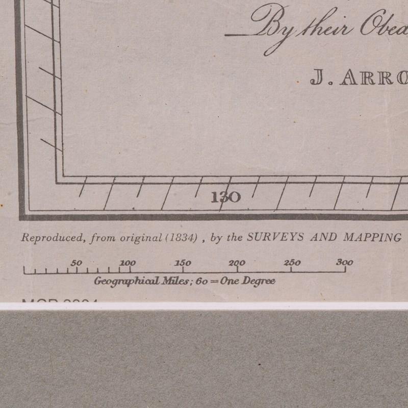
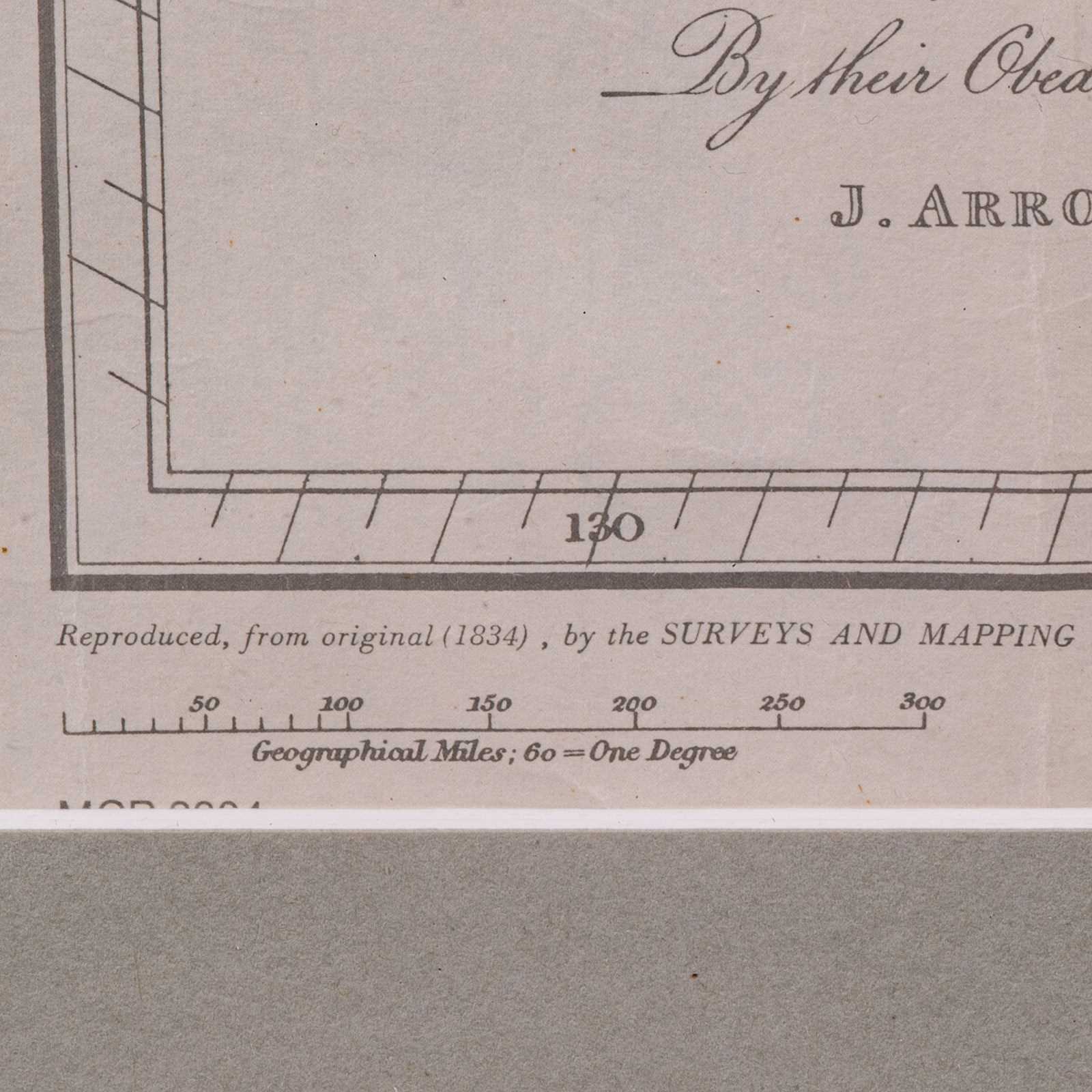
Originally published in London, December 1834 and subject to a quality reproduction here
Hand coloured border detail using different hues to separate each region
Pair of scales given, one for Geographical Miles and the other for UK Miles
This is a fascinating vintage map of British North America, state issued for use in the field. Presented in a lightly aged manner within a tasteful frame, delivered ready for display.
Dimensions:
Max Width: 87cm (34.25'')
Max Depth: 2.5cm (1'')
Max Height: 67cm (26.5'')
Map Width: 64cm (25.25'')
Map Height: 50cm (19.75'')
Item Info
Seller
Seller Location
Hele, Devon
Item Dimensions
H: 67cm W: 87cm D: 2.5cm
Period
1960s
Item Location
United Kingdom
Seller Location
Hele, Devon
Item Location
United Kingdom
Seller Contact No
+44 (0)207 1833511
More from LONDON FINE ANTIQUES