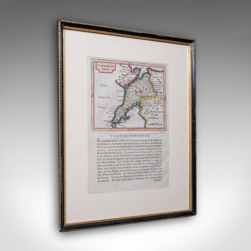

Antique Dual Sided Carnarvonshire Map, Atlas Excerpt, North Wales, Cartography
Stock No
26108
2024
- £395.00
- €456 Euro
- $523 US Dollar
Questions about this item?
Like this item?
Item Description
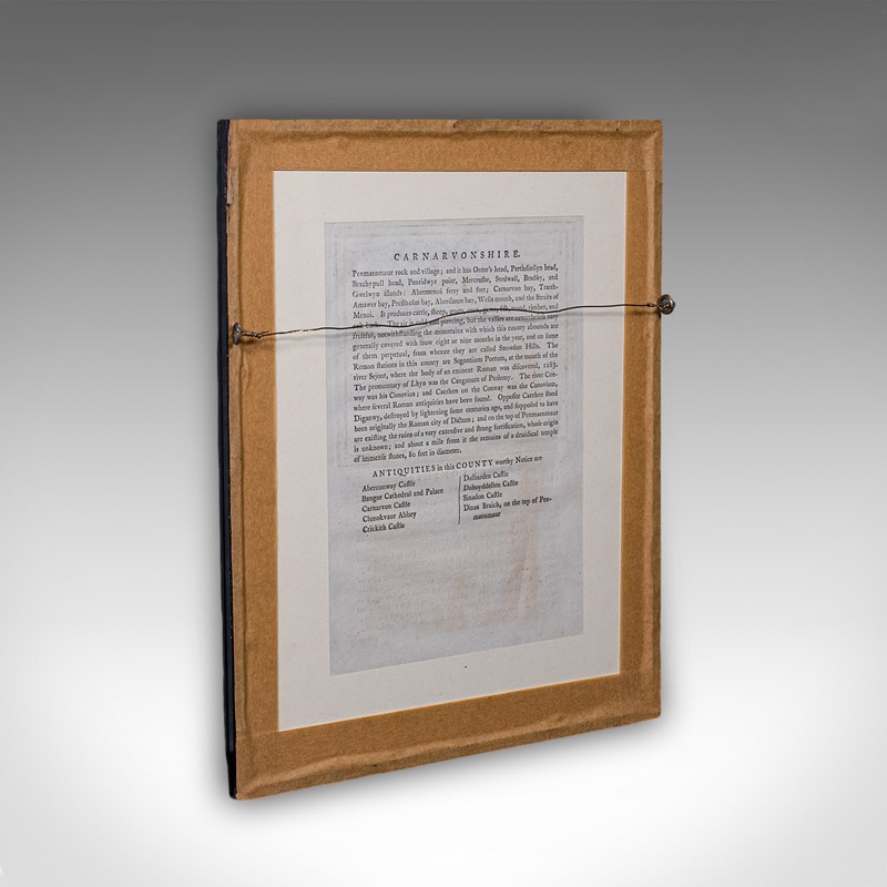
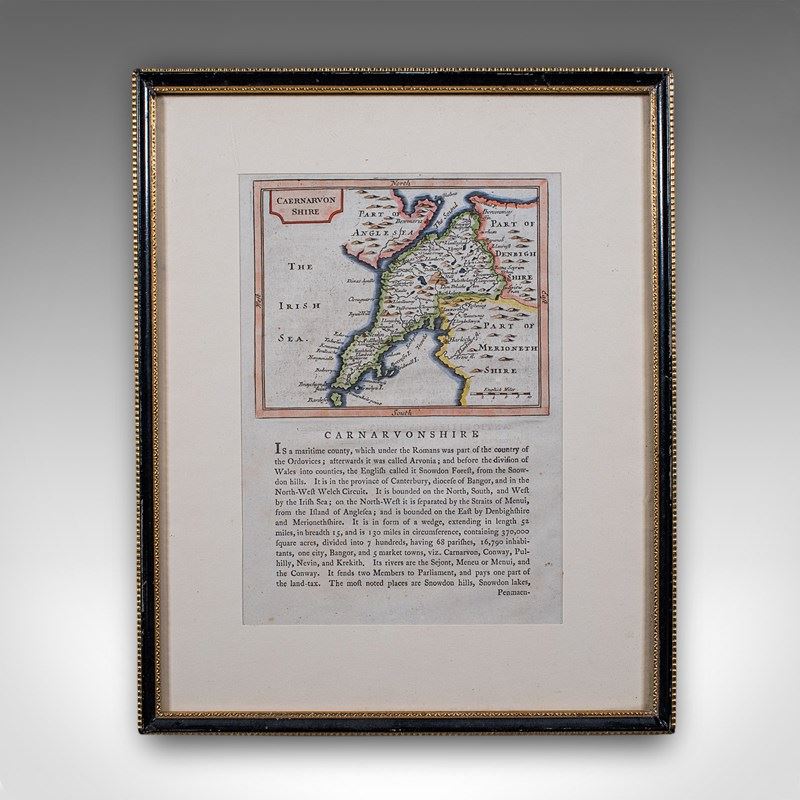
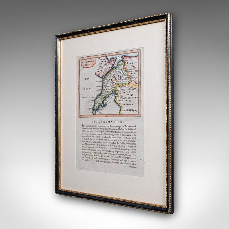
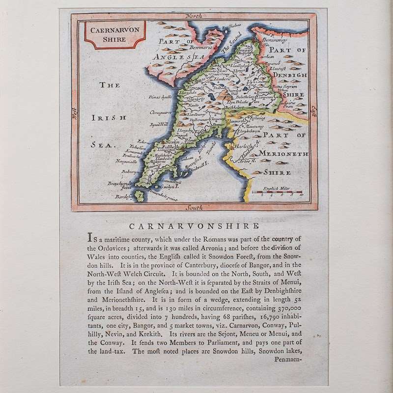
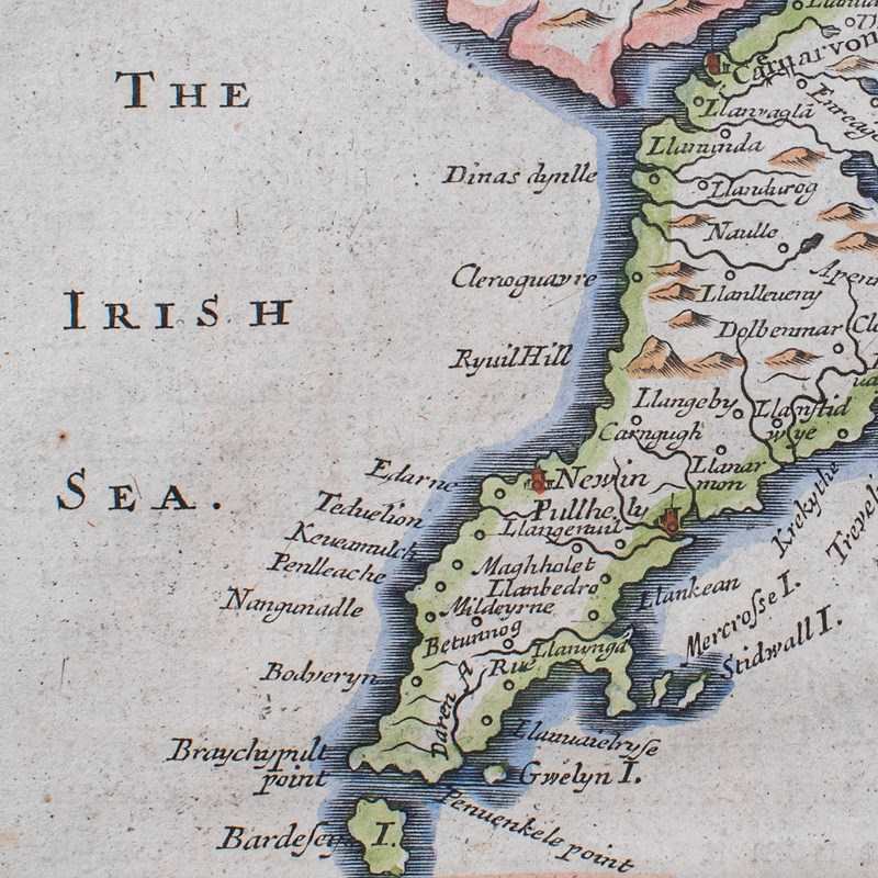
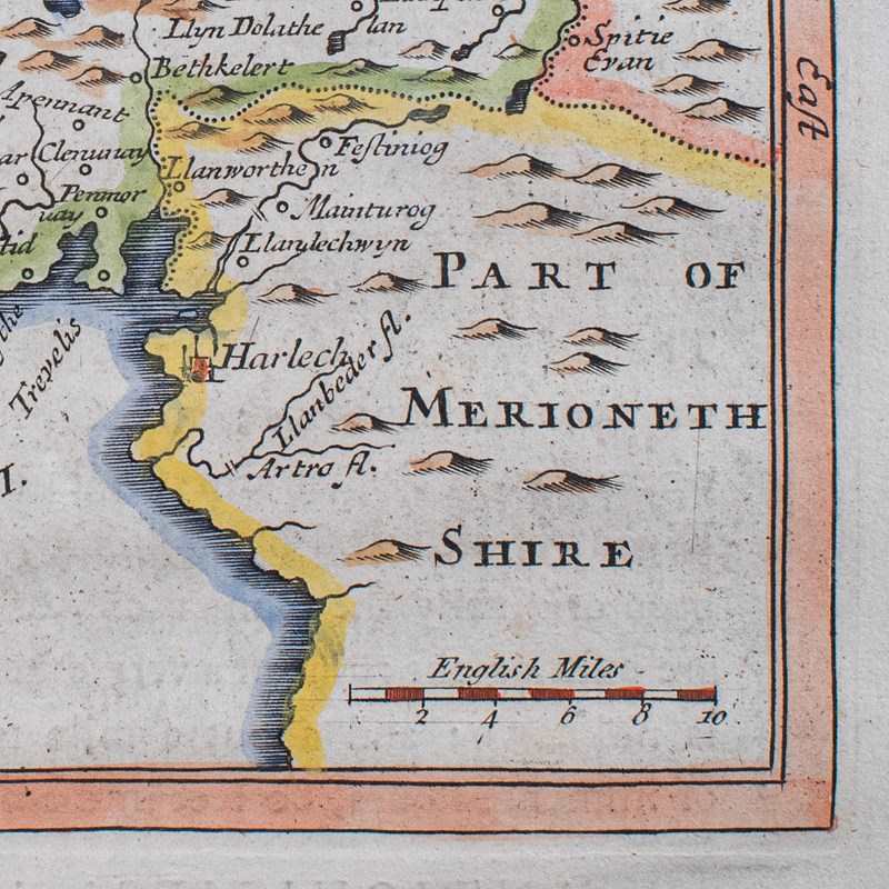
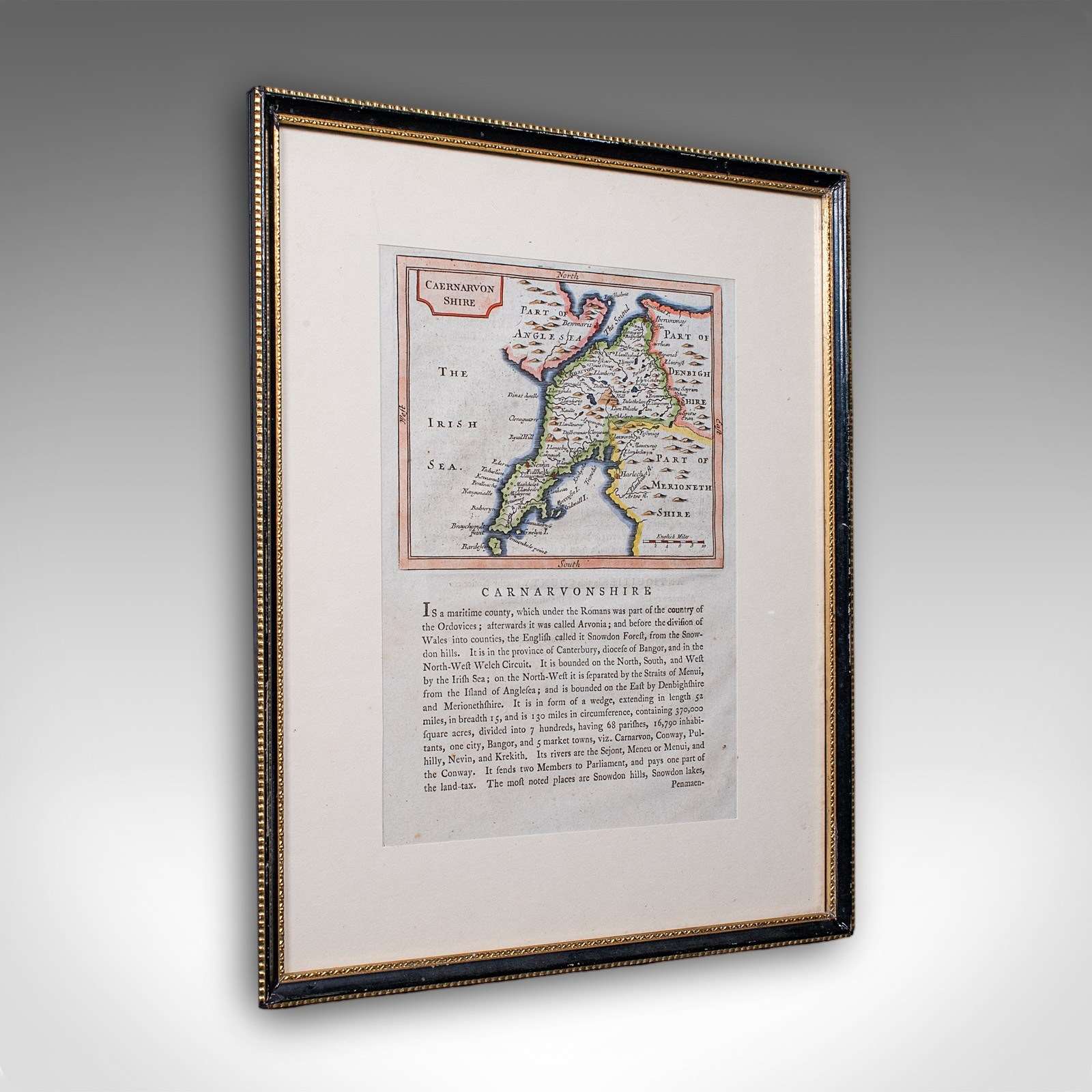
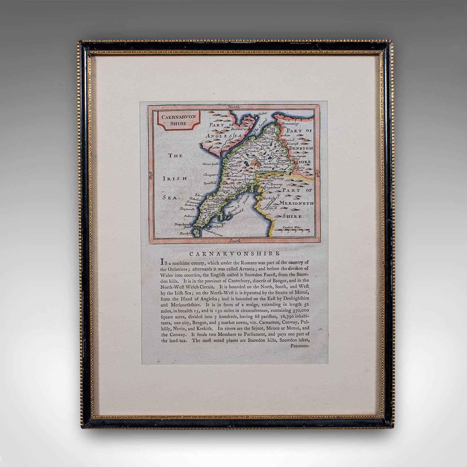
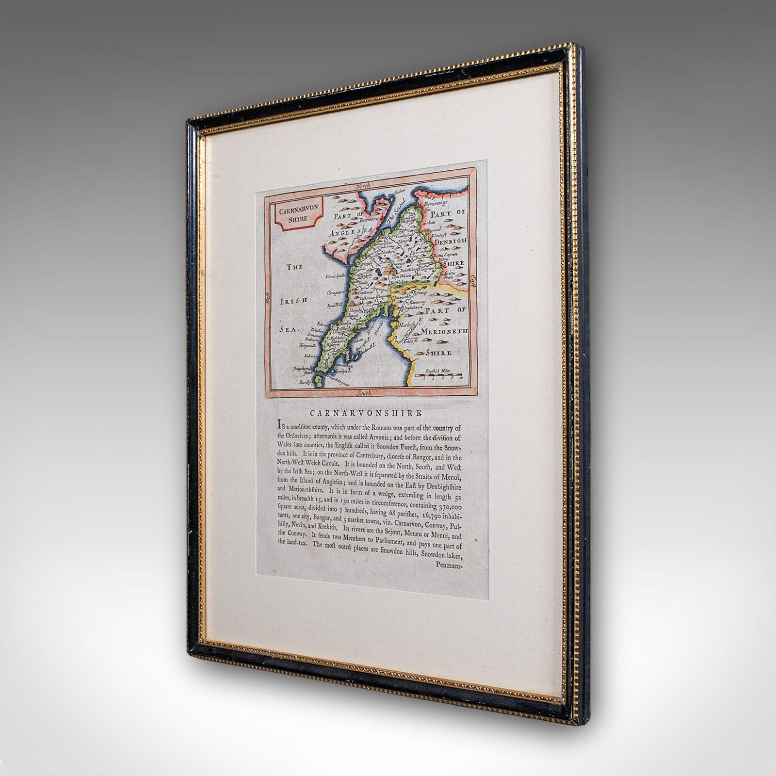
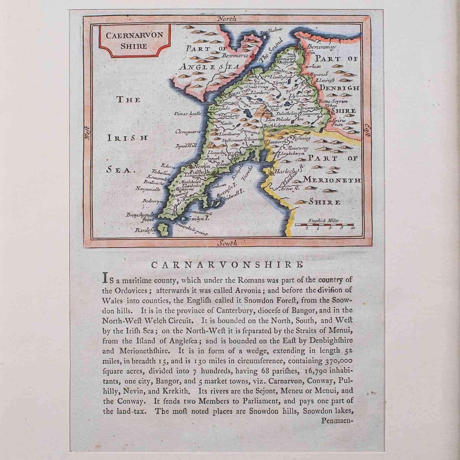
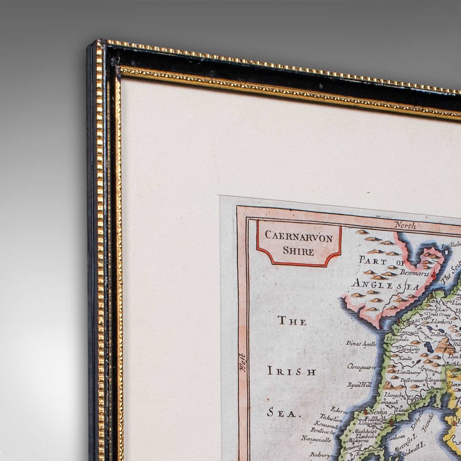
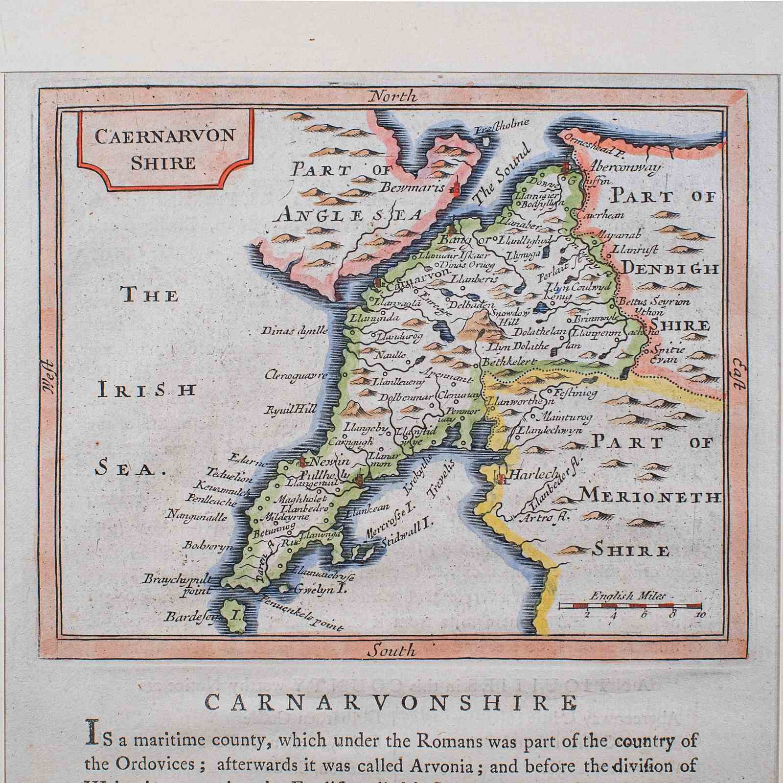
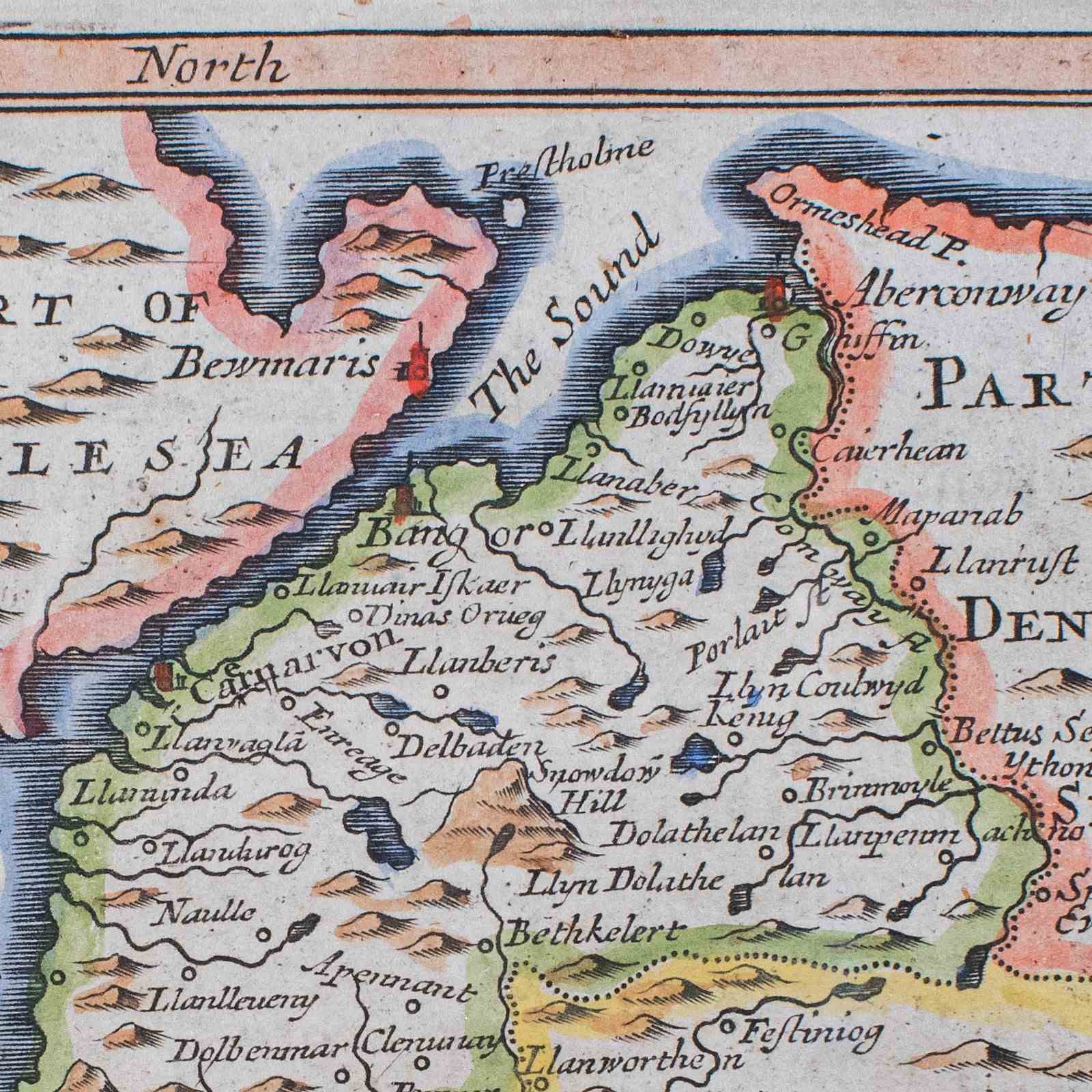
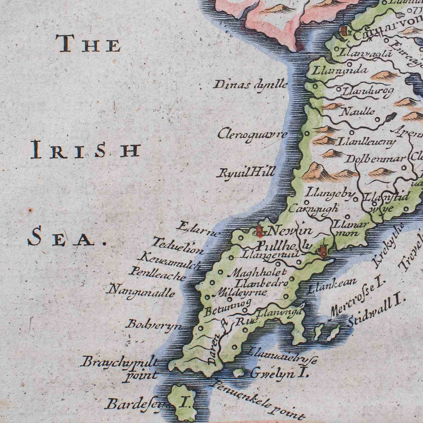
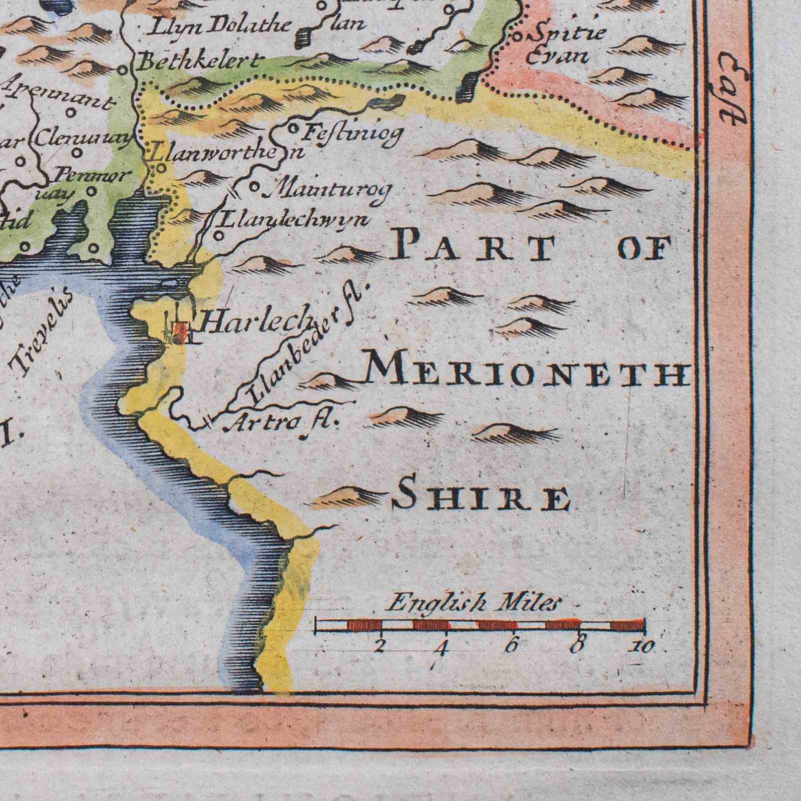
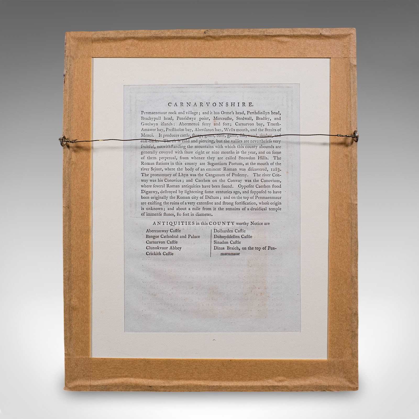
This is an antique dual-sided Carnarvonshire map. An English, engraved North Wales atlas excerpt, dating to the early 18th century and later.
Delightful, dual-sided excerpt from an early 18th century publication
Displays a desirable aged patina and in good order
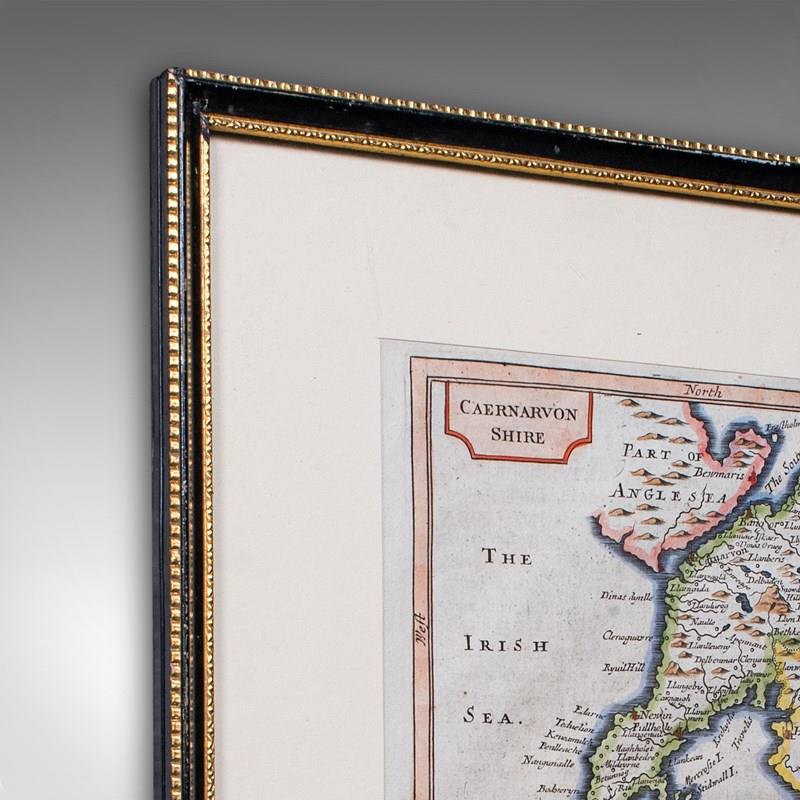
Set behind clear glass within a tasteful, later frame
Gilt and ebonised, the frame is dressed to the rear with hanging wire
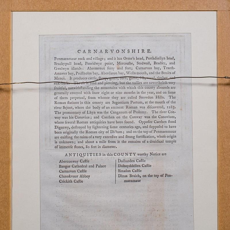
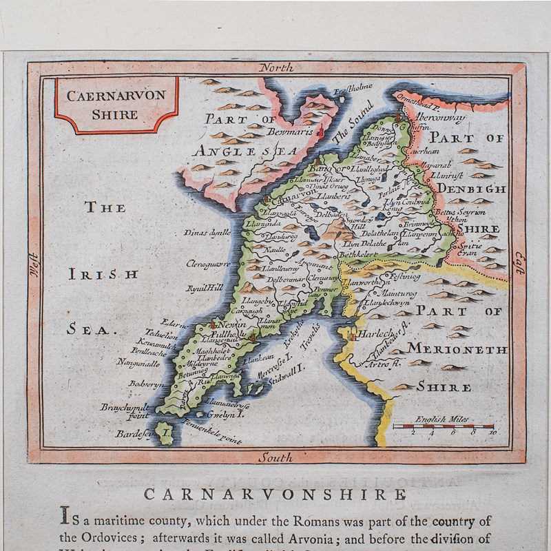
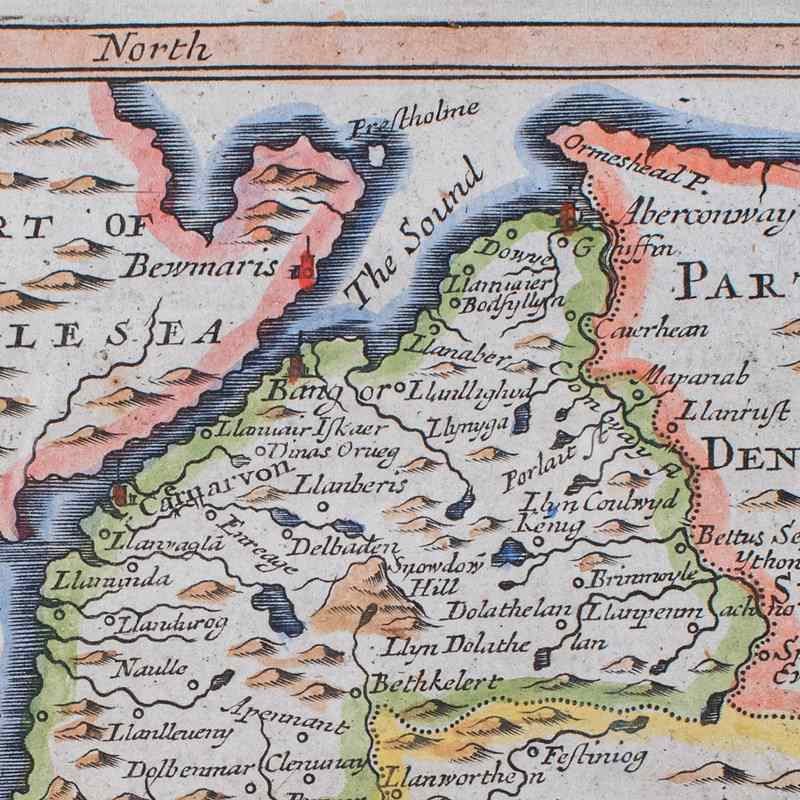
Charming hand-coloured map, set above descriptive text
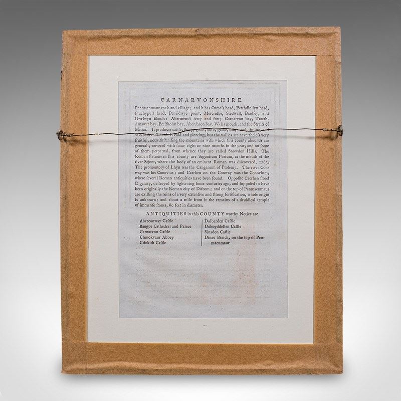
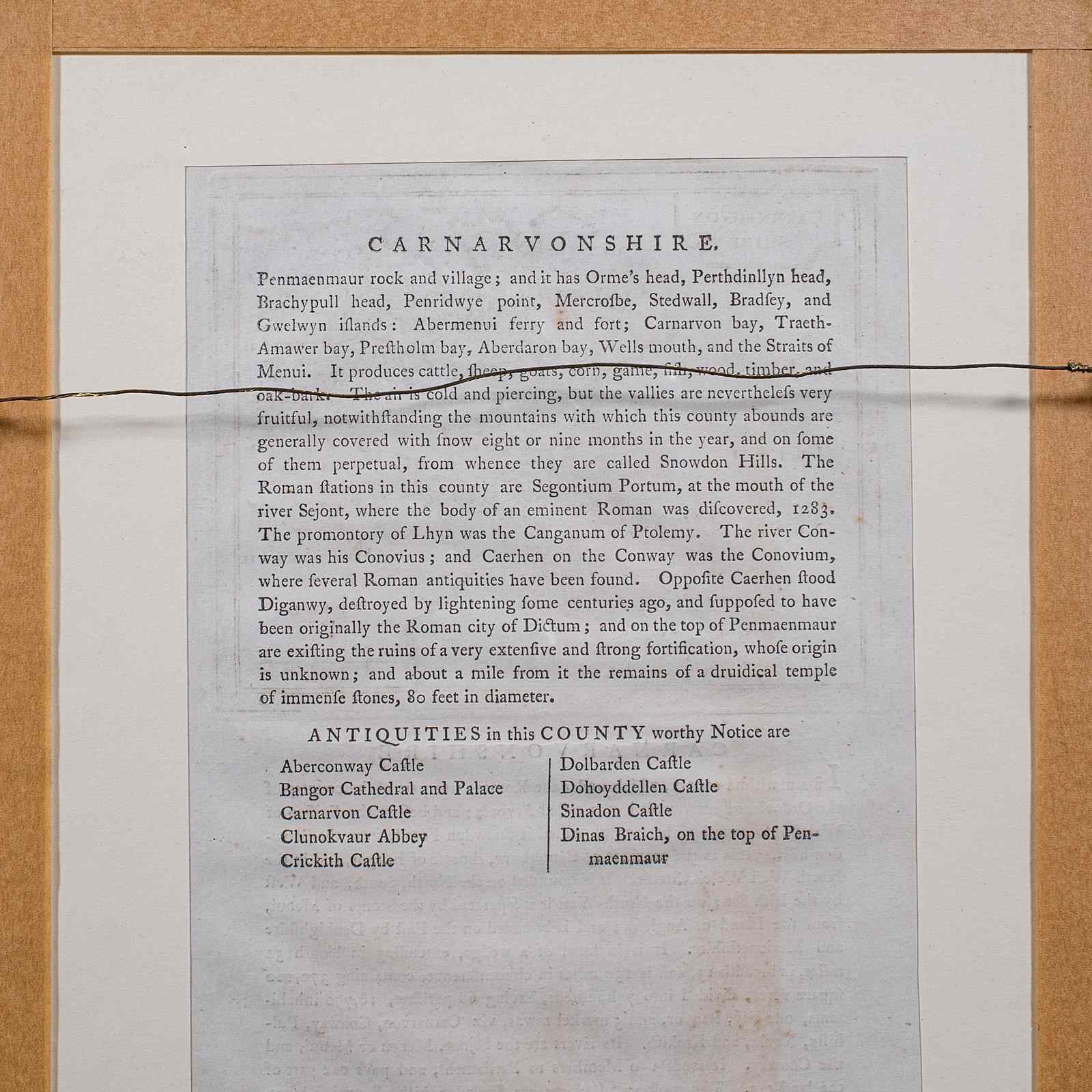
Reverse hosts a second page of text detail
Originally engraved in the late 17th century, from John Seller's Anglia Contracta atlas
Presented here as it was published in The Antiquities of England & Wales by Francis Grose
A fascinating dual-sided map, with appealing colour and supporting text from an 18th century publication. Delivered ready to display.
Dimensions:
Max Width: 27cm (10.75'')
Max Depth: 1.5cm (.5'')
Max Height: 33cm (13'')
Map Width: 14.5cm (5.75'')
Map Height: 12cm (4.75'')
Item Info
Seller
Seller Location
Hele, Devon
Item Dimensions
H: 33cm W: 27cm D: 1.5cm
Period
1800s
Item Location
United Kingdom
Seller Location
Hele, Devon
Item Location
United Kingdom
Seller Contact No
+44 (0)207 1833511
More from LONDON FINE ANTIQUES