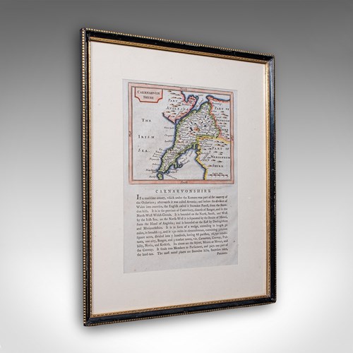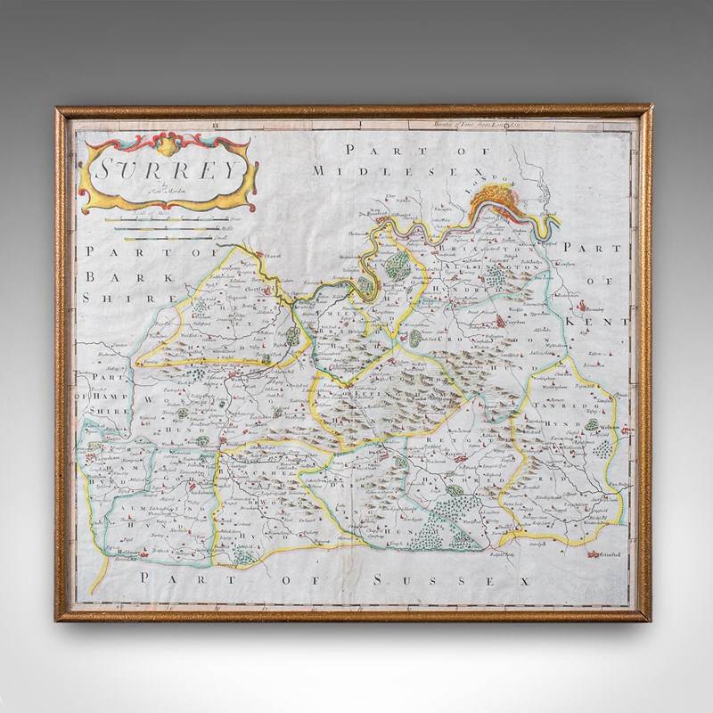


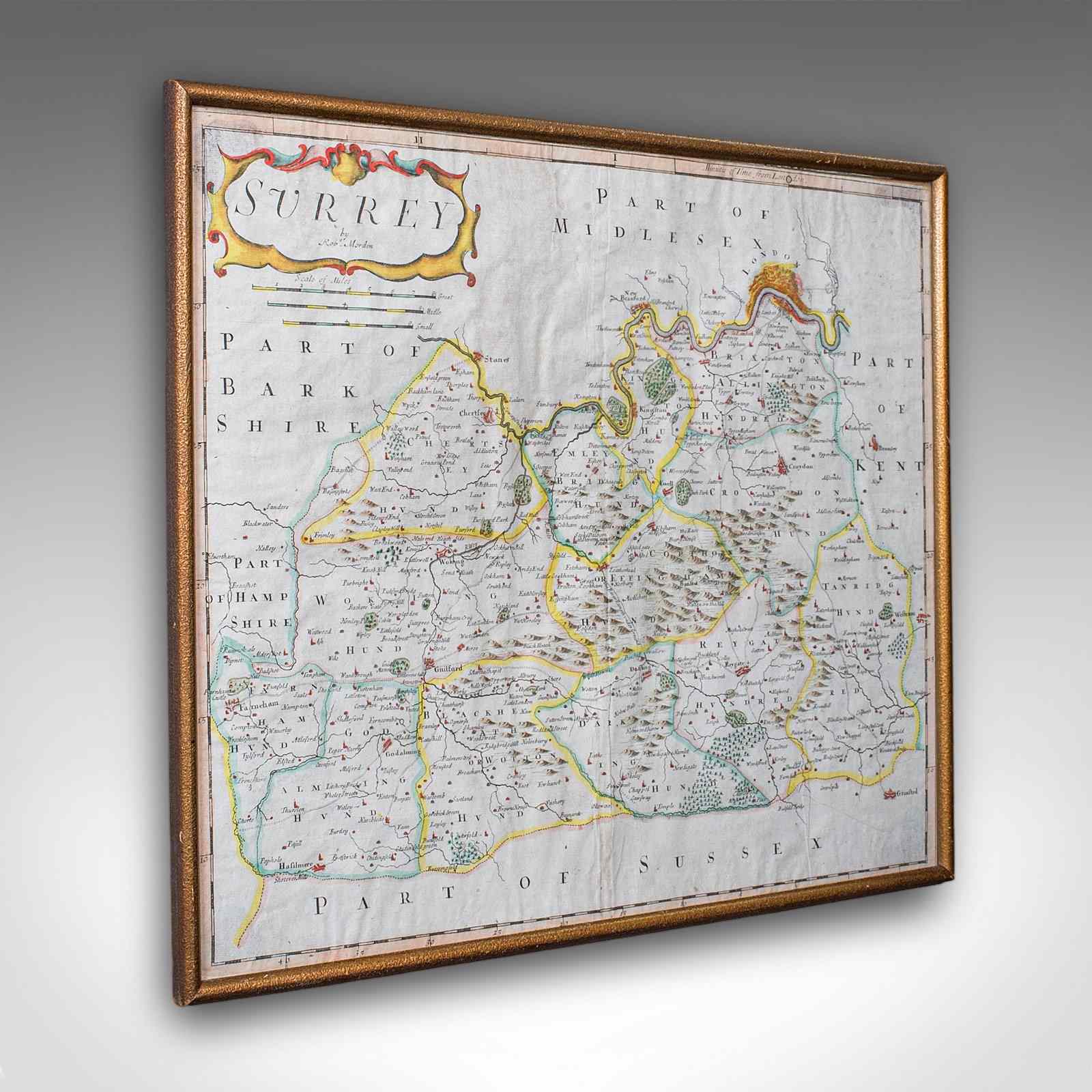
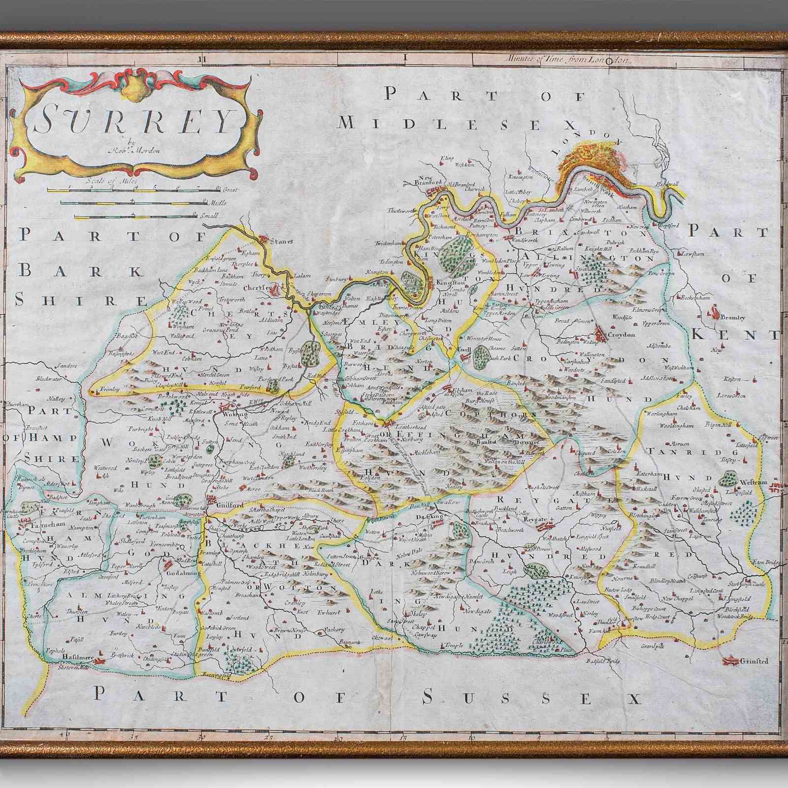

Antique Surrey Map, English, County Cartography, Atlas, Robert Morden, C.1700
Stock No
26109
2024
- £595.00
- €686 Euro
- $787 US Dollar
Questions about this item?
Like this item?
Item Description
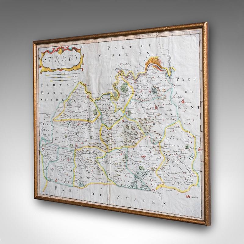
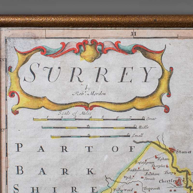
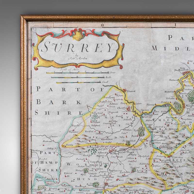
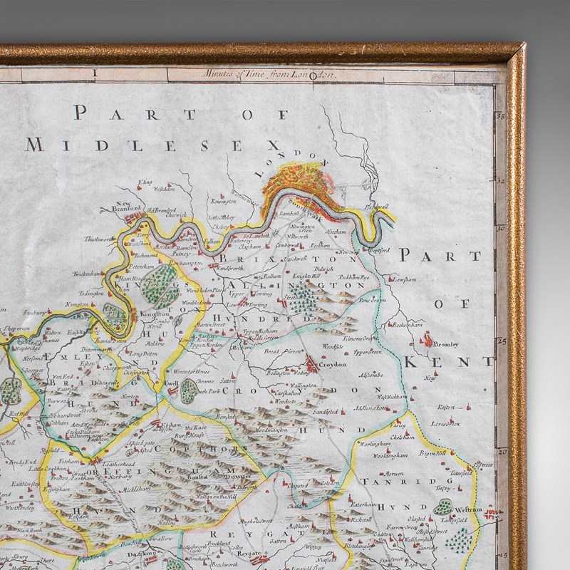
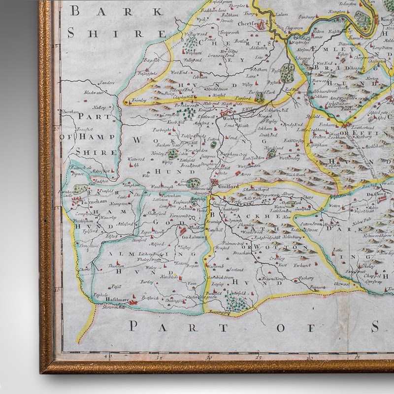
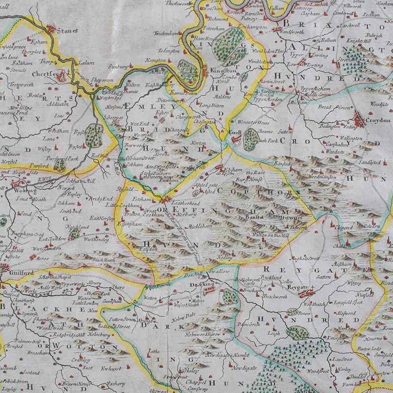
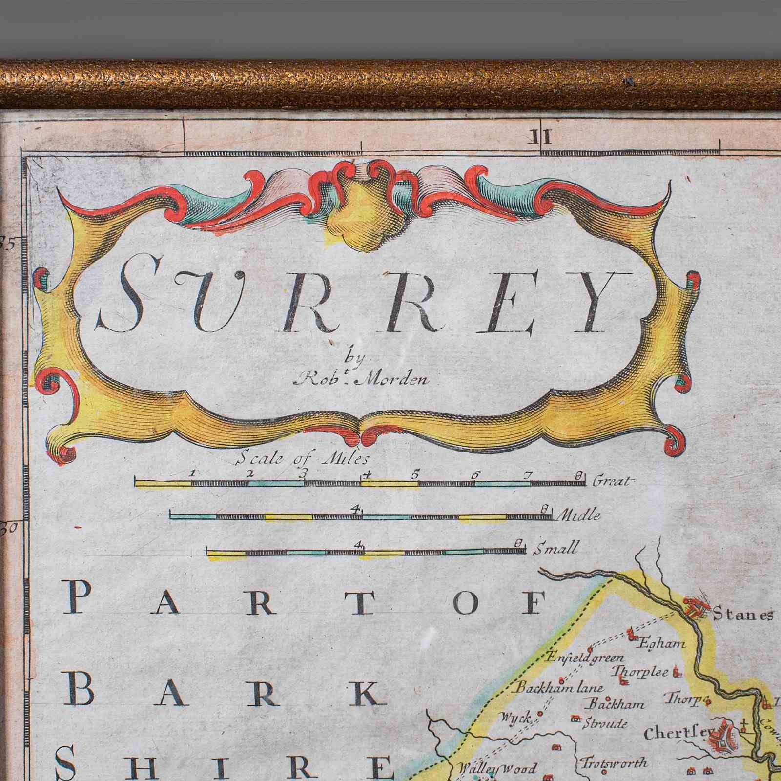
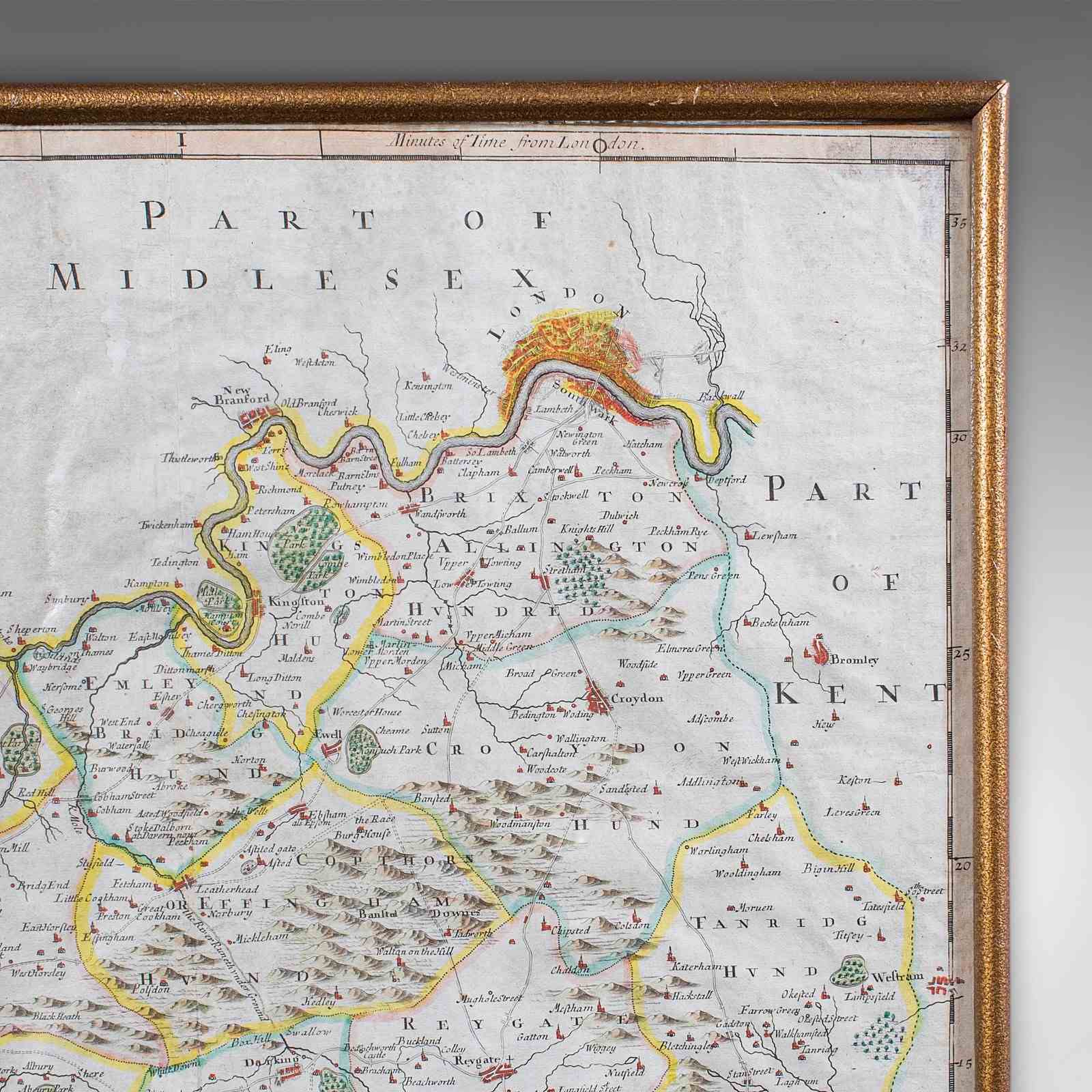
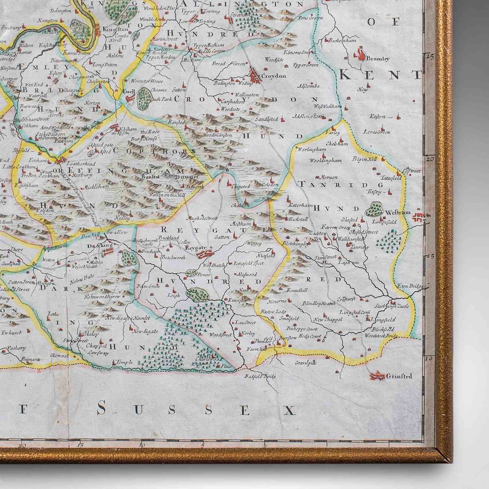
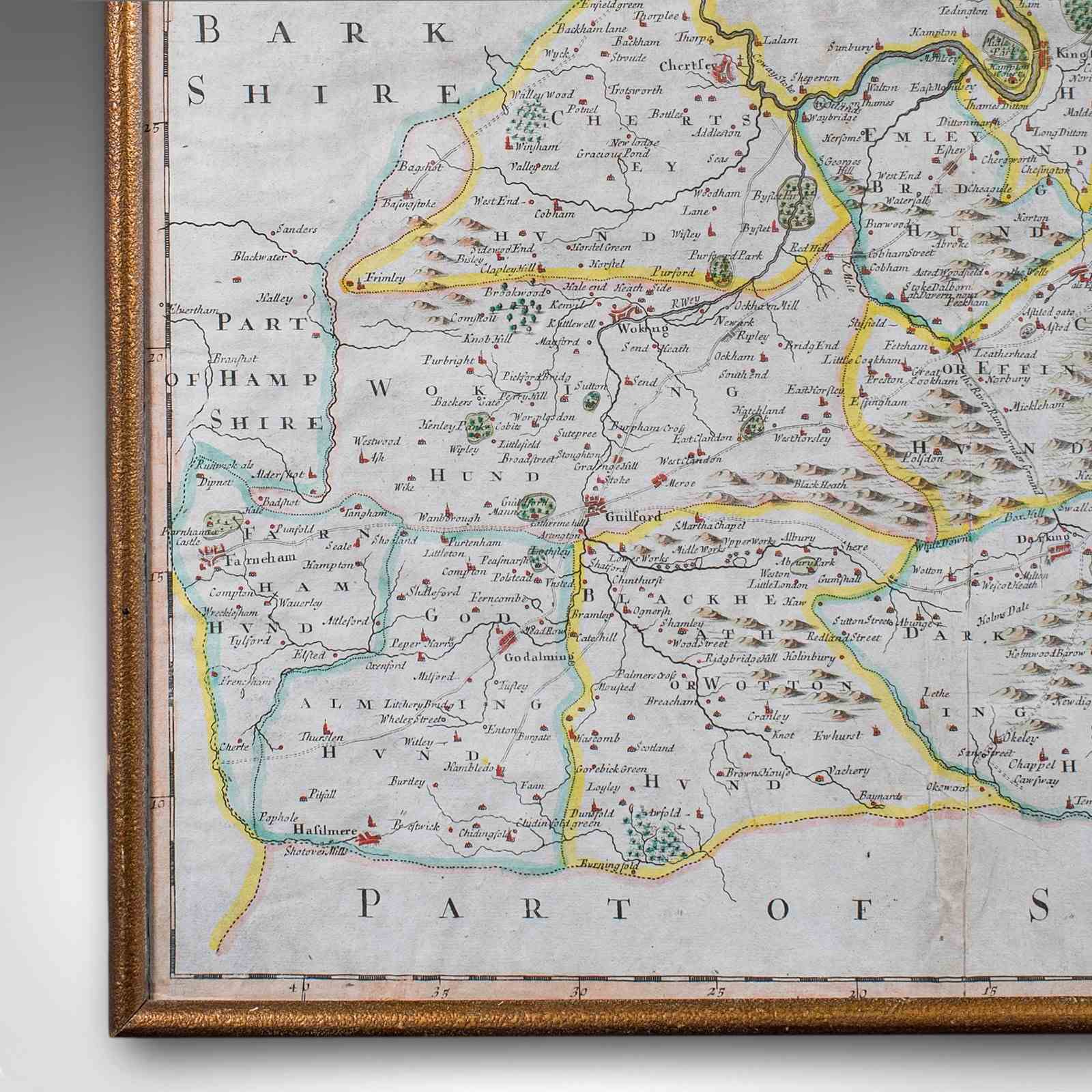
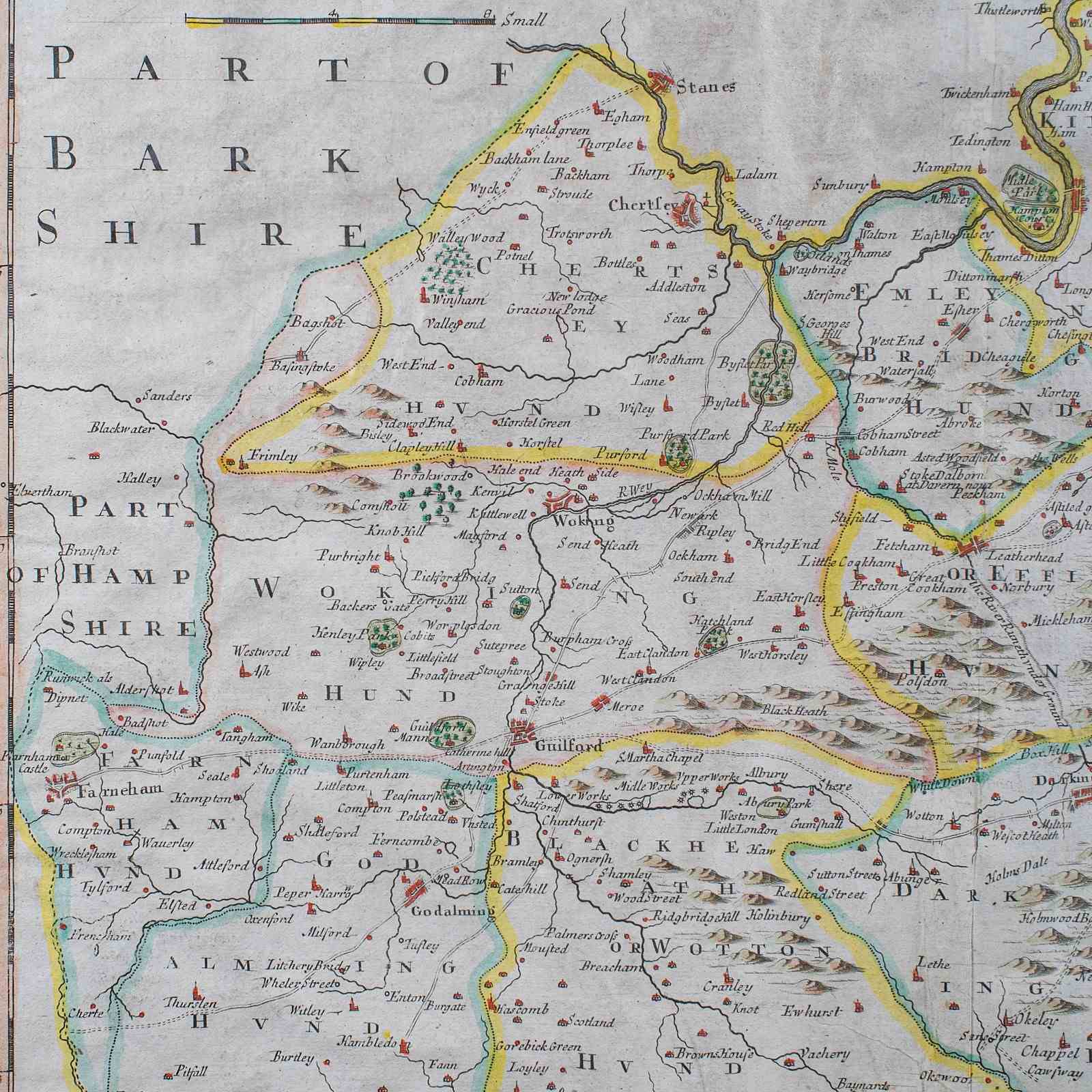
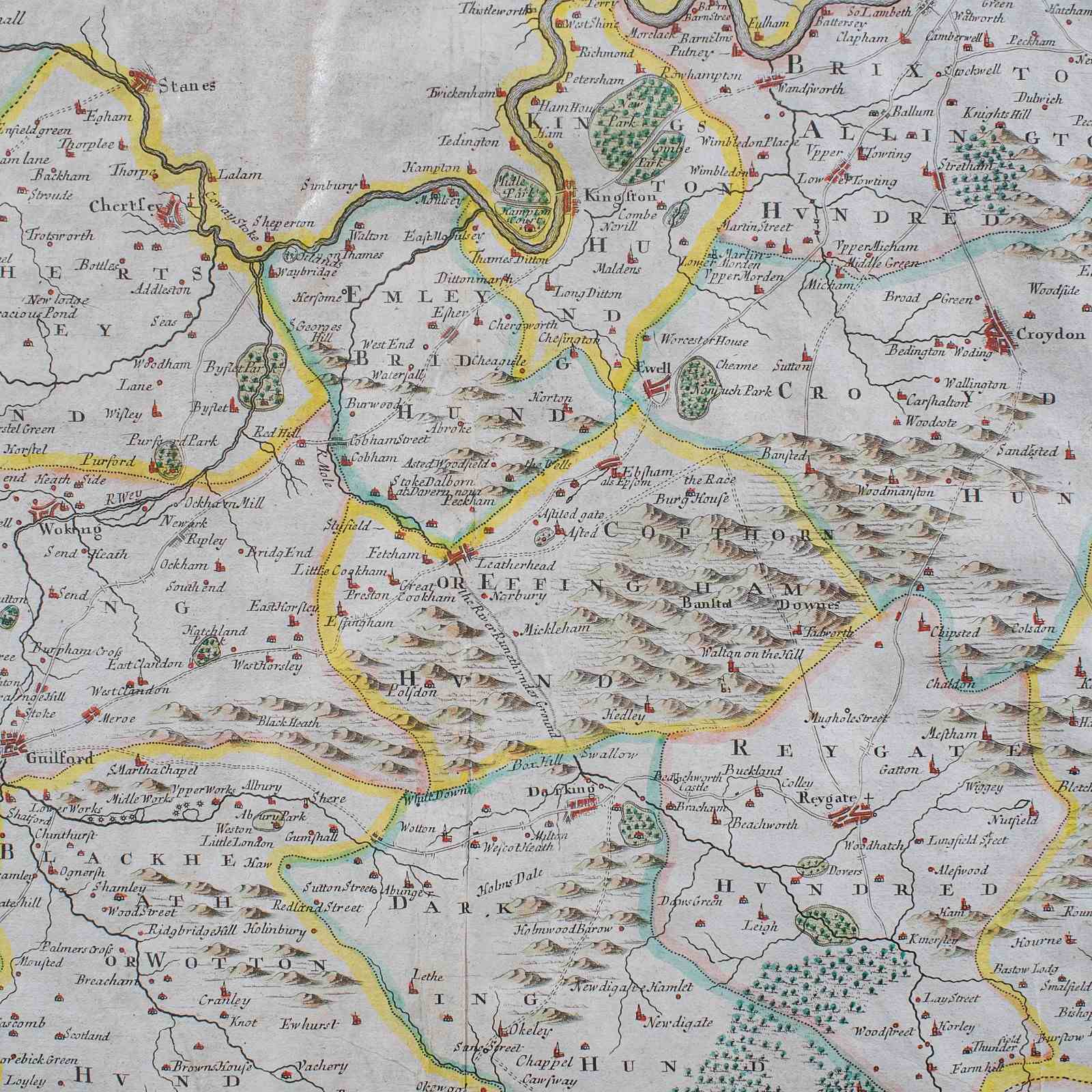
This is an antique map of Surrey. An English, framed atlas engraving by Robert Morden, this centre fold edition dating to the dating to the late 17th century and later.
A finely detailed 17th century county map, rich in historical and decorative appeal
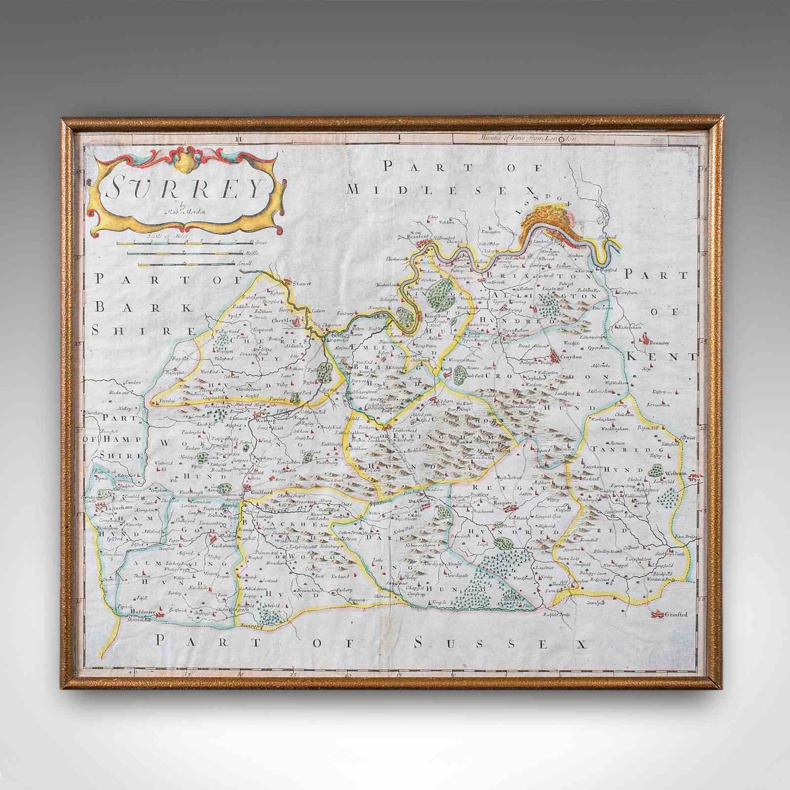
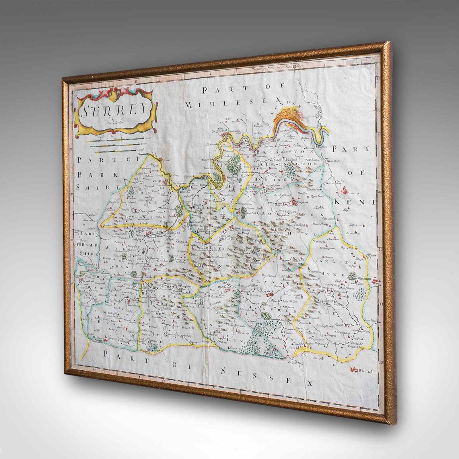
Displays a desirable aged patina and in good order throughout
Presented within a tasteful later frame and mounted behind clear protective glazing
Dressed to the rear with hanging wire for ease of display
Atlas engraving with hand-coloured finish for further visual interest
Scale of Great, Middle and Small miles - a fascinating system devised before the standardised mile
Decorative, finely coloured cartouche enriches the composition
Ideal for the study, library or country house interior
This is a superb late 17th century Surrey map, combining Morden’s renowned cartographic detail with decorative charm. Perfect for collectors of antique maps and regional history. Delivered ready to display.
Dimensions:
Max Width: 43.5cm (17.25'')
Max Depth: 1cm (.5'')
Max Height: 37.5cm (14.75'')
Map Width: 41cm (16.25'')
Map Height: 35.5cm (14'')
Item Info
Seller
Seller Location
Hele, Devon
Item Dimensions
H: 37.5cm W: 43.5cm D: 1cm
Period
1700s
Item Location
United Kingdom
Seller Location
Hele, Devon
Item Location
United Kingdom
Seller Contact No
+44 (0)207 1833511
More from LONDON FINE ANTIQUES